Safety Score: 2,7 of 5.0 based on data from 9 authorites. Meaning we advice caution when travelling to United States.
Travel warnings are updated daily. Source: Travel Warning United States. Last Update: 2024-05-16 08:19:50
Explore Slocun Village
The district Slocun Village of Havelock in Craven County (North Carolina) is located in United States about 277 mi south of Washington DC, the country's capital.
If you need a place to sleep, we compiled a list of available hotels close to the map centre further down the page.
Depending on your travel schedule, you might want to pay a visit to some of the following locations: New Bern, Bayboro, Beaufort, Trenton and Jacksonville. To further explore this place, just scroll down and browse the available info.
Local weather forecast
Todays Local Weather Conditions & Forecast: 27°C / 81 °F
| Morning Temperature | 18°C / 65 °F |
| Evening Temperature | 21°C / 69 °F |
| Night Temperature | 19°C / 66 °F |
| Chance of rainfall | 2% |
| Air Humidity | 55% |
| Air Pressure | 1013 hPa |
| Wind Speed | Gentle Breeze with 7 km/h (4 mph) from North |
| Cloud Conditions | Broken clouds, covering 70% of sky |
| General Conditions | Light rain |
Saturday, 18th of May 2024
23°C (74 °F)
21°C (69 °F)
Moderate rain, gentle breeze, overcast clouds.
Sunday, 19th of May 2024
25°C (77 °F)
20°C (68 °F)
Moderate rain, gentle breeze, overcast clouds.
Monday, 20th of May 2024
24°C (76 °F)
20°C (68 °F)
Light rain, gentle breeze, broken clouds.
Hotels and Places to Stay
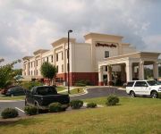
Hampton Inn Havelock
Holiday Inn Express & Suites HAVELOCK NW-NEW BERN
Quality Inn
KNIGHTS INN & SUITES HAVELOCK
Econo Lodge Havelock
DAYS INN HAVELOCK
Videos from this area
These are videos related to the place based on their proximity to this place.
Promo: New Age Sheepherders vs 96.3 Thunder Country's Mudflap & Chase for S.W.E.
After finding their Tag Title shot rematch against Anarchy Now postponed due to Scab having other "contractual obligations," Wallabee Joe and Rassle Crowe issue a talent challenge to friends...
Videos provided by Youtube are under the copyright of their owners.
Attractions and noteworthy things
Distances are based on the centre of the city/town and sightseeing location. This list contains brief abstracts about monuments, holiday activities, national parcs, museums, organisations and more from the area as well as interesting facts about the region itself. Where available, you'll find the corresponding homepage. Otherwise the related wikipedia article.
Newport, North Carolina
Newport is a town in Carteret County, North Carolina, United States. The population was 4,510 at the 2010 census.
Havelock, North Carolina
Havelock is a city in Craven County, North Carolina, United States. The population was 22,442 at the 2000 census, and estimated to be 21,906 in 2006. The city is home to Marine Corps Air Station Cherry Point, the world's largest Marine Corps Air station, and home to the 2nd Marine Aircraft Wing. Havelock is part of the New Bern, North Carolina Micropolitan Statistical Area.
Neuse Forest, North Carolina
Neuse Forest is a census-designated place (CDP) in Craven County, North Carolina, United States. The population was 1,426 at the 2000 census. It is part of the New Bern, North Carolina Micropolitan Statistical Area.
Arapahoe, North Carolina
Arapahoe is a town in Pamlico County, North Carolina, United States. As of the 2004 census, the town population was 434. Arapahoe shares many of its roles and duties with Minnesott Beach, North Carolina. It is part of the New Bern, North Carolina Micropolitan Statistical Area. Arapahoe, North Carolina — Town — File:Arapahoe.
Minnesott Beach, North Carolina
Minnesott Beach is a town in Pamlico County, North Carolina, United States. The population was 311 at the 2000 census. It is part of the New Bern, North Carolina Micropolitan Statistical Area.
Battle of New Bern
The Battle of New Bern (also known as the Battle of New Berne) was fought on 14 March 1862, near the city of New Bern, North Carolina, as part of the Burnside Expedition of the American Civil War. The US Army's Coast Division, led by Brigadier General Ambrose E. Burnside and accompanied by armed vessels from the North Atlantic Blockading Squadron, were opposed by an undermanned and badly trained Confederate force of North Carolina soldiers and militia led by Brigadier General Lawrence O'B.
Havelock High School
Havelock High School is a public high school located in Havelock, North Carolina, founded in 1956. Havelock is one of three high schools operated by the Craven County Schools district. The original campus is now the site of Havelock Middle School, and the current campus was built in 1971, although it has been expanded several times since. Serving grades 9-12, the school is one of three high schools in the Craven County Schools district.
Croatan High School
Croatan High School is a public secondary school in Newport, North Carolina. The high school is part of the Carteret County Public Schools system. It serves the westernmost third of Carteret County, including the towns of Peletier, Cape Carteret, Cedar Point and western half of the island of Bogue Banks, which includes the town of Emerald Isle. Ethnically, Croatan's students are 92% White, 5% African-American, 2% Hispanic, and less than 1% other.
West Carteret High School
West Carteret High School is a public secondary school located in Morehead City, North Carolina on Country Club Road, and is part of the Carteret County Public Schools system. The school serves the student populations of Morehead City, Newport, Atlantic Beach, and surrounding areas. It opened in 1964, and has since grown to be the largest high school in Carteret County. Its school mascot is Pete the Patriot.
WRHT
WRHT (also known as "Thunder Country") is a radio station, broadcasting with 100,000 watts that cover the Greenville/New Bern/Jacksonville area with a country music format. WRHT is licensed to Morehead City. WRHT is owned and operated by Inner Banks Media, owned by Henry Hinton.
Gales Creek, North Carolina
The Gales Creek area of Carteret County, North Carolina is part of the greater Newport, North Carolina area. Gales Creek empties into Bogue Sound, which is separated from the Atlantic Ocean by Bogue Banks, part of North Carolina's barrier islands known as the Southern Outer Banks. A Presbyterian Church Camp, Camp Albemarle, is located near the mouth of Gales Creek at the former home of Henry Wilkins Hibbs, 1862-1942, the second mayor of St.
Wildwood, North Carolina
Wildwood, North Carolina is a small unincorporated community centered on the Wildwood Road, just west of the Morehead City, North Carolina town limits along US Highway 70, in Carteret County, NC. Newport, North Carolina is the next closest town.
Newport River
The Newport River is a small river in North Carolina that runs approximately twenty kilometers southeast through the town of Newport with its mouth opening into Bogue Sound, between Morehead City and Beaufort. It is popular for flatwater paddling and canoeing.
Broad Creek, North Carolina
The Broad Creek area of Carteret County, North Carolina is part of the greater Newport, North Carolina area. It currently shares the Newport zip code of 28570.
Broad Creek (Bogue Sound)
Broad Creek is a water body bordering the community of Broad Creek, North Carolina. The creek empties into Bogue Sound, which is separated from the Atlantic Ocean by Bogue Banks, part of North Carolina's barrier islands known as the Southern Outer Banks. The creek also runs through the Croatan National Forest.
Gales Creek (North Carolina)
Gales Creek is a creek bordering the communities of Broad Creek and Gales Creek in the U.S. state of North Carolina. Gales Creek empties into Bogue Sound, which is separated from the Atlantic Ocean by Bogue Banks, part of North Carolina's barrier islands known as the Southern Outer Banks. The Creek also runs through the Croatan National Forest. Upstream along Gales Creek and further into the Pocosin, is a camp for youth operated by the Eckerd Youth Alternatives program, Camp E-Ma-Henwu.
WNBU
WNBU is a radio station broadcasting a Talk radio format. Licensed to Oriental, North Carolina, USA, the station serves the Greenville-New Bern-Jacksonville area. The station is currently owned by Inner Banks Media, LLC. The station has obtained a construction permit from the FCC for a power increase to 35,000 watts.
WOTJ
WOTJ is a radio station broadcasting family christian programming. Licensed to Morehead City, North Carolina, USA, it serves the Greenville-New Bern, North Carolina, area. The station is currently owned by Grace Christian School, a ministry of Grace Baptist Church of Newport, North Carolina, and is the flagship station of the Fundamental Broadcasting Network.
WNBB
WNBB and WNBR-FM are radio station simulcasting a classic country music format. With WNBB licensed to Bayboro, North Carolina and WNBR-FM to Bethel, North Carolina USA, it serves the Greenville-New Bern area. The station is currently owned by Coastal Carolina Radio.
WLGP
WLGP is a radio station broadcasting a Christian Radio format as an affiliate of Good News Network. Licensed to Harkers Island, North Carolina, USA, it serves the Greenville-New Bern area. The station is currently owned by Augusta Radio Fellowship Institute, Inc. Programs heard on WLGP include; Grace to You with John MacArthur, In Touch with Charles Stanley, Thru the Bible with J.
WANG
This article is about the radio station. For WANG computers, see Wang Laboratories. For other uses, see Wang.
Marine Corps Air Station Cherry Point
Marine Corps Air Station Cherry Point or MCAS Cherry Point is a United States Marine Corps airfield located in Havelock, North Carolina, USA, in the eastern part of the state. It was built in 1941, and was commissioned in 1942 and is currently home to the 2nd Marine Aircraft Wing.
WLVG
WLVG is a radio station broadcasting the K-Love Contemporary Christian format. Licensed to Havelock, North Carolina, USA, the station served the Havelock, NC area. The station was recently sold by NM Licensing LLC.
Neusiok Trail
The Neusiok Trail is a 20.4-mile hiking trail located in the Croatan National Forest in Carteret County, North Carolina. The trail traverses the forest from a sandy beach on the Neuse River to a salt marsh on the Newport River, and along the way, it crosses cypress swamps, hardwood ridges, longleaf-pine savannah and pocosin—shrubby bogs The entire Neusiok is part of the Mountains-to-Sea Trail (MST) which spans North Carolina, and the MST in the Croatan is a designated National Recreation Trail.
Carteret General Hospital
Carteret General Hospital is a 135 bed, non-profit hospital in Morehead City, North Carolina. Carteret General was founded in 1967.


