Safety Score: 2,7 of 5.0 based on data from 9 authorites. Meaning we advice caution when travelling to United States.
Travel warnings are updated daily. Source: Travel Warning United States. Last Update: 2024-05-17 08:07:57
Explore Quincetree Landing
Quincetree Landing in Suffolk County (New York) is a city in United States about 304 mi (or 489 km) north-east of Washington DC, the country's capital.
Local time in Quincetree Landing is now 07:43 PM (Friday). The local timezone is named America / New York with an UTC offset of -4 hours. We know of 12 airports in the vicinity of Quincetree Landing, of which 5 are larger airports. The closest airport in United States is Elizabeth Field in a distance of 15 mi (or 25 km), North. Besides the airports, there are other travel options available (check left side).
Also, if you like golfing, there are multiple options in driving distance. We found 2 points of interest in the vicinity of this place. If you need a place to sleep, we compiled a list of available hotels close to the map centre further down the page.
Depending on your travel schedule, you might want to pay a visit to some of the following locations: Riverhead, Johnston, Cranston, North Providence and Hartford. To further explore this place, just scroll down and browse the available info.
Local weather forecast
Todays Local Weather Conditions & Forecast: 16°C / 61 °F
| Morning Temperature | 13°C / 55 °F |
| Evening Temperature | 15°C / 58 °F |
| Night Temperature | 13°C / 55 °F |
| Chance of rainfall | 0% |
| Air Humidity | 72% |
| Air Pressure | 1013 hPa |
| Wind Speed | Moderate breeze with 12 km/h (8 mph) from South-West |
| Cloud Conditions | Broken clouds, covering 72% of sky |
| General Conditions | Broken clouds |
Friday, 17th of May 2024
13°C (56 °F)
12°C (54 °F)
Overcast clouds, gentle breeze.
Saturday, 18th of May 2024
14°C (58 °F)
12°C (54 °F)
Overcast clouds, gentle breeze.
Sunday, 19th of May 2024
13°C (56 °F)
11°C (52 °F)
Overcast clouds, gentle breeze.
Hotels and Places to Stay
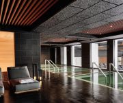
Gurney's Montauk Resort & Seawater Spa
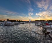
Montauk Yacht Club Resort and Marina
The Hermitage
The Montauk Beach House
Haven Montauk
Kenny's Tipperary Inn
Montauk Blue Hotel
Daunt's Albatross Motel
Ocean Resort Inn
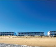
Oceanside Beach Resort
Videos from this area
These are videos related to the place based on their proximity to this place.
Monster Montauk Striped Bass Trolling Fish Aholic Tubes
Thanks for watching Please subscribe and give me a thumbs up!!! Trolling my custom Fish Aholic trolling tubes off Montauk Point in my kayak for big striped bass. Interested in Fish Aholic Trolling...
Kayak Eel Fishing for Monster Montauk Striped Bass
Catching big and better than average striped bass off Montauk Point NY a day or two before the July Full moon with Live Eels. Thanks for watching Please subscribe and give me a thumbs up!!!...
Surfing - Hurricane Cristobal - Turtles - Montauk, NY
This is swell from Hurricane Cristobal at Turtles in Montauk, NY from August 28, 2014.
Surfing - Ditch Plains - Montauk, NY - August 14, 2014
Surfing and learning to surf on a beautiful summer day at Ditch Plains in Montauk, New York on August 14, 2014.
Surfing - Hurricane Surf - East Coast
Here is some swell from Hurricane Cristobal in Montauk, New York.
Striped Bass surf casting Montauk South Side
Working Montauk south side with a 1/2 to 1oz bucktail and porkrind for school bass and small keepers during summer under the right daytime conditions. Thanks to GoPro Cameras: http://gopro.com/...
Kayak Fishing Montauk Part2
Trolling off Montauk South side August 2nd on my home made kayak trolling tubes.
Fishing in Montauk, Long Island, NY / Lowienie Ryb w Montauk, NY (#Active)
Epic Fishing Trip to Montauk, NY. We caught a lot of good fish including stripped bass, sea bass, porgy and many more. Too bad the camera man happened to have really bad sea sickness.
Picturesque Property with Stunning Water Views in Montauk, New York
Presented by Sotheby's International Realty - East Hampton Brokerage For more information go to http://ow.ly/ugLQP The historic Startop Ranch offers the most stunning vistas of the East End...
Videos provided by Youtube are under the copyright of their owners.
Attractions and noteworthy things
Distances are based on the centre of the city/town and sightseeing location. This list contains brief abstracts about monuments, holiday activities, national parcs, museums, organisations and more from the area as well as interesting facts about the region itself. Where available, you'll find the corresponding homepage. Otherwise the related wikipedia article.
Hither Hills State Park
Hither Hills State Park is a state park located on the southern shore near the eastern tip of Long Island in Suffolk County, New York in the USA. The park is located on the South Fork of Long Island at Napeague, New York. Three additional state parks a few miles farther east are: Montauk Downs State Park, Camp Hero State Park, and Montauk Point State Park.
Gurney's Inn
Gurney's Inn is a historic oceanfront resort on the very tip of Long Island, located on 290 Old Montauk Highway in Montauk, New York. U.S. President Richard Nixon wrote his acceptance speech at the Skippers Cottage. It has a famous Thalasso spa. Amenities include "one of the nation's few true seawater pools" and accommodations for groups (weddings, business meetings, etc. ) Gurney's was featured on the Travel Channel show Hotel Impossible on April 9, 2012.
WELJ
WELJ (104.7 FM, "104-7 WELJ") is a Hot Adult Contemporary radio station licensed to Montauk, New York and serves the New London, Connecticut area. The station is owned by Volt Radio and broadcasts at 104.7 MHz with 6 kW ERP from a tower in nearby Montauk, New York. The station was assigned its current WELJ call sign by the Federal Communications Commission on September 21, 2010.
WEGB
WEGB is a planned radio station serving the Long Island, New York, area under a "shared time" agreement. It will be broadcasting on FM frequency 90.7 MHz and is under ownership of the Community Bible Church of Long Island. The station was assigned the current WEGB call letters by the Federal Communications Commission on February 13, 2009.
WEEG
WEEG was a radio station serving the Long Island, New York from May 2010 until October 2011. It broadcast on FM frequency 90.7 MHz and is under ownership of the Hamptons Community Radio Corporation. This station was operated under a construction permit with program test authority as their radio station facility was built. The station had a license to simulcast from Westhampton, New York (89.1) assigned callsign WEEW.
WJJF
WJJF (94.9 FM; "94.9 News Now") is a radio station licensed to Montauk, New York, USA and serving the New London, Connecticut area. The station is owned by Full Power Radio (controlled by John Fuller), and offers a news/talk format. WJJF signed on February 27, 2012. The WJJF call letters were previously used by a country music station broadcasting at 1180 AM in Hope Valley, Rhode Island from 1985 through 2004.
WEER (FM)
WEER is an American radio station licensed to serve the community of Montauk, New York, since 2006. The station's broadcast license is held by Hamptons Community Radio Corporation. Currently silent, WEER normally broadcasts a community radio format to Montauk and East Hampton, New York.


