Safety Score: 4,0 of 5.0 based on data from 9 authorites. Meaning please reconsider your need to travel to Switzerland.
Travel warnings are updated daily. Source: Travel Warning Switzerland. Last Update: 2024-04-27 08:23:39
Explore Löbbia
Löbbia in Region Maloja (Kanton Graubünden) is located in Switzerland about 112 mi (or 180 km) east of Bern, the country's capital.
Local time in Löbbia is now 02:16 AM (Sunday). The local timezone is named Europe / Zurich with an UTC offset of 2 hours. We know of 11 airports in the wider vicinity of Löbbia, of which 5 are larger airports. The closest airport in Switzerland is Samedan Airport in a distance of 15 mi (or 25 km), North-East. Besides the airports, there are other travel options available (check left side).
There are several Unesco world heritage sites nearby. The closest heritage site is Rhaetian Railway in the Albula / Bernina Landscapes in Italy at a distance of 12 mi (or 20 km). The closest in Switzerland is Three Castles, Defensive Wall and Ramparts of the Market-Town of Bellinzona in a distance of 33 mi (or 20 km), North-East. If you need a place to sleep, we compiled a list of available hotels close to the map centre further down the page.
Depending on your travel schedule, you might want to pay a visit to some of the following locations: Promontogno, Silvaplana, Val Masino, Cataeggio and Villa. To further explore this place, just scroll down and browse the available info.
Local weather forecast
Todays Local Weather Conditions & Forecast: 4°C / 40 °F
| Morning Temperature | 1°C / 34 °F |
| Evening Temperature | 5°C / 40 °F |
| Night Temperature | 4°C / 39 °F |
| Chance of rainfall | 4% |
| Air Humidity | 98% |
| Air Pressure | 1018 hPa |
| Wind Speed | Gentle Breeze with 9 km/h (5 mph) from North |
| Cloud Conditions | Overcast clouds, covering 96% of sky |
| General Conditions | Snow |
Monday, 29th of April 2024
6°C (44 °F)
3°C (37 °F)
Scattered clouds, gentle breeze.
Tuesday, 30th of April 2024
10°C (50 °F)
5°C (41 °F)
Light rain, gentle breeze, broken clouds.
Wednesday, 1st of May 2024
10°C (50 °F)
4°C (39 °F)
Rain and snow, gentle breeze, overcast clouds.
Hotels and Places to Stay
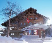
Schweizerhaus Swiss Quality Hotel
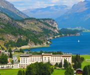
Maloja Palace
Videos from this area
These are videos related to the place based on their proximity to this place.
Banca Raiffeisen Engiadina Val Müstair
c/o Val Torta 250a -- Centro puntoBregaglia 7603 Vicosoprano.
Jaguar S-Type 2.7d Riding up Maloja Pass (part 2)
Riding up to the Maloja pass (Switzerland) with a Jaguar S-Type 2,7d auto (sport mode, full auto). Cameracar on board (ContourROAM). Beautiful road!
Wandern mit Oliver Okt'06 Teil 2-2
Wir wandern mit Oliver im Kanton Graubünden - Am zweiten Tag geht es von Juf über mehrere Pässe ins Engadin.
Videos provided by Youtube are under the copyright of their owners.
Attractions and noteworthy things
Distances are based on the centre of the city/town and sightseeing location. This list contains brief abstracts about monuments, holiday activities, national parcs, museums, organisations and more from the area as well as interesting facts about the region itself. Where available, you'll find the corresponding homepage. Otherwise the related wikipedia article.
Maloja District
Maloja District (Italian: Distretto di Maloggia) is an administrative district in the canton of Graubünden, Switzerland. It has an area of 973.28 km and has a population of 18,830 (as of 31 December 2011). It is trilingual, with official languages used by municipalities inside the district being, in order of dominance, German, Italian, and Romansh. It consists of two Kreise (sub-districts) and sixteen municipalities:
Piz Lunghin
Piz Lunghin (2,780 m) is a mountain in the Swiss canton of Graubünden, located in the Albula range, overlooking the Maloja Pass. It can be considered as the "roof of Europe" as the water running off the mountain can head towards the Atlantic, Mediterranean or Black Sea.
Lägh dal Lunghin
Lägh dal Lunghin is a lake at an elevation of 2484 m, below the peak of Piz Lunghin, in the Graubünden, Switzerland. It is considered the source of the Inn River.
Lägh da Bitabergh
Lägh da Bitabergh is a lake near Maloja Pass in Val Bregaglia, Grisons, Switzerland.
Roticcio
Roticcio is a village in Switzerland.
Casaccia, Graubünden
Casaccia is a village located in the Val Bregaglia, in the Swiss canton of Graubünden. It lies at an altitude of 1,458 metres above sea level, at the southern foot of Piz Lunghin. The village belongs to the municipality of Bregaglia.


