Safety Score: 4,0 of 5.0 based on data from 9 authorites. Meaning please reconsider your need to travel to Switzerland.
Travel warnings are updated daily. Source: Travel Warning Switzerland. Last Update: 2024-05-09 08:23:21
Delve into Allenberg
Allenberg in Bezirk Hinwil (Canton of Zurich) with it's 30 habitants is a city located in Switzerland about 72 mi (or 117 km) east of Bern, the country's capital town.
Current time in Allenberg is now 05:06 AM (Friday). The local timezone is named Europe / Zurich with an UTC offset of 2 hours. We know of 12 airports closer to Allenberg, of which 5 are larger airports. The closest airport in Switzerland is Zürich Airport in a distance of 18 mi (or 29 km), North-West. Besides the airports, there are other travel options available (check left side).
There are several Unesco world heritage sites nearby. The closest heritage site in Switzerland is Abbey of St Gall in a distance of 24 mi (or 39 km), East. We saw 10 points of interest near this location. In need of a room? We compiled a list of available hotels close to the map centre further down the page.
Since you are here already, you might want to pay a visit to some of the following locations: Hinwil, Pfaffikon, Schmerikon, Lachen and Uster. To further explore this place, just scroll down and browse the available info.
Local weather forecast
Todays Local Weather Conditions & Forecast: 19°C / 66 °F
| Morning Temperature | 7°C / 44 °F |
| Evening Temperature | 18°C / 64 °F |
| Night Temperature | 10°C / 49 °F |
| Chance of rainfall | 0% |
| Air Humidity | 52% |
| Air Pressure | 1020 hPa |
| Wind Speed | Gentle Breeze with 7 km/h (4 mph) from South-West |
| Cloud Conditions | Clear sky, covering 7% of sky |
| General Conditions | Sky is clear |
Saturday, 11th of May 2024
21°C (69 °F)
12°C (53 °F)
Scattered clouds, light breeze.
Sunday, 12th of May 2024
23°C (73 °F)
13°C (56 °F)
Light rain, light breeze, few clouds.
Monday, 13th of May 2024
22°C (71 °F)
14°C (57 °F)
Light rain, light breeze, overcast clouds.
Hotels and Places to Stay
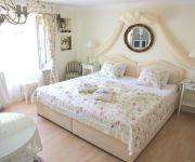
Im Roeseligarten
Hotel Swiss Star
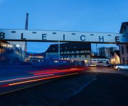
Bleiche
Videos from this area
These are videos related to the place based on their proximity to this place.
SNOW WAY BLOKE THE MOVIE / GoPro Snowboarding Video, Sestriere, GoPro Pole Mount
SNOWBOARDING, SESTRIERE, 2013, GOPRO HIGH DEFINITION, IN THE SUN!! This is the 1st movie I have ever made and with software I have never set eyes on before so it is far from perfect! but I...
Bachtel Panorama
Bachtel 1'115 m in Föhn weather, in early fall, overlooking the Linth valley, Hinwil, Wald, and the northeastern Alps.
OTB crew Jam Session 2014 - it's Longboard and Drift Trike time
Im Sommer 2014 traf sich die OTB crew regelmässig am Sonntag Nachmittag in Bäretswil ZH um die Strassen runter zu heizen und den Tag auf eine ganz eigene Art zu verbringen. OTB crew is...
Supermoto Championship Bäretswil 2012
Leider hat meine Cam den geist aufgegeben darum nur Fotos :-(( Unfortunately, my Cam just about given up the gohst. Therefore only Photos.
Hans Künzi - Die Fotos vom Bachtel bzw. von der Bachtelregion
In Gedenken an Hans Künzi (früheres Vorstandsmitglied der Genossenschaft Bachtel-Kulm). Bilder in Copyright von Hans bzw. Eva Künzi.
Videos provided by Youtube are under the copyright of their owners.
Attractions and noteworthy things
Distances are based on the centre of the city/town and sightseeing location. This list contains brief abstracts about monuments, holiday activities, national parcs, museums, organisations and more from the area as well as interesting facts about the region itself. Where available, you'll find the corresponding homepage. Otherwise the related wikipedia article.
Hinwil District
Hinwil District is one of the twelve districts of the German-speaking canton of Zurich, Switzerland. It lies to the southeast of the canton, bordering the adjacent St. Gallen. Hinwil has a population of 89,349 (as of 31 December 2011); its capital is the town of Hinwil, located at the centre of the district.
Ghöch Pass
Ghöch Pass is a mountain pass in the canton of Zürich in Switzerland.
Schufelberger Egg Pass
Schufelberger Egg Pass (el. 990 m. ) is a mountain pass in the Alps in the canton of Zürich in Switzerland. It connects Wernetshausen and Gibswil (in the municipality of Fischenthal).
Girenbad
Girenbad is a village in the municipality Hinwil in the Canton of Zürich, Switzerland.
Bachtel Tower
Bachtel Tower is a 60 m tall radio tower on 1,115 m high Bachtel mountain near Hinwil, Switzerland, overloking Zürcher Oberland. Bachtel Tower is a lattice tower whose observation deck, 30 m metres above the ground, is accessible by a stairway. It was built as replacement for a smaller observation tower on the site in 1986. On the observation deck of Bachtel Tower there is an illustration with the names of the mountains of the Swiss Alps visible.
Bachtelblick-Schanze
The Bachtelblick-Schanze is a ski jumping hill in the town of Gibswil, close to Fischenthal, Switzerland. It was built in 2005-06 and was opened in late 2006. In the summer it is covered with plastic matting. Close to this hill there is also a K28 and K14. The hill record, 65.5 m was set by Adrian Schuler, jumping for SC Einsiedeln.
Greifenberg Castle
Greifenberg Castle is a ruined castle in the municipality of Bäretswil and the canton of Zürich in Switzerland. It is a Swiss heritage site of national significance.
Bauma railway station
Bauma is a railway station in the Swiss canton of Zurich and municipality of Bauma. The station is situated at the junction of the Tösstal railway line, which is still in full use, and the Uerikon to Bauma railway (UeBB), which is partly closed and partly used as a heritage railway. Bauma station is an intermediate station on the Zurich S-Bahn route S26, which operates between Rapperswil and Winterthur.


