Safety Score: 2,8 of 5.0 based on data from 9 authorites. Meaning we advice caution when travelling to Poland.
Travel warnings are updated daily. Source: Travel Warning Poland. Last Update: 2024-05-15 08:00:47
Touring Heidelberg b. Landeck
The district Heidelberg b. Landeck of Lutynia in Powiat kłodzki (Województwo Dolnośląskie) is a subburb located in Poland about 219 mi south-west of Warsaw, the country's capital place.
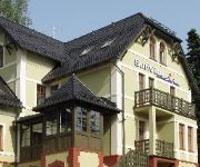
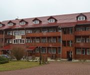
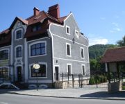
Need some hints on where to stay? We compiled a list of available hotels close to the map centre further down the page.
Being here already, you might want to pay a visit to some of the following locations: Ladek-Zdroj, Paczkow, Ziebice, Otmuchow and Kamiennik. To further explore this place, just scroll down and browse the available info.
Local weather forecast
Todays Local Weather Conditions & Forecast: 19°C / 67 °F
| Morning Temperature | 10°C / 51 °F |
| Evening Temperature | 16°C / 61 °F |
| Night Temperature | 12°C / 53 °F |
| Chance of rainfall | 0% |
| Air Humidity | 41% |
| Air Pressure | 1013 hPa |
| Wind Speed | Gentle Breeze with 8 km/h (5 mph) from North-West |
| Cloud Conditions | Few clouds, covering 20% of sky |
| General Conditions | Light rain |
Thursday, 16th of May 2024
16°C (61 °F)
11°C (52 °F)
Light rain, moderate breeze, scattered clouds.
Friday, 17th of May 2024
13°C (55 °F)
10°C (50 °F)
Light rain, light breeze, overcast clouds.
Saturday, 18th of May 2024
11°C (52 °F)
11°C (51 °F)
Light rain, gentle breeze, overcast clouds.
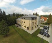
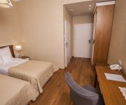
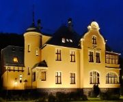
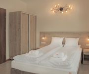
Hotels and Places to Stay
Kalina Centrum Konferencyjne
Rezydencja Grawert - Victorian Boutique Residence
Alhambra
Villa Elise Park Pension
Willa Bursztynowe Buki
Willa Marianna
Sunvita
Jonny's Apartments
Apartamenty Amadeus
Geovita
Videos from this area
These are videos related to the place based on their proximity to this place.
Miś - Lądek Zdrój (Londyn)
"nie ma takiego miasta Londyn, jest Lądek, Lądek Zdrój..." Nieśmiertelna komedia Stanisława Barei "Miś" z jakże ważną 'reklamą' dla miasta Lądek Zdrój :)
21.02.2015 r., Lądek-Zdrój - Wizyta Prezydenta RP Bronisława Komorowskiego
Obraz z kamery PanoLive.pl w Lądku-Zdroju zarejestrowany dnia 21.02.2015 r..
Lądek Zdrój
Kilka knajpek w Lądku Zdroju. W pobliżu jest dom Przyrodoleczniczy Jerzy oraz restauracja Casablanca. Jest to ulica Ostrowicza prowadząca do Kościuszki, Dalej znajduje się restauracja...
Uzdrowisko Lądek Zdrój - Wojciech - HD z lotu ptaka
Zdrój Wojciech to obiekt wybudowany w 1680 r. bezpośrednio nad gorącym i bijącym do dziś gorącym źródłem wody mineralnej. Łączy w sobie niezwykłość architektury, wysmakowaną...
Lądek Zdrój. Kompleks Basenów Odkrytych.
Zespół basenów miejskich, ul. Zamenhofa Lądek Zdrój © Produkcja Filmów Baleys ™ http://baleys.blogspot.com W związku z olimpiadą letnią w Berlinie w Lądku Zdroju obok Lutego Potoku...
Wojciech Lądek Zdrój opinie
Filmik pokazujący pokój w Domu Zdrojowym Wojciech w Lądku Zdroju, Byliśmy tam cztery dni w okresie majówki 2013 roku. http://www.moj-wroclaw-i-dolny-slask.com/Ladek-Zdroj.html Spędziliśmy...
Lądek Zdrój wiadukt 0-130 w 5sek. / Bandit 600
no góra 6sek... Lądek Zdrój, wiadukt i Bandzior ;] czyli sobotni wypad z Liskiem xD.
Lądek Zdrój restauracja Roma 2013
Do restauracji Roma zawsze przychodzę z wielką przyjemnością. Jedzenie jest wyjątkowo smaczne, a Właściciele wyjątkowo dbają o Gości. Najbardziej lubię smażonego pstrąga oraz dania...
Dyskoteka w Restauracji Stawy Biskupie Lądek Zdrój
Wyjątkowo sympatyczna restauracja w Lądku Zdroju. Niedawno Stawy Biskupie zmieniły właściciela i prezentują nieco inny poziom sztuki kulinarnej. Organizowane są dyskoteki, podobne do...
Videos provided by Youtube are under the copyright of their owners.
Attractions and noteworthy things
Distances are based on the centre of the city/town and sightseeing location. This list contains brief abstracts about monuments, holiday activities, national parcs, museums, organisations and more from the area as well as interesting facts about the region itself. Where available, you'll find the corresponding homepage. Otherwise the related wikipedia article.
Lądek-Zdrój
Lądek-Zdrój is a town in Kłodzko County, Lower Silesian Voivodeship, in south-western Poland. It is the seat of the administrative district called Gmina Lądek-Zdrój, close to the Czech border. It lies approximately 20 kilometres south-east of Kłodzko, and 88 kilometres south of the regional capital Wrocław. As at 2006, the town has a population of 6,181. Lądek-Zdrój became famous in Poland because of Stanisław Bareja's cult film Incredibly peaceful man (Niespotykanie spokojny człowiek).
Złoty Stok
Złoty Stok is a town in Ząbkowice Śląskie County, Lower Silesian Voivodeship, in south-western Poland. It is situated on the border with the Czech Republic, adjoining the Czech village Bílá Voda. The name Złoty Stok means "golden slope" in Polish and is a reference to the fact that a gold deposit was mined here in the Middle Ages.
Hraničky
Hraničky (German: Grenzdorf, Grenzdörfel or Gränzdorf) is a settlement located in the Rychlebské Hory (Reichensteiner Gebirges in German) in the north-eastern part of Moravia in the Czech Republic, a territory historically known as Sudetenland.
Stronie Śląskie
Stronie Śląskie is a town in Kłodzko County, Lower Silesian Voivodeship, in south-western Poland. It is the seat of the administrative district called Gmina Stronie Śląskie, close to the Czech border. Prior to 1945 it was in Germany. It lies approximately 23 kilometres south-east of Kłodzko, and 93 kilometres south of the regional capital Wrocław. As at 2006, the town has a population of 6,246.
Kąty Bystrzyckie
Kąty Bystrzyckie is a village in the administrative district of Gmina Lądek-Zdrój, within Kłodzko County, Lower Silesian Voivodeship, in south-western Poland. Prior to 1945 it was in Germany. It lies approximately 7 kilometres south-west of Lądek-Zdrój, 20 km south-east of Kłodzko, and 94 km south of the regional capital Wrocław. The village has a population of 68.
Lutynia, Kłodzko County
Lutynia is a village in the administrative district of Gmina Lądek-Zdrój, within Kłodzko County, Lower Silesian Voivodeship, in south-western Poland. Prior to 1945 it was in Germany. The village has a population of 68.
Młynowiec
Młynowiec is a village in the administrative district of Gmina Stronie Śląskie, within Kłodzko County, Lower Silesian Voivodeship, in south-western Poland. Prior to 1945 it was in Germany. It lies approximately 4 kilometres south-east of Stronie Śląskie, 26 km south-east of Kłodzko, and 96 km south of the regional capital Wrocław.
Nowy Gierałtów
Nowy Gierałtów is a village in the administrative district of Gmina Stronie Śląskie, within Kłodzko County, Lower Silesian Voivodeship, in south-western Poland, near the border with the Czech Republic. Prior to 1945 it was in Germany. It lies approximately 7 kilometres east of Stronie Śląskie, 28 km south-east of Kłodzko, and 92 km south of the regional capital Wrocław.
Strachocin, Lower Silesian Voivodeship
Strachocin is a village in the administrative district of Gmina Stronie Śląskie, within Kłodzko County, Lower Silesian Voivodeship, in south-western Poland. Prior to 1945 it was in Germany. It lies approximately 2 kilometres north of Stronie Śląskie, 22 km south-east of Kłodzko, and 92 km south of the regional capital Wrocław.
Stronie Wieś
Stronie Wieś is a village in the administrative district of Gmina Stronie Śląskie, within Kłodzko County, Lower Silesian Voivodeship, in south-western Poland. Prior to 1945 it was in Germany. It lies approximately 2 kilometres south-west of Stronie Śląskie, 23 km south-east of Kłodzko, and 95 km south of the regional capital Wrocław.
Popków
Popków is a village in the administrative district of Gmina Stronie Śląskie, within Kłodzko County, Lower Silesian Voivodeship, in south-western Poland. Prior to 1945 it was in Germany. It lies approximately 4 kilometres east of Stronie Śląskie, 25 km south-east of Kłodzko, and 93 km south of the regional capital Wrocław.
Sławęcin, Lower Silesian Voivodeship
Sławęcin is a village in the administrative district of Gmina Kamieniec Ząbkowicki, within Ząbkowice Śląskie County, Lower Silesian Voivodeship, in south-western Poland. Prior to 1945 it was in Germany. It lies approximately 6 kilometres south of Kamieniec Ząbkowicki, 13 km south-east of Ząbkowice Śląskie, and 73 km south of the regional capital Wrocław.
Śrem, Ząbkowice Śląskie County
Śrem is a village in the administrative district of Gmina Kamieniec Ząbkowicki, within Ząbkowice Śląskie County, Lower Silesian Voivodeship, in south-western Poland. Prior to 1945 it was in Germany. It lies approximately 4 kilometres south-east of Kamieniec Ząbkowicki, 11 km south-east of Ząbkowice Śląskie, and 71 km south of the regional capital Wrocław.
Błotnica, Ząbkowice Śląskie County
Błotnica is a village in the administrative district of Gmina Złoty Stok, within Ząbkowice Śląskie County, Lower Silesian Voivodeship, in south-western Poland, close to the Czech border. Prior to 1945 it was in Germany. It lies approximately 5 kilometres north-east of Złoty Stok, 15 kilometres south-east of Ząbkowice Śląskie, and 73 kilometres south of the regional capital Wrocław.
Chwalisław, Lower Silesian Voivodeship
Chwalisław is a village in the administrative district of Gmina Złoty Stok, within Ząbkowice Śląskie County, Lower Silesian Voivodeship, in south-western Poland, close to the Czech border. Prior to 1945 it was in Germany. It lies approximately 5 kilometres south-west of Złoty Stok, 18 kilometres south of Ząbkowice Śląskie, and 79 kilometres south of the regional capital Wrocław.
Mąkolno, Lower Silesian Voivodeship
Mąkolno is a village in the administrative district of Gmina Złoty Stok, within Ząbkowice Śląskie County, Lower Silesian Voivodeship, in south-western Poland, close to the Czech border. Prior to 1945 it was in Germany. The village has a population of 590 and since 1692 been producing black dust .
Płonica, Lower Silesian Voivodeship
Płonica is a village in the administrative district of Gmina Złoty Stok, within Ząbkowice Śląskie County, Lower Silesian Voivodeship, in south-western Poland, close to the Czech border. Prior to 1945 it was in Germany. It lies approximately 5 kilometres north-west of Złoty Stok, 12 km south of Ząbkowice Śląskie, and 73 km south of the regional capital Wrocław.
Bílý Potok (Javorník)
Bílý Potok is a small village located in the foothills of Rychlebské Hory (Reichensteiner Gebirges in German) in the Olomouc Region, Czech Republic. The village still administers the nearby settlement Chlum and today is a part of the town of Javorník.
Horní Hoštice (Javorník)
Horní Hoštice is a small village located in the foothills of Rychlebské Hory (Reichensteiner Gebirges in German) in the Olomouc Region in Czech Republic. Today, the village is a part of town Javorník.
Travná (Javorník)
Travná or Krutvald is a small village located in Rychlebské Hory (Reichensteiner Gebirges in German) in the Olomouc Regionin northeastern part of the Czech Republic. Today, the village is a part of the town of Javorník; the population was 53 according to 2001 census.
Zálesí (Javorník)
Zálesí or Valdek is a small village located in Rychlebské Hory (Reichensteiner Gebirges in German) in the Olomouc Region in northeastern part of the Czech Republic. In the past, the village administered the no-longer existing settlement Waldoro and today is a part of the town of Javorník. The population according to 2001 census was 20.
Kamienica, Opole Voivodeship
Kamienica is a village in the administrative district of Gmina Paczków, within Nysa County, Opole Voivodeship, in south-western Poland, close to the Czech border. It lies approximately 4 kilometres west of Paczków, 28 km west of Nysa, and 74 km west of the regional capital Opole. Before 1945 the area was part of Germany. The village has an approximate population of 1,300.
Gościce
Gościce is a village in the administrative district of Gmina Paczków, within Nysa County, Opole Voivodeship, in south-western Poland, close to the Czech border. It lies approximately 3 kilometres south-west of Paczków, 26 km west of Nysa, and 72 km west of the regional capital Opole. Before 1945 the area was part of Germany. The village has a population of 470.
Kozielno
Kozielno is a village in the administrative district of Gmina Paczków, within Nysa County, Opole Voivodeship, in south-western Poland, close to the Czech border. It lies approximately 3 kilometres north-west of Paczków, 27 km west of Nysa, and 72 km west of the regional capital Opole. Before 1945 the area was part of Germany. The village has a population of 311.
Lisie Kąty, Opole Voivodeship
Lisie Kąty is a village in the administrative district of Gmina Paczków, within Nysa County, Opole Voivodeship, in south-western Poland, close to the Czech border. It lies approximately 3 kilometres south of Paczków, 24 km west of Nysa, and 71 km west of the regional capital Opole. Before 1945 the area was part of Germany and named Fuchsloch. The village has a population of 110.


