Safety Score: 3,0 of 5.0 based on data from 9 authorites. Meaning we advice caution when travelling to Germany.
Travel warnings are updated daily. Source: Travel Warning Germany. Last Update: 2024-05-08 08:04:21
Discover Zastler
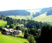
The district Zastler of Vörlinsbach in Freiburg Region (Baden-Württemberg) is a district in Germany about 398 mi south-west of Berlin, the country's capital city.
Looking for a place to stay? we compiled a list of available hotels close to the map centre further down the page.
When in this area, you might want to pay a visit to some of the following locations: Oberried, Buchenbach, Kirchzarten, Stegen and Breitnau. To further explore this place, just scroll down and browse the available info.
Local weather forecast
Todays Local Weather Conditions & Forecast: 16°C / 60 °F
| Morning Temperature | 8°C / 47 °F |
| Evening Temperature | 16°C / 61 °F |
| Night Temperature | 11°C / 51 °F |
| Chance of rainfall | 0% |
| Air Humidity | 65% |
| Air Pressure | 1024 hPa |
| Wind Speed | Gentle Breeze with 6 km/h (4 mph) from South-West |
| Cloud Conditions | Broken clouds, covering 81% of sky |
| General Conditions | Broken clouds |
Friday, 10th of May 2024
21°C (69 °F)
13°C (55 °F)
Few clouds, light breeze.
Saturday, 11th of May 2024
22°C (72 °F)
14°C (58 °F)
Scattered clouds, light breeze, broken clouds.
Sunday, 12th of May 2024
22°C (72 °F)
15°C (59 °F)
Light rain, light breeze, overcast clouds.
Hotels and Places to Stay
Bergvital Hotel
Rainhof Scheune
Schwärs Löwen
Waldhotel am Notschrei
Best Western Hofgut Sternen
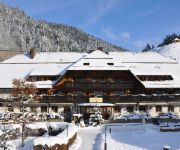
Hofgut Himmelreich
Grüner Baum
Zum Kreuz Gasthof
Sonnenalm
Sternen Anno 1769
Videos from this area
These are videos related to the place based on their proximity to this place.
Gourmands les cigogneaux de Montreux-Vieux
http://montreux-vieux.org c'est l'adresse du blog de Montreux-Vieux Ce blog se veut être un lien entre tous les acteurs du village, associations, écoles, artisans commerçants, etc....mais...
Kirchzarten 2013 PKW vs. Mountainbiker im Black Forest
In Kirchzarten ist der Autoverkehr im Wald fast genau so hoch wie auf der Straße;-) Auf einer Abfahrt waren Null Wanderer aber 4 PKW unterwegs und diese waren zum Teil Sauschnell! Black Forest...
Kampfdrachen Edo, Rokkaku und Lenkdrachen Kite
Nach dem Zweiten Weltkrieg lebte die Drachenkultur in Japan erst wieder in den 1960er Jahren auf. Durch die internationalen Drachenfeste wurde vor allem der Edo Kaku-Dako auch im Westen ...
new Oxy 1.5 Opale Paramodels first fun flight Germany RC-Paraglider
all info: http://www.karorace.de Oxy 1.5 Opale Paramodels first fun flight Germany.
ACCENTO in G
electric hurdy gurdy ACCENTO - Soundimpression www.drehleierwerkstatt.de via Schertler YELLOW, UNICO+SIDE, Effect Reverb.
أجمل مناظر في الطريق بين فرايبورغ ألمانيا إلى شلالات الراين في Full HD 1080p
أجمل مناظر في الطريق بين فرايبورغ ألمانيا إلى شلالات الراين في Full HD 1080p أتمنى أن تكونوا في أتم صحة وعافية...
Oxy 3.0 schneller Abstieg RC-Paraglider Opale Paramodels
http://www.karorace.de schnelle Höhenreduzierung mit dem Oxy 3.0 RC-Paraglider von Opale Paramodels.
1. Deutsche Meisterschaft MTB XC Eliminator Sprint: Streckenvorschau
Streckenvorschau der 1. Deutschen Meisterschaft MTB XC Eliminator Sprint.
Bio Jung: Neues von den Streuobstwiesen. So beschneiden wir unsere jungen Obstbäume.
Bio-Saftbauer Klaus Jung erklärt wie junge Obstbäume beschnitten werden.
Videos provided by Youtube are under the copyright of their owners.
Attractions and noteworthy things
Distances are based on the centre of the city/town and sightseeing location. This list contains brief abstracts about monuments, holiday activities, national parcs, museums, organisations and more from the area as well as interesting facts about the region itself. Where available, you'll find the corresponding homepage. Otherwise the related wikipedia article.
Breisgau-Hochschwarzwald
Breisgau-Hochschwarzwald is a district (Kreis) in the south of Baden-Württemberg, Germany. Neighboring districts are Emmendingen, Schwarzwald-Baar, Waldshut, Lörrach and the French départements of the Haut-Rhin and the Bas-Rhin. The district-free city of Freiburg is surrounded by the district. The District is named after the Breisgau, a historical territory, and the high parts of the Black Forest (Hochschwarzwald).
Sender Feldberg/Black Forest
The Sender Feldberg/Black Forest (transmitter Black Forest) is a transmission facility for FM and TV on Feldberg, Black Forest, Germany. It has an old and a new transmission tower: The old transmission tower was built at {{#invoke:Coordinates|coord}}{{#coordinates:47|51|52|N|8|01|20|E|type:landmark_region:DE | |name= }}. It is a 75 metre high concrete tower with an observation deck in a height of 36 metres and a diameter of 9.1 metres, which is nowadays closed.
Eugen-Keidel Tower
Eugen-Keidel Tower is a 31 metre-high observation tower location on the Schauinsland mountain near Freiburg, Germany. It was built in 1981. The Eugen-Keidel Tower has an extraordinary design with a triangular cross section.
Schule Birklehof
Schule Birklehof is a prestigious independent boarding school located in Hinterzarten in the High Black Forest region of southwestern Germany, approximately 25 km from Freiburg. It is a private coeducational secondary school. Currently, the school has approximately 240 students, 170 of whom are boarders who live on campus. The school was established by the educator Kurt Hahn in 1932 and from the beginning accepted girls and boys.
Abbey of Saint Peter in the Black Forest
St Peter's Abbey in the Black Forest or St. Peter's Abbey, Schwarzwald (German: Kloster St. Peter auf dem Schwarzwald) is a former Benedictine monastery in the village of St. Peter im Schwarzwald, in the district of Breisgau-Hochschwarzwald, Baden-Württemberg, Germany.
Schauinslandbahn
The Schauinslandbahn is a gondola lift in the Black Forest area of Baden-Württemberg, Germany. It links a lower station in the municipality of Horben, near the city of Freiburg im Breisgau, with an upper station near the summit of the Schauinsland mountain. The line is operated by VAG Freiburg, the city transport operator for Freiburg.
Mage Solar Stadion
Mage Solar Stadion is a football stadium in Freiburg, Baden-Württemberg, Germany. It is currently used mostly for football matches and is the home stadium of Sport-Club Freiburg. The stadium holds 24,000 spectators and was built in 1953. Due to a sponsorship deal, it is currently named the MAGE SOLAR Stadion. In 1993, Rolf Disch Solar Architecture and coach Volker Finke created the initiative to change their field into a solar soccer stadium.
Ravenna Bridge
Ravenna Bridge is the name of a 58-metre high and 225-metre long railway viaduct on the Höllentalbahn line in the Black Forest, in Breitnau, Breisgau-Hochschwarzwald, Baden-Württemberg, Germany. The bridge crosses the Ravenna gorge that ends in the upper Höllental, and has a grade of 12 metres . The origin of the name most likely comes from the French ravin for gorge.
Freiburg Charterhouse
Freiburg Charterhouse (Kartause Freiburg) is a former Carthusian monastery, or charterhouse, in Freiburg im Breisgau, Baden-Württemberg, Germany.
Höllental (Black Forest)
The Höllental in the Black Forest is a deep valley - in places like a gorge - in the state of Baden-Württemberg in Germany. The valley, which is about 9 kilometres long, is located in the southern part of the Southern Black Forest Nature Park about 18 km southeast of Freiburg im Breisgau between Hinterzarten and Buchenbach-Himmelreich. The Rotbach stream (also called Höllenbach in the upper Höllental) runs through the valley. "Hölle" is the German word for "hell".
Arboretum Freiburg-Günterstal
The Arboretum Freiburg-Günterstal (about 100 hectares) is an arboretum maintained by the University of Freiburg. It is located in Günterstal in the Städtischen Forstamt Freiburg at Günterstalstraße 71, Freiburg, Baden-Württemberg, Germany, and open daily without charge. The arboretum dates back to 1896, or earlier, when its first Douglas fir plantations were created to investigate their uses in local forestry. These early plantings focused primarily on useful trees from North America and Japan.
Hasenhorn
Hasenhorn is a mountain of Baden-Württemberg, Germany.
Hinterwaldkopf
Hinterwaldkopf is a mountain of Baden-Württemberg, Germany.
Rappeneck
Rappeneck is a mountain of Baden-Württemberg, Germany.
Seebuck
Seebuck is a mountain of Baden-Württemberg, Germany.
Stollenbach (Schwarzwald)
Stollenbach (Schwarzwald) is a mountain of Baden-Württemberg, Germany.
Stübenwasen
Stübenwasen is a mountain of Baden-Württemberg, Germany.
Hochschule für Musik Freiburg
The Hochschule für Musik Freiburg (University of Music, Freiburg or Freiburg Conservatory of Music) is a public music academy subsidized by the State of Baden-Württemberg for academic research and artistic and pedagogical training in music.
Muettersproch-Gsellschaft
The Muettersproch-Gsellschaft (short MSG, engl. society for the mother tongue) is a society established in 1967 whose goal it is to preserve and foster the Alemannic dialects. It currently has over 3,500 members from all Alemannic speaking areas, i.e. Elsass, Switzerland and Vorarlberg, but especially from South Baden. There are also members from all over Europe and the Americas. Most Alemannic authors, poets and singer-songwriters in South Baden are members of the society.
Kirchzarten Airfield
Kirchzarten Airfield (in German Segelfluggelände Kirchzarten-Oberried) is an unpaved airfield located approximately 10 km southeast of Freiburg im Breisgau, Germany, in the town of Kirchzarten. The airfield is home to Freiburg and Kirchzarten based gliding club Breisgauverein für Segelflug (BVS), which has also constructed the airfield and the facilities in the 70s. Until 2009, two other gliding clubs shared the airfield with the BVS, AKA Flieg Freiburg and CFM Emmendingen.
Alb (Southern Black Forest)
The Alb is a river in the Black Forest. It arises from two headwaters, the Menzenschwander Alb and Bernauer Alb and flows in a southerly direction. It ends after 42.8 km at a confluence with the High Rhine at Albbruck.
Wagensteigbach
Wagensteigbach is a river of Baden-Württemberg, Germany.
Sagebach
Sagebach is a river of North Rhine-Westphalia, Germany. It is 4.5 kilometres long and passes through the Egge Hills.
Roßkopfturm
The Roßkopf tower (actually Friedrichsturm or Frederick's tower after Frederick I, Grand Duke of Baden) is a 34.4 m (113 ft) high observation tower of steel frame structure commissioned and financed by the Schwarzwaldverein (Black Forest Club) and built by the Freiburg architect Philipp Anton Lazy in 1889 on the 737 m (2,418 ft) high Roßkopf near Freiburg between the Dreisam valley and the Glotter valley. It is one of the oldest steel lattice towers in Germany.
St. Wendelin chapel
The small St. Wendelin chapel is located about 750 metres east of St. Odile above the Musbach valley, Germany, on the Small Roßkopf, a spur of the Roßkopf, at a height of 540 m. It belongs to the parish of St. Hilarius in Freiburg's suburb Ebnet. It is named after Saint Wendelin, a king's son who lived as a shepherd and hermit. Wendelin is the patron saint of shepherds and flocks.


