Safety Score: 3,0 of 5.0 based on data from 9 authorites. Meaning we advice caution when travelling to Germany.
Travel warnings are updated daily. Source: Travel Warning Germany. Last Update: 2024-05-14 08:25:02
Discover Inner-Fröhnd
The district Inner-Fröhnd of Finsterlingen in Freiburg Region (Baden-Württemberg) is a district in Germany about 408 mi south-west of Berlin, the country's capital city.
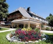
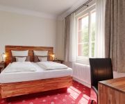
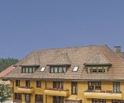
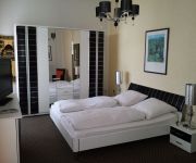
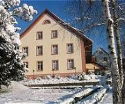
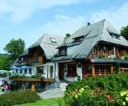
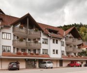
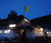
Looking for a place to stay? we compiled a list of available hotels close to the map centre further down the page.
When in this area, you might want to pay a visit to some of the following locations: Dachsberg, Ibach, Goerwihl, Herrischried and Hochenschwand. To further explore this place, just scroll down and browse the available info.
Local weather forecast
Todays Local Weather Conditions & Forecast: 11°C / 52 °F
| Morning Temperature | 10°C / 49 °F |
| Evening Temperature | 11°C / 51 °F |
| Night Temperature | 10°C / 50 °F |
| Chance of rainfall | 5% |
| Air Humidity | 92% |
| Air Pressure | 1007 hPa |
| Wind Speed | Light breeze with 4 km/h (3 mph) from East |
| Cloud Conditions | Overcast clouds, covering 100% of sky |
| General Conditions | Light rain |
Thursday, 16th of May 2024
15°C (59 °F)
9°C (47 °F)
Light rain, gentle breeze, broken clouds.
Friday, 17th of May 2024
10°C (49 °F)
8°C (47 °F)
Light rain, calm, overcast clouds.
Saturday, 18th of May 2024
17°C (62 °F)
9°C (48 °F)
Light rain, gentle breeze, scattered clouds.
Hotels and Places to Stay
Rößle Schwarzwald Gasthof
La Quinta
Alpenblick Bio- und Wellnesshotel
Am Kurpark
Waldeck
Hirschen Landgasthof
Albtalblick
Kupferkanne
Ratsstüble Hotel Restaurant
Cortina
Videos from this area
These are videos related to the place based on their proximity to this place.
TETRA-Informationsveranstaltung Herrischried 2.7.2013 - zweiter Teil
Am Tag vorher hatte Bürgermeister Berger in der öffentlichen Gemeinderatssitzung das bestätigt was er auf der Podiumsveranstaltung - entgegen seiner vorherigen Ankündigugung nicht wiederholen...
Höllbachwasserfälle bei Görwihl
http://www.suedschwarzwald.biz/hotzenwald/ - Eindrücke von den Höllbachwasserfällen bei Görwihl im Hotzenwald. Über den Link kommt Ihr zur ausführlichen Beschreibung der Wanderung mit...
Millions of Mountain Finches Swarm in the Black Forest
A huge gathering of Finches have been swarming over a region of the Black Forest, in Germany. Some estimates reckon as many as 4000000 birds are present there. It is quite a spectacle to...
Mittlere Alb 2007
Sorry for the crap sound! Come to vimeo: http://www.vimeo.com/user730968/videos Wildwasser Kajak auf der mittleren Alb Wasserstand: Genug Fahrer: - Rolf - Céd - Christian - Nick - Pascal.
Alb Schlucht Winter 08
Wildwasser Kajak auf der Unteren Alb Zeit: 06.12.2008 von 11:30 bis 16:30 Wasserstand: Gerade noch genug Lufttemperatur: 3° Wassertemperatur: 3-4 cm :o) Und ein grosses Dankeschön...
Fasnet 2015: Hemdglunkerumzung und Erstürmung des Rathaus St. Blasien
Die Erstürmung des Rathauses in St. Blasien am Hemdglunkerumzug 2015.
THW OV Schramberg und Laufenburg Brückenbau in St. Blasien
Kurzvideo über den Bauverlauf des Brückenbaus in St. Blasien. Weitere Infos auf http://www.thw-laufenburg.de.
Videos provided by Youtube are under the copyright of their owners.
Attractions and noteworthy things
Distances are based on the centre of the city/town and sightseeing location. This list contains brief abstracts about monuments, holiday activities, national parcs, museums, organisations and more from the area as well as interesting facts about the region itself. Where available, you'll find the corresponding homepage. Otherwise the related wikipedia article.
Aar
The Aar, a tributary of the High Rhine, is the longest river that both rises and ends entirely within Switzerland. Its total length from its source to its junction with the Rhine comprises about 295 km (183 miles), during which distance it descends 1,565 m, draining an area of 17,779 km, including the whole of central Switzerland.
Waldshut (district)
Waldshut is a district (Kreis) in the south of Baden-Württemberg, Germany. Neighbouring districts are (clockwise from the west) Lörrach, Breisgau-Hochschwarzwald and Schwarzwald-Baar; followed in the south by the Swiss cantons of Schaffhausen, Zürich and Aargau.
Sender Feldberg/Black Forest
The Sender Feldberg/Black Forest (transmitter Black Forest) is a transmission facility for FM and TV on Feldberg, Black Forest, Germany. It has an old and a new transmission tower: The old transmission tower was built at {{#invoke:Coordinates|coord}}{{#coordinates:47|51|52|N|8|01|20|E|type:landmark_region:DE | |name= }}. It is a 75 metre high concrete tower with an observation deck in a height of 36 metres and a diameter of 9.1 metres, which is nowadays closed.
Klingnauer Stausee
The Klingnauer Stausee (or "Klingnau reservoir") is a reservoir near Böttstein, canton of Aargau, Switzerland, at {{#invoke:Coordinates|coord}}{{#coordinates:47|35|N|8|14|E|region:CH-AG_type:waterbody|| | |name= }}. The lake with a surface of 1.16 km² was formed at the construction of a power plant on the Aar river in the 1930s.
Sankt Blasien Abbey in the Black Forest
Sankt Blaise's Abbey in the Black Forest was a Benedictine monastery in the village of St. Blasien in the Black Forest in Baden-Württemberg, Germany.
Laufenburg District
Laufenburg District is a district of the canton of Aargau, Switzerland, essentially consisting of the upper Fricktal valley in the Aargau Jura south of the Rhine. Its capital is the town of Laufenburg. It has a population of 29,915 (as of 30 June 2012).
Rothaus
The Badische Staatsbrauerei Rothaus (Rothaus, State Brewery of Baden) is a brewery located 1000m (3300 ft. ) above sea level in Rothaus, 2 miles north of the village of Grafenhausen in the southern Black Forest. It is one of Germany's most successful and profitable regional breweries, and in the past decade has become well-known outside Baden as well. The brewery remains 100% owned by the state of Baden-Württemberg.
Kolleg St. Blasien
The Kolleg St. Blasien is a state-recognised private Gymnasium (university preparatory school) and Catholic school with boarding facilities for boys and girls. It is situated in the town of St. Blasien in the German Black Forest. The school has 850 students, 300 of whom are boarders, and is led by members of the Jesuit order (Society of Jesus). It is considered to be one of the most prestigious schools in Germany with a rich and long history.
Wutach (river)
The Wutach is a river in Baden-Württemberg, Germany, partly located on the border with the canton of Schaffhausen, Switzerland. It is formed in the southern part of the Black Forest by the confluence of two smaller rivers, the Haslach and the Gutach, near the town of Lenzkirch.
Gustav Siewerth Academy
The Gustav-Siewerth Academy (GSA) is a private university with state recognition, based in Weilheim-beer Bronnen in Baden-Wuerttemberg. The Academy is named after the philosopher and pedagogue Gustav Siewerth. With only 16 students, it is the smallest state-recognized institution of higher education in Germany. The Academy was created in an effort to the neo-Marxism of the Frankfurt School of Theodor W. Adorno and Max Horkheimer counteract.
Windgfällweiher
Windgfällweiher is a lake in Südschwarzwald, Baden-Württemberg, Germany. At an elevation of, its surface area is 19.81 ha.
Eggberg
Eggberg is a mountain of Baden-Württemberg, Germany.
Hasenhorn
Hasenhorn is a mountain of Baden-Württemberg, Germany.
Hochkopf (Südschwarzwald)
Hochkopf (Südschwarzwald) is a mountain of Baden-Württemberg, Germany.
Rohrenkopf
Rohrenkopf is a mountain of Baden-Württemberg, Germany.
Seebuck
Seebuck is a mountain of Baden-Württemberg, Germany.
Waldshut–Koblenz Rhine Bridge
The Waldshut–Koblenz Rhine Bridge is a single-track railway bridge on the Turgi–Koblenz–Waldshut railway, between Waldshut and Koblenz AG, crossing the Rhine and the border between Germany and Switzerland. It was the first railway bridge built over the Rhine below Lake Constance. It is the only major railway bridge over the Rhine, which is completely preserved in its original condition and is one of Europe's few lattice truss bridges.
Alb (Southern Black Forest)
The Alb is a river in the Black Forest. It arises from two headwaters, the Menzenschwander Alb and Bernauer Alb and flows in a southerly direction. It ends after 42.8 km at a confluence with the High Rhine at Albbruck.
Sissle
The Sissle is a 16-kilometer long river in the Swiss canton of Aargau in Switzerland. It is a tributary of the Rhine and drains the eastern part of the Fricktal. The largest town on the river is Frick. The river rises in the municipalities of Schinznach-Dorf and Thalheim at an altitude of 650 m above the sea (Switzerland) on the southern slope of Mount Dreierberg and the northern slope of Mount Zeiher Homberg, in the Jura Mountains.
Liederbach (Main)
Liederbach (Main) is a river of Hesse, Germany.
Sagebach
Sagebach is a river of North Rhine-Westphalia, Germany. It is 4.5 kilometres long and passes through the Egge Hills.
Koblenz railway station (Switzerland)
Koblenz is a railway station in the Swiss canton of Aargau and municipality of Koblenz. The station is located at junction of the Turgi to Waldshut railway line with the Winterthur to Koblenz line and the Stein-Säckingen to Koblenz line. The station is served by Zurich S-Bahn line S41, which links Winterthur and Waldshut, and Aargau S-Bahn line S27, which links Baden and Koblenz, with alternate trains continuing to either Waldshut or Bad Zurzach.
Koblenz Dorf railway station
Koblenz Dorf is a railway station in the Swiss canton of Aargau and municipality of Koblenz. The station is located on the Winterthur to Koblenz line and is served by Zurich S-Bahn line S41, which links Winterthur and Waldshut, and by alternate trains on Aargau S-Bahn line S27, which link Baden and Bad Zurzach. Koblenz Dorf station should not be confused with Koblenz station, which is situated rather further from the centre of Koblenz.
Koblenz Aar railway bridge
The Koblenz Aar railway bridge, also known as the Koblenz–Felsenau railway bridge or the Aarebrücke Koblenz, is a single-track railway bridge which carries the Stein-Säckingen to Koblenz line across the River Aar in Switzerland. The bridge dates from 1892 and is listed as a Swiss heritage site of national significance. The bridge links the municipalities of Koblenz and Leuggern, both of which are in the canton of Aargau.
Gersbach (Schopfheim)
Gersbach is a nationally recognized resort and district of Schopfheim, a town in the district of Lörrach in Baden-Württemberg, Germany. Gersbach is situated in a mountain valley basin to the south from the eponymous river in the Black Forest at an altitude of 800-1170 m above sea level. The old town of Schopfheim is roughly 17 km away. The formerly independent village, together with the six associated hamlets forms one of Baden-Württemberg's largest Gemarkung, with an area of 2009 hectares.


