Safety Score: 3,0 of 5.0 based on data from 9 authorites. Meaning we advice caution when travelling to Germany.
Travel warnings are updated daily. Source: Travel Warning Germany. Last Update: 2024-05-20 08:01:38
Discover Hinter Engelschwand
The district Hinter Engelschwand of Engelschwand in Freiburg Region (Baden-Württemberg) is a district in Germany about 410 mi south-west of Berlin, the country's capital city.
Looking for a place to stay? we compiled a list of available hotels close to the map centre further down the page.
When in this area, you might want to pay a visit to some of the following locations: Herrischried, Todtmoos, Ibach, Goerwihl and Dachsberg. To further explore this place, just scroll down and browse the available info.
Local weather forecast
Todays Local Weather Conditions & Forecast: 20°C / 67 °F
| Morning Temperature | 9°C / 48 °F |
| Evening Temperature | 17°C / 63 °F |
| Night Temperature | 11°C / 53 °F |
| Chance of rainfall | 2% |
| Air Humidity | 53% |
| Air Pressure | 1008 hPa |
| Wind Speed | Light breeze with 4 km/h (3 mph) from South-West |
| Cloud Conditions | Broken clouds, covering 63% of sky |
| General Conditions | Light rain |
Tuesday, 21st of May 2024
9°C (49 °F)
9°C (48 °F)
Moderate rain, light breeze, overcast clouds.
Wednesday, 22nd of May 2024
9°C (47 °F)
7°C (44 °F)
Light rain, gentle breeze, overcast clouds.
Thursday, 23rd of May 2024
14°C (57 °F)
8°C (46 °F)
Light rain, light breeze, overcast clouds.
Hotels and Places to Stay
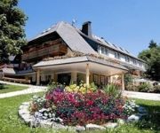
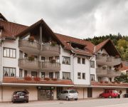
La Quinta
Rößle Schwarzwald Gasthof
Am Kurpark
Ratsstüble Hotel Restaurant
Waldeck
Kupferkanne
Gersbacher Hof
Alemannenhof Engel
Sonnenhof Landhaus
Zum Hirschen Gasthof
Videos from this area
These are videos related to the place based on their proximity to this place.
TETRA-Informationsveranstaltung Herrischried 2.7.2013 - zweiter Teil
Am Tag vorher hatte Bürgermeister Berger in der öffentlichen Gemeinderatssitzung das bestätigt was er auf der Podiumsveranstaltung - entgegen seiner vorherigen Ankündigugung nicht wiederholen...
Höllbachwasserfälle bei Görwihl
http://www.suedschwarzwald.biz/hotzenwald/ - Eindrücke von den Höllbachwasserfällen bei Görwihl im Hotzenwald. Über den Link kommt Ihr zur ausführlichen Beschreibung der Wanderung mit...
Millions of Mountain Finches Swarm in the Black Forest
A huge gathering of Finches have been swarming over a region of the Black Forest, in Germany. Some estimates reckon as many as 4000000 birds are present there. It is quite a spectacle to...
Casa Cristina - Wintersport in Herrischried
Discover one of the Black Forest Ski Areas - Herrischried 2 Ski Slopes (Easy & Medium) 2 Drag Lifts 1 Restaurant Ice skating hall Indoor swimming pool Cross-country skiing Skiing School Ski-...
* * Stein am Rhein (Schaffhausen)__Suiza * * Kenny G__Passages * *
Stein am Rhein (literalmente Piedra del Rin) es una comuna y ciudad histórica suiza del cantón de Schaffhausen, situada en el exclave oriental del cantón, en la riviera extrema occidental...
Tradingsignale Devisenkurse Währungskurse Charts Währungshandel Tradingservice
Mit den FXTS-Trading-Signalen gelingt Ihnen ein einfacher Einstieg in den größten und dynamischsten Handelsmarkt der Welt. www.Forex-Tradingsignale.de TRADINGSERVICE Martin Lauffer ...
Videos provided by Youtube are under the copyright of their owners.
Attractions and noteworthy things
Distances are based on the centre of the city/town and sightseeing location. This list contains brief abstracts about monuments, holiday activities, national parcs, museums, organisations and more from the area as well as interesting facts about the region itself. Where available, you'll find the corresponding homepage. Otherwise the related wikipedia article.
Waldshut (district)
Waldshut is a district (Kreis) in the south of Baden-Württemberg, Germany. Neighbouring districts are (clockwise from the west) Lörrach, Breisgau-Hochschwarzwald and Schwarzwald-Baar; followed in the south by the Swiss cantons of Schaffhausen, Zürich and Aargau.
Schweigmatt
Schweigmatt is a hamlet located in the southern Black Forest of Germany at an altitude of 780 metres. It belongs to the village of Raitbach and is part of the municipality of Schopfheim in the district of Lörrach. Schweigmatt lies beneath the 985 m peak of the Hohe Möhr, from which it is possible to see as far as the Swiss Alps and Jura Mountains across the Rhine River.
Sankt Blasien Abbey in the Black Forest
Sankt Blaise's Abbey in the Black Forest was a Benedictine monastery in the village of St. Blasien in the Black Forest in Baden-Württemberg, Germany.
Stilli
Stilli is a former municipality of the canton of Aargau, Switzerland. On 1 January 2006, it merged with its neighbouring municipality, Villigen.
Laufenburg District
Laufenburg District is a district of the canton of Aargau, Switzerland, essentially consisting of the upper Fricktal valley in the Aargau Jura south of the Rhine. Its capital is the town of Laufenburg. It has a population of 29,915 (as of 30 June 2012).
Kolleg St. Blasien
The Kolleg St. Blasien is a state-recognised private Gymnasium (university preparatory school) and Catholic school with boarding facilities for boys and girls. It is situated in the town of St. Blasien in the German Black Forest. The school has 850 students, 300 of whom are boarders, and is led by members of the Jesuit order (Society of Jesus). It is considered to be one of the most prestigious schools in Germany with a rich and long history.
Canton of Fricktal
Fricktal was a canton of the Helvetic Republic from February 1802 to February 1803, consisting of that part of the Breisgau south of the Rhine. Now, the territories of Fricktal form the districts of Rheinfelden and Laufenburg in the canton of Aargau. In 1799, a year after the proclamation of the Helvetic Republic, French Revolutionary troops marched into the Fricktal.
Gustav Siewerth Academy
The Gustav-Siewerth Academy (GSA) is a private university with state recognition, based in Weilheim-beer Bronnen in Baden-Wuerttemberg. The Academy is named after the philosopher and pedagogue Gustav Siewerth. With only 16 students, it is the smallest state-recognized institution of higher education in Germany. The Academy was created in an effort to the neo-Marxism of the Frankfurt School of Theodor W. Adorno and Max Horkheimer counteract.
Ägelsee (Zeiningen)
Ägelsee (or Egelsee) is a small lake in the municipality of Zeiningen, Canton of Aargau, Switzerland. The 7500 m² nature preserve is an amphibian spawning area of national importance.
Windgfällweiher
Windgfällweiher is a lake in Südschwarzwald, Baden-Württemberg, Germany. At an elevation of, its surface area is 19.81 ha.
Möhlintal
The Möhlintal is a 10-kilometre long valley running between Möhlin and Wegenstetten in the Rheinfelden district of Canton Aargau, Switzerland. The five municipalities in the valley have a total population of around 14,000 people. In the upper valley, the valley is also known as the "Wegenstettertal". This name was particularly used by associations and groups related to the upper Möhlintal municipalities. In Habsburg times the area Landschaft (territory) Möhlinbach was already known.
Fischingertal
The Fischingertal is a 5 kilometer long valley running between Mumpf and Schupfart in the Rheinfelden District of Canton Aargau, Switzerland.
Säckingen Abbey
Säckingen Abbey is a former Roman Catholic abbey located in Bad Säckingen, Baden-Württemberg in Germany. The Abbey was founded in the 6th or 7th Century by Fridolin of Säckingen, an Irish monk. While the Abbey had both monks and nuns, only the nuns convent grew to be an important religious, economic and cultural institution for the entire upper Rhine.
Eggberg
Eggberg is a mountain of Baden-Württemberg, Germany.
Hasenhorn
Hasenhorn is a mountain of Baden-Württemberg, Germany.
Hochkopf (Südschwarzwald)
Hochkopf (Südschwarzwald) is a mountain of Baden-Württemberg, Germany.
Hohe Möhr
Hohe Möhr is a mountain of Baden-Württemberg, Germany.
Rohrenkopf
Rohrenkopf is a mountain of Baden-Württemberg, Germany.
Schöpfebach
Schöpfebach is a river of Baden-Württemberg, Germany.
Wehra
Wehra is a river of Baden-Württemberg, Germany.
Sissle
The Sissle is a 16-kilometer long river in the Swiss canton of Aargau in Switzerland. It is a tributary of the Rhine and drains the eastern part of the Fricktal. The largest town on the river is Frick. The river rises in the municipalities of Schinznach-Dorf and Thalheim at an altitude of 650 m above the sea (Switzerland) on the southern slope of Mount Dreierberg and the northern slope of Mount Zeiher Homberg, in the Jura Mountains.
Liederbach (Main)
Liederbach (Main) is a river of Hesse, Germany.
Sagebach
Sagebach is a river of North Rhine-Westphalia, Germany. It is 4.5 kilometres long and passes through the Egge Hills.
Gersbach (Schopfheim)
Gersbach is a nationally recognized resort and district of Schopfheim, a town in the district of Lörrach in Baden-Württemberg, Germany. Gersbach is situated in a mountain valley basin to the south from the eponymous river in the Black Forest at an altitude of 800-1170 m above sea level. The old town of Schopfheim is roughly 17 km away. The formerly independent village, together with the six associated hamlets forms one of Baden-Württemberg's largest Gemarkung, with an area of 2009 hectares.


