Safety Score: 3,0 of 5.0 based on data from 9 authorites. Meaning we advice caution when travelling to France.
Travel warnings are updated daily. Source: Travel Warning France. Last Update: 2024-04-29 08:03:39
Discover Manteyer
Manteyer in Hautes-Alpes (Provence-Alpes-Côte d'Azur Region) with it's 330 citizens is a city in France about 344 mi (or 553 km) south-east of Paris, the country's capital city.
Local time in Manteyer is now 12:58 PM (Monday). The local timezone is named Europe / Paris with an UTC offset of 2 hours. We know of 12 airports in the vicinity of Manteyer, of which 4 are larger airports. The closest airport in France is Gap - Tallard Airport in a distance of 7 mi (or 11 km), South-East. Besides the airports, there are other travel options available (check left side).
There are several Unesco world heritage sites nearby. The closest heritage site in France is Roman Theatre and its Surroundings and the "Triumphal Arch" of Orange in a distance of 64 mi (or 102 km), South-West. Looking for a place to stay? we compiled a list of available hotels close to the map centre further down the page.
When in this area, you might want to pay a visit to some of the following locations: Gap, Le Devoluy, Digne-les-Bains, Forcalquier and Die. To further explore this place, just scroll down and browse the available info.
Local weather forecast
Todays Local Weather Conditions & Forecast: 16°C / 61 °F
| Morning Temperature | 8°C / 46 °F |
| Evening Temperature | 12°C / 53 °F |
| Night Temperature | 8°C / 46 °F |
| Chance of rainfall | 3% |
| Air Humidity | 57% |
| Air Pressure | 1017 hPa |
| Wind Speed | Gentle Breeze with 6 km/h (3 mph) from South-West |
| Cloud Conditions | Overcast clouds, covering 100% of sky |
| General Conditions | Light rain |
Tuesday, 30th of April 2024
14°C (57 °F)
7°C (45 °F)
Light rain, gentle breeze, overcast clouds.
Wednesday, 1st of May 2024
14°C (57 °F)
8°C (47 °F)
Moderate rain, light breeze, overcast clouds.
Thursday, 2nd of May 2024
6°C (43 °F)
4°C (39 °F)
Moderate rain, light breeze, overcast clouds.
Hotels and Places to Stay
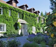
Les Olivades Le Manoir de Malcombe
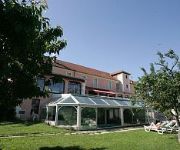
Muret Logis de France
Azur Logis de France
Videos from this area
These are videos related to the place based on their proximity to this place.
Passage d'un Transall sur Gap-Tallard
Passage d'un Transall sur l'aérodrome de Gap-Tallard en novembre 2013.
Saut en tandem de Jade chez SKYDIVE CENTER à tallard
Saut en tandem Skydive Center, aérodrome de Gap Tallard. Vous voulez aussi faire le grand saut !!! Alors venez ici http://www.skydivecenter.fr.
Chute libre à 4000m - Tallard
Saut effectué le 26 juillet 2014 sur l'aérodrome Gap-Tallard avec Micronic. Musique : Lindsey Stirling - Crystallize.
Parachutisme - Fab 4eme saut PAC au CERPS Gap-Tallard
programme du saut : sortie 400 m sur le dos - remis à plat ventre - stabilisation - ouverture du parachute à 1500 m (c'est un peu le bordel par moment, mais le programme est respecté ;o)
Montgolfière dans les Alpes du Sud en Hiver
Vol en Montgolfière dans les Hautes-Alpes. Décollage à Gap et atterrissage sur l'aérodrome de Gap-Tallard. On pense souvent que la montgolfière se pratique uniquement en été alors que...
Site de parapente de Rabou (Alpes du Sud - 05 Hautes-Alpes)
Vidéo de présentation du site de parapente de Rabou dans les Alpes du Sud. Ce site est situé à proximité de la ville de Gap (05 Hautes-Alpes). Images et Montage par Thibaut de Rosnay.
F/AM-320-357-359
Summit Information for F/AM-320 Pic de Gleize - 2160m, 8 points Association: France Region: Alpes Méridionales Latitude: 44 38 3 N, Longitude: 6 2 38 E ----------------------------------------...
Olonzac Market
Market day at Olonzac, a short distance from Cesseras. CHATEAU MARCEL. Holiday apartments in Cesseras, France.
Videos provided by Youtube are under the copyright of their owners.
Attractions and noteworthy things
Distances are based on the centre of the city/town and sightseeing location. This list contains brief abstracts about monuments, holiday activities, national parcs, museums, organisations and more from the area as well as interesting facts about the region itself. Where available, you'll find the corresponding homepage. Otherwise the related wikipedia article.
Realization (climb)
Realization, or Biographie, is a sport climbing route on a crag on the southern face of the 2016-metre (6614-foot) Montagne de Céüse near Gap and Céüse, France. The first person to successfully climb Realization was Chris Sharma, who did not grade the climb. It is generally considered to be 9a+ or 5.15a. Among the routes that have been repeated by anyone else except the author, Realization is the first ascent to be recognized with a 5.15a rating making it the most difficult at that time.
Céüse
Céüse is a hamlet in the Hautes-Alpes département of France, part of the commune of Manteyer. The nearby Montagne de Céüse (2016 m) is home to one of France's most important venues for sport climbing. Biographie, one of the hardest rock climbs in the world, is located at Céüse.


