Safety Score: 2,7 of 5.0 based on data from 9 authorites. Meaning we advice caution when travelling to United States.
Travel warnings are updated daily. Source: Travel Warning United States. Last Update: 2024-05-02 08:23:34
Discover Sattes
Sattes in Kanawha County (West Virginia) is a city in United States about 260 mi (or 419 km) west of Washington DC, the country's capital city.
Local time in Sattes is now 08:43 AM (Thursday). The local timezone is named America / New York with an UTC offset of -4 hours. We know of 9 airports in the vicinity of Sattes, of which 5 are larger airports. The closest airport in United States is Yeager Airport in a distance of 12 mi (or 20 km), East. Besides the airports, there are other travel options available (check left side).
Also, if you like golfing, there are a few options in driving distance. Looking for a place to stay? we compiled a list of available hotels close to the map centre further down the page.
When in this area, you might want to pay a visit to some of the following locations: Winfield, Charleston, Hamlin, Madison and Ripley. To further explore this place, just scroll down and browse the available info.
Local weather forecast
Todays Local Weather Conditions & Forecast: 29°C / 84 °F
| Morning Temperature | 14°C / 58 °F |
| Evening Temperature | 26°C / 79 °F |
| Night Temperature | 19°C / 67 °F |
| Chance of rainfall | 0% |
| Air Humidity | 42% |
| Air Pressure | 1015 hPa |
| Wind Speed | Light breeze with 3 km/h (2 mph) from South |
| Cloud Conditions | Clear sky, covering 0% of sky |
| General Conditions | Sky is clear |
Thursday, 2nd of May 2024
28°C (82 °F)
17°C (63 °F)
Light rain, moderate breeze, overcast clouds.
Friday, 3rd of May 2024
25°C (77 °F)
18°C (64 °F)
Moderate rain, light breeze, overcast clouds.
Saturday, 4th of May 2024
25°C (76 °F)
16°C (60 °F)
Light rain, gentle breeze, broken clouds.
Hotels and Places to Stay
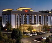
Hampton Inn Charleston-Southridge
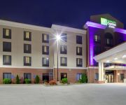
Holiday Inn Express & Suites CHARLESTON NW - CROSS LANES
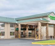
Comfort Inn Cross Lanes
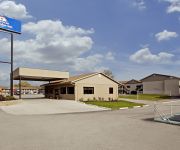
Sleep Inn & Suites
MOTEL 6 CHARLESTON WEST - CROSS LANES WV
AMERICAS BEST VALUE INN
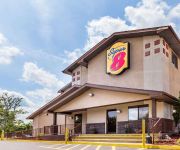
SUPER 8 DUNBAR CHARLESTON AREA
Videos from this area
These are videos related to the place based on their proximity to this place.
Dick Henderson Bridge Explosion on Nitro Side
March 8, 2013 bridge implosion on Nitro Side. Recorded from Saint Albans Roadside Park.
Plumber Nitro WV | 304-935-5154 | Plumbing Services West Virginia
Plumber Nitro WV | 304-935-5154 | Plumbing Services West Virginia We offer a complete plumbing service for new installations, repairs, and remodeling. Our fast, professional service includes...
Short wintertime flight
Short flight with the Latrax Alias and 808 #16 keychain camera over a snowy football field in Nitro, WV. Glad to have a little warmer temperatures to enjoy a bit.
Blue and Gold Dinner Video
I made this video to show at my Troop's Blue and Gold Dinner. It is a summary of the bird watching trip, making snowshoes, and the snowshoeing trips from the past few months.
Festival Of Lights - St. Albans - 12-8-13
Quick tour of the Festival Of Lights at St. Albans City Park.
Train Meet and Superliners: Railfanning Saint Albans, West Virginia on January 5th, 2014
Went out to railfan on January 5th, 2014 with a few fellow railfans from the Kanawha Valley Area, we saw a train meet and Amtrak with detoured superliners in the town of Saint Albans, West...
PHS Big Red Band
St Albans half time show 2012 Parkersburg High School Band, Parkersburg WV performing during half time show in St. Albans.
AFL-CIO, Construction Trades, WVCAG Supporting the Jobs Act St. Albans, WV
Labor, Community and Faith groups join to make a statement in support of the American Jobs Act. Location is the Dick Henderson bridge linking St Albans to Nitro, WV. Speakers in order of appearence.
Videos provided by Youtube are under the copyright of their owners.
Attractions and noteworthy things
Distances are based on the centre of the city/town and sightseeing location. This list contains brief abstracts about monuments, holiday activities, national parcs, museums, organisations and more from the area as well as interesting facts about the region itself. Where available, you'll find the corresponding homepage. Otherwise the related wikipedia article.
Cross Lanes, West Virginia
Cross Lanes is an unincorporated census-designated place and suburb of Charleston in Kanawha County, West Virginia, United States. As of the 2010 census, its population was 9,995.
Jefferson, West Virginia
Jefferson is an unincorporated census-designated place in Kanawha County, West Virginia, United States, along the Kanawha River. The population was 676 at the 2010 census. Jefferson was incorporated on March 22, 1997, but was disincorporated less than a decade later on February 21, 2007. In January 2001, Jefferson was profiled on The Daily Show with Jon Stewart by faux reporter Stephen Colbert.
St. Albans, West Virginia
St. Albans is a city in Kanawha County, West Virginia, United States, at the confluence of the Kanawha and Coal Rivers. The population was 11,044 at the 2010 census. St. Albans was laid out in 1816. Originally, it was known as Philippi, after Philip Thompson, an early settler, the name afterwards being changed to Coalsmouth due to its location at the mouth of the Coal River. The city was then incorporated as Kanawha City in 1868. The town was renamed in 1872 by H.C.
Nitro, West Virginia
Nitro is a city in Kanawha and Putnam counties in the U.S. state of West Virginia, along the Kanawha River. The population was 7,178 at the 2010 census. Nitro is a part of the Huntington-Ashland, WV-KY-OH, Metropolitan Statistical Area (MSA). As of the 2010 census, the MSA had a population of 287,702. New definitions from February 28, 2013 placed the population at 363,000. Nitro was incorporated in 1932 by Circuit Court.
WJYP
WJYP is a Southern Gospel-formatted broadcast radio station licensed to St. Albans, West Virginia, serving Western Kanawha County, West Virginia and Central Putnam County, West Virginia. WJYP is owned and operated by L.M. Communications, Inc.


