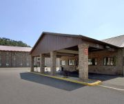
Safety Score: 2,7 of 5.0 based on data from 9 authorites. Meaning we advice caution when travelling to United States.
Travel warnings are updated daily. Source: Travel Warning United States. Last Update: 2024-04-28 08:22:10
Discover Rutledge
Rutledge in Kanawha County (West Virginia) is a town in United States about 246 mi (or 396 km) west of Washington DC, the country's capital city.
Current time in Rutledge is now 03:44 PM (Sunday). The local timezone is named America / New York with an UTC offset of -4 hours. We know of 10 airports near Rutledge, of which 5 are larger airports. The closest airport in United States is Yeager Airport in a distance of 3 mi (or 5 km), West. Besides the airports, there are other travel options available (check left side).
Also, if you like playing golf, there are a few options in driving distance. Looking for a place to stay? we compiled a list of available hotels close to the map centre further down the page.
When in this area, you might want to pay a visit to some of the following locations: Charleston, Winfield, Madison, Clay and Spencer. To further explore this place, just scroll down and browse the available info.
Local weather forecast
Todays Local Weather Conditions & Forecast: 27°C / 80 °F
| Morning Temperature | 14°C / 57 °F |
| Evening Temperature | 26°C / 78 °F |
| Night Temperature | 21°C / 70 °F |
| Chance of rainfall | 0% |
| Air Humidity | 43% |
| Air Pressure | 1021 hPa |
| Wind Speed | Gentle Breeze with 6 km/h (3 mph) from East |
| Cloud Conditions | Clear sky, covering 0% of sky |
| General Conditions | Sky is clear |
Sunday, 28th of April 2024
27°C (81 °F)
18°C (64 °F)
Scattered clouds, gentle breeze.
Monday, 29th of April 2024
18°C (64 °F)
14°C (58 °F)
Moderate rain, gentle breeze, overcast clouds.
Tuesday, 30th of April 2024
25°C (77 °F)
17°C (62 °F)
Light rain, light breeze, scattered clouds.
Hotels and Places to Stay
Residence Inn Charleston
WV Charleston S Country Inn and Suites by Radisson
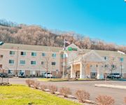
Holiday Inn Express CHARLESTON-KANAWHA CITY
BUDGET HOST INN CHA
Sleep Inn Charleston
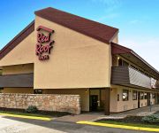
WV Red Roof Inn Charleston - Kanawha City
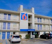
MOTEL 6 CHARLESTON EAST WV
KNIGHTS INN CHARLESTON EAST
DAYS INN CHARLESTON EAST
Videos from this area
These are videos related to the place based on their proximity to this place.
Diamond DA40 Rainy Charleston WV Takeoff/Landing
Diamond DA40 Takeoff and Landing on a Rainy Charleston WV Winter Day.
Structure Fire Response 3/9/13
Pinch VFD along with Malden VFD responded to Beech Street for a reported structure fire at around 1900 hours. We had a crew at Sub-Station 2 when the tones dropped. We rolled out with a crew...
Jeepinwv.com Ivy April 14 2012
Selected Video of narnwv's Grand Cherokee. Sorry, no audio - I haven't had time to edit it all together yet.
Christmas Morning 2009
Christmas Morning with the grandsons in Charleston, WV. A great, exciting morning.
Yeager Airport landslide forces evacuations
A landslide from a Yeager Airport runway extension project covered Keystone Drive, destroyed one home and threatens a church and other homes. Read more here: ...
C-5 Galaxy Landing at CRW, Yeager Airport, Charleston WV
The second of a total of 3 C-5's that came to CRW on this day. A graceful landing for such a massive aircraft, and reverse thrust towards the end of the landing roll. The General Electric TF39...
Videos provided by Youtube are under the copyright of their owners.
Attractions and noteworthy things
Distances are based on the centre of the city/town and sightseeing location. This list contains brief abstracts about monuments, holiday activities, national parcs, museums, organisations and more from the area as well as interesting facts about the region itself. Where available, you'll find the corresponding homepage. Otherwise the related wikipedia article.
Kanawha County, West Virginia
Kanawha County is a county located in the U.S. state of West Virginia. As of the 2010 census, the county population was 193,063. Its county seat is Charleston, which is also the capital city of West Virginia. The county was named in honor of the Great Kanawha River.
Schoenbaum Stadium
Schoenbaum Stadium is a soccer stadium in Charleston, West Virginia located in Coonskin Park. The 2,000-seat stadium is home to the West Virginia Chaos of the USL Premier Development League.
Kanawha City, West Virginia
Kanawha City is a neighborhood of the city of Charleston in Kanawha County, West Virginia, United States. It is in the southeastern part of the city, and located along WV 61 (MacCorkle Ave. ) It officially starts at the 35th Street bridge, where there is a sign welcoming visitors. It comprises mostly small stores and neighborhood/residential on both sides. The stores, malls, and restaurants are mostly located in the southern part of the neighborhood.
Capital High School (Charleston, West Virginia)
Capital High School is a public high school located in Charleston, West Virginia.


