Safety Score: 2,7 of 5.0 based on data from 9 authorites. Meaning we advice caution when travelling to United States.
Travel warnings are updated daily. Source: Travel Warning United States. Last Update: 2024-05-20 08:01:38
Touring Poages Mill Estates
Poages Mill Estates in Roanoke County (Virginia) is a town located in United States about 202 mi (or 326 km) south-west of Washington DC, the country's capital place.
Time in Poages Mill Estates is now 06:31 AM (Monday). The local timezone is named America / New York with an UTC offset of -4 hours. We know of 11 airports nearby Poages Mill Estates, of which 5 are larger airports. The closest airport in United States is Roanoke Regional Woodrum Field in a distance of 10 mi (or 16 km), North-East. Besides the airports, there are other travel options available (check left side).
Also, if you like the game of golf, there are several options within driving distance. We collected 8 points of interest near this location. Need some hints on where to stay? We compiled a list of available hotels close to the map centre further down the page.
Being here already, you might want to pay a visit to some of the following locations: Salem, Roanoke, Rocky Mount, New Castle and Christiansburg. To further explore this place, just scroll down and browse the available info.
Local weather forecast
Todays Local Weather Conditions & Forecast: 26°C / 79 °F
| Morning Temperature | 15°C / 59 °F |
| Evening Temperature | 24°C / 75 °F |
| Night Temperature | 17°C / 62 °F |
| Chance of rainfall | 0% |
| Air Humidity | 47% |
| Air Pressure | 1016 hPa |
| Wind Speed | Light breeze with 5 km/h (3 mph) from West |
| Cloud Conditions | Clear sky, covering 0% of sky |
| General Conditions | Sky is clear |
Monday, 20th of May 2024
28°C (82 °F)
18°C (65 °F)
Sky is clear, light breeze, clear sky.
Tuesday, 21st of May 2024
31°C (88 °F)
21°C (69 °F)
Broken clouds, gentle breeze.
Wednesday, 22nd of May 2024
23°C (73 °F)
19°C (67 °F)
Light rain, gentle breeze, overcast clouds.
Hotels and Places to Stay
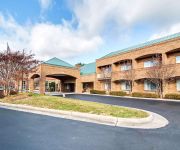
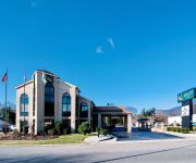
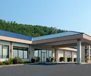
Comfort Suites Inn at Ridgewood Farm
Hampton Inn Salem East - Electric Road
Quality Inn Salem
Hampton Inn Salem VA
Comfort Suites Salem
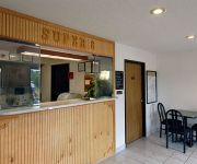
SUPER 8 SALEM VA
HOWARD JOHNSON INN AND CONFERE
Videos from this area
These are videos related to the place based on their proximity to this place.
Roanoke River Salem Greenway Ride-Thru
A ride-thru of The Roanoke River Salem Greenway in Salem,VA www.RoanokeGreenways.com.
Roanoke Valley RC Club Field
Roanoke Valley RC Club Field from an Aerial Point of view. Video taken from a FlyCamOne2 mounted to an Avistar Trainer. For information on the RVRC Club visit http://www.rvrc.org.
Custom Outdoor Kitchen Cabinets - Atlantis Cabinetry
http://www.atlantiscabinetry.com Atlantis produces high quality custom built cabinets for outdoor kitchens as well as other outdoor cabinetry that is available in a broad variety of colors...
NS 1647 at Salem (21JUL2014)
Norfolk Southern 1647, NS 1652 work train waited for two westbounds to pass. They likely cut the power off the train ran up to the crossover and back to the front of their train before heading...
NS 2633 at Salem (21JUL2014)
Norfolk Southern 2633, NS 8399, NS 9465 westbound departing Roanoke, Virginia passing NS 1647 work train.
NS 9329 at Salem (21JUL2014)
Norfolk Southern 9329, NS 8906 westbound departing Roanoke, Virginia passing NS 1647 work train.
KLR650 Bent Mtn FEB 28 2010
Temperature in the mid-20s, light snowfall, and 6'+ snowdrifts. It was a great day to ride ! Video shot with a ContourHD 1080p camera on the 720p setting.
USA 2008 xx 640 Blue Ridge Parkway Drive
a part of the BRP taken by camera right outside of the car. Between Roanoke n Mt.Airy.
The Farm - Movie trailer [HD]
In the middle of the night several friends decide to investigate an old farmhouse. What they see and experience there is beyond human understanding. "The Farm totally lived up to our expectation...
Videos provided by Youtube are under the copyright of their owners.
Attractions and noteworthy things
Distances are based on the centre of the city/town and sightseeing location. This list contains brief abstracts about monuments, holiday activities, national parcs, museums, organisations and more from the area as well as interesting facts about the region itself. Where available, you'll find the corresponding homepage. Otherwise the related wikipedia article.
Hidden Valley, Virginia
Hidden Valley is the name given to a wide, mostly unforested floodplain of the Jackson River some miles north of Virginia route 39 and west of US Route 220 in the George Washington National Forest. The Forest Service maintains the open character of the land by using it as a large hayfield. Otherwise it would quickly revert to lowland forest, little of which now exists in the eastern United States. Many people enjoy recreational activities on this mountain.
Twelve O'clock Knob (Roanoke County, Virginia)
Twelve O'clock Knob is a mountain located in southwestern Roanoke County, Virginia, directly south of Salem, Virginia. According to local lore, slaves in the western Roanoke Valley noted that the Sun was directly over the mountain roughly around noon local time. In 1995 and 1996, the Tour Du Pont staged a time trial in the Roanoke Valley, the highlight of which was a ride over the steep, winding Twelve O'clock Knob Road.
Valhalla Vineyards
Valhalla Vineyards is a vineyard and winery located in Roanoke County, Virginia, founded by James and Debra Vascik in 1994.


!['The Farm - Movie trailer [HD]' preview picture of video 'The Farm - Movie trailer [HD]'](https://img.youtube.com/vi/zg1Ssa2ounM/mqdefault.jpg)