Safety Score: 2,7 of 5.0 based on data from 9 authorites. Meaning we advice caution when travelling to United States.
Travel warnings are updated daily. Source: Travel Warning United States. Last Update: 2024-04-27 08:23:39
Delve into Burlington Heights
Burlington Heights in Roanoke County (Virginia) is located in United States about 192 mi (or 309 km) south-west of Washington DC, the country's capital town.
Current time in Burlington Heights is now 11:24 PM (Saturday). The local timezone is named America / New York with an UTC offset of -4 hours. We know of 11 airports close to Burlington Heights, of which 5 are larger airports. The closest airport in United States is Roanoke Regional Woodrum Field in a distance of 1 mi (or 2 km), South. Besides the airports, there are other travel options available (check left side).
Also, if you like playing golf, there are some options within driving distance. We encountered 8 points of interest near this location. If you need a hotel, we compiled a list of available hotels close to the map centre further down the page.
While being here, you might want to pay a visit to some of the following locations: Roanoke, Salem, Fincastle, New Castle and Rocky Mount. To further explore this place, just scroll down and browse the available info.
Local weather forecast
Todays Local Weather Conditions & Forecast: 26°C / 79 °F
| Morning Temperature | 12°C / 54 °F |
| Evening Temperature | 24°C / 75 °F |
| Night Temperature | 16°C / 61 °F |
| Chance of rainfall | 0% |
| Air Humidity | 44% |
| Air Pressure | 1022 hPa |
| Wind Speed | Gentle Breeze with 6 km/h (4 mph) from North-East |
| Cloud Conditions | Few clouds, covering 19% of sky |
| General Conditions | Few clouds |
Sunday, 28th of April 2024
28°C (82 °F)
17°C (62 °F)
Few clouds, gentle breeze.
Monday, 29th of April 2024
24°C (75 °F)
15°C (59 °F)
Light rain, light breeze, overcast clouds.
Tuesday, 30th of April 2024
28°C (82 °F)
19°C (66 °F)
Sky is clear, light breeze, clear sky.
Hotels and Places to Stay
Sheraton Roanoke Hotel & Conference Center
VA Roanoke Country Inn and Suites by Radisson
Holiday Inn ROANOKE - VALLEY VIEW
Fairfield Inn & Suites Roanoke North
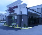
Hampton Inn Roanoke-Hollins-I-81
Holiday Inn Express ROANOKE-CIVIC CENTER
Home2 Suites by Hilton Roanoke
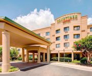
Courtyard Roanoke Airport
Residence Inn Roanoke Airport
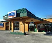
HOWARD JOHNSON INN ROANOKE AIR
Videos from this area
These are videos related to the place based on their proximity to this place.
Roanoke City Reserve Engine 904 Responding
Roanoke Fire EMS - Reserve Engine 904 (running as Engine 3) to a commercial fire alarm in Roanoke County. Reserve Engine 904 is a 1992 HME/Grumman. Engine 3 usually runs a 2002 KME and is ...
Roanoke County - Wagon 5 and Ladder 5 Responding
Roanoke County Fire Rescue Department: Wagon 5 and Ladder 5 responding to Interstate 581 in the city limits right before exit 3C for a tractor trailer collision with heavy fire. 6-12-13 Wagon...
Roanoke County Wagon 1 Responding
Roanoke County Fire Rescue Department: Wagon 1 to a commercial fire alarm in Station 5's (Hollins) first due. 8-4-11 Wagon 1 - 2009 Pierce Quantum (1500/750/30)
Roanoke County Ladder 5 Responding
Roanoke County Fire Rescue Department: Ladder 5 responding to a fire alarm. 7-22-11.
Roanoke County Engine 5 Walkaround 8-11-09
former Engine 5, after serving as Engine 11 this unit was sent to the Roanoke Valley Regional Fire-EMS Training Center in 2013. Pierce Arrow.
2008 Chevrolet Colorado Used Cars Roanoke VA
http://www.brooksideautosales.com This 2008 Chevrolet Colorado is available from Brookside Auto Sales. For details, call us at 540-362-9111.
Roanoke County - Ladder 5 and Battalion 1 Responding
Roanoke County Fire Rescue Department: Ladder 5 and Battalion 1 responding from a fire alarm to a working fire. 11-15-11.
Roanoke County Battalion 1 and Wagon 5 Responding
to Friendship Manor for a commercial fire alarm. 1-28-11 Video captured by Tom Griffin.
Videos provided by Youtube are under the copyright of their owners.
Attractions and noteworthy things
Distances are based on the centre of the city/town and sightseeing location. This list contains brief abstracts about monuments, holiday activities, national parcs, museums, organisations and more from the area as well as interesting facts about the region itself. Where available, you'll find the corresponding homepage. Otherwise the related wikipedia article.
Hollins, Virginia
Hollins is a census-designated place (CDP) in Botetourt and Roanoke counties in the U.S. state of Virginia. Hollins covers much of the area known locally as "North County". The population was 14,309 at the 2000 census. It is part of the Roanoke Metropolitan Statistical Area.
Hollins University
Hollins University is a four-year private institution of higher education located on a 475-acre campus on the border of Roanoke and Botetourt counties in the U.S. state of Virginia. Founded in 1842 as Valley Union Seminary in the historical settlement of Botetourt Springs, it is one of the oldest institutions of higher education for women in the United States. Hollins has since evolved into a full university with more than 1000 enrolled undergraduate and graduate students.
Roanoke Regional Airport
Roanoke Regional Airport, also known as Woodrum Field, is a regional airport located three nautical miles northwest of the central business district of Roanoke, a city in Roanoke County, Virginia, United States. It is governed by the five-member Roanoke Regional Airport Commission that includes representatives from both the city and county of Roanoke. The airport has two runways and over 60 scheduled flights each day.
Northside High School (Roanoke, Virginia)
Northside High School is one of five high schools in Roanoke County, Virginia.
Valley View Mall (Roanoke, Virginia)
Valley View Mall is a 800,000-square-foot regional shopping mall located in the Roundhill neighborhood of Roanoke, Virginia. It is located near the interchange of Interstate 581 with Hershberger Road in the northwest section of the city. Most outparcel locations around Valley View Mall have been developed into restaurants, retail stores, offices, and hotels. Major surrounding stores include Ashley Furniture, Dick's Sporting Goods, Best Buy, Grand Home Furnishings, Wal-Mart, and Target.
William Fleming High School
William Fleming High Schoolis an urban school, and one of the only two public high schools in the Roanoke City area school division, the other being the Patrick Henry High School. The edifice itself is located at 3649 Ferncliff Ave. Roanoke, Virginia 24017 and is positioned within the Miller/Arrowood neighborhood of the city.
Intervale, Virginia
Intervale is an unincorporated community in Alleghany County, Virginia, United States.
Westview Terrace, Roanoke, Virginia
Westview Terrace is a Roanoke, Virginia neighborhood located in northwest Roanoke. It borders the neighborhoods of Peachtree/Norwood on the west, Villa Heights and Washington Heights on the south and Miller Court/Arrowood on the north and east. The neighborhood is predominantly residential in character throughout its area with limited commercial development along its Virginia State Route 117 (Peters Creek Road) frontage.


