Safety Score: 3,0 of 5.0 based on data from 9 authorites. Meaning we advice caution when travelling to United Kingdom.
Travel warnings are updated daily. Source: Travel Warning United Kingdom. Last Update: 2024-04-27 08:23:39
Touring Kirktown of Slains
Kirktown of Slains in Aberdeenshire (Scotland) is a town located in United Kingdom about 410 mi (or 660 km) north of London, the country's capital place.
Time in Kirktown of Slains is now 02:57 PM (Saturday). The local timezone is named Europe / London with an UTC offset of one hour. We know of 11 airports nearby Kirktown of Slains, of which 4 are larger airports. The closest airport in United Kingdom is Aberdeen Dyce Airport in a distance of 14 mi (or 23 km), South-West. Besides the airports, there are other travel options available (check left side).
There are several Unesco world heritage sites nearby. The closest heritage site in United Kingdom is Old and New Towns of Edinburgh in a distance of 102 mi (or 164 km), South. Also, if you like the game of golf, there are several options within driving distance. Need some hints on where to stay? We compiled a list of available hotels close to the map centre further down the page.
Being here already, you might want to pay a visit to some of the following locations: Aberdeen, Forfar, Dundee, Elgin and Haddington. To further explore this place, just scroll down and browse the available info.
Local weather forecast
Todays Local Weather Conditions & Forecast: 7°C / 45 °F
| Morning Temperature | 4°C / 39 °F |
| Evening Temperature | 6°C / 43 °F |
| Night Temperature | 4°C / 40 °F |
| Chance of rainfall | 0% |
| Air Humidity | 68% |
| Air Pressure | 1010 hPa |
| Wind Speed | Moderate breeze with 9 km/h (6 mph) from North-West |
| Cloud Conditions | Broken clouds, covering 57% of sky |
| General Conditions | Broken clouds |
Sunday, 28th of April 2024
8°C (46 °F)
5°C (41 °F)
Light rain, moderate breeze, overcast clouds.
Monday, 29th of April 2024
10°C (50 °F)
7°C (44 °F)
Overcast clouds, fresh breeze.
Tuesday, 30th of April 2024
10°C (50 °F)
8°C (47 °F)
Light rain, fresh breeze, overcast clouds.
Hotels and Places to Stay
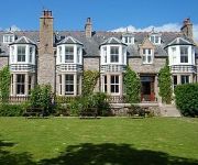
Kilmarnock Arms
Videos from this area
These are videos related to the place based on their proximity to this place.
Newburgh Beach Banter - Summer 2007
Just banter on the beach in the north-east of Scotland jumping off dunes etc. Good times.
Seals 130321 H264
Seals at Sands of Forvie, Aberdeenshire, Scotland, April 2013. Sound via Olympus LS3 with Rycote windshield.
Trump International Golf Links VistaBee Movie
Watch the stunning video of Donald Trump's International Golf Links in Scotland, filmed by VistaBee using drone technology. Produced for Trump International, Copyright VistaBee Ltd 2014 ...
Buchan.wmv
Fire Section RAF Buchan. Aberdeenshire. Special guest appearance from Jeff Murgatroyds head. C.1989/90.
Collieston Coasteering - Cliff Jumping and Newburgh for BBQ
Collieston Coasteering / Cliff Jumping , going north. June 2013. Then Newburgh BBQ watching sun go down. Filmed on GoPro Hero 3 helmet mount.
We're Jumping To Conclusions
Collieston Pier Jumping with Calan Turriff, Craig Gray and Darren Archer. All Editing was done by Craig Gray. One of the First Times at Collieston so hopefully better videos will come with...
Cathy.B sailing off Sandhaven on the N'east of Scotland
"Cathy.B" sailing off Sandhaven on the N'east of Scotland.
Bullers O Buchan.mp4
Bullers O Buchan 11 miles South of Peterhead. Small cliff top fishing community where the sea cauldron was created due to the sea action causing the roof of a sea cave to collapse. The fishermen...
Videos provided by Youtube are under the copyright of their owners.
Attractions and noteworthy things
Distances are based on the centre of the city/town and sightseeing location. This list contains brief abstracts about monuments, holiday activities, national parcs, museums, organisations and more from the area as well as interesting facts about the region itself. Where available, you'll find the corresponding homepage. Otherwise the related wikipedia article.
Meikle Loch
Meikle Loch is designated – as part of the Ythan Estuary complex along with the Sands of Forvie – as a Special Protection Area for wildlife conservation purposes. It is an inland loch in Aberdeenshire on the north east coast of Scotland. It is a eutrophic loch with limited aquatic vegetation but is important as the home to overwintering Pink-footed Geese.
Collieston
Collieston is a small former fishing village on the North Sea coast in Aberdeenshire, Scotland. The village lies just north of the Sands of Forvie Special Protection Area, between Cruden Bay and Newburgh.
Ythan Estuary
The Ythan Estuary is the tidal component of the Ythan River, emptying into the North Sea 19 kilometres north of Aberdeen, Scotland. The estuary’s tidal action extends a 7 kilometres inland and has characteristic widths of between 250 metres and 780 metres . Besides the tidal channel there are interfaces to the upland dunes including mudflats, sand beaches and shingle flats.
Hackley Head
Hackley Head (otherwise Forvie Ness) is a headland in Aberdeenshire, northeast Scotland. Hackley Head is located to the south of Hackley Bay and to the north of the Sands of Forvie and the Ythan estuary. The nearest village is Collieston.
Cotehill Loch
Cotehill Loch is a loch located in Scotland in the Aberdeenshire area, approximately one mile (1.5 km) northwest of the coastal town of Collieston and two miles (3 km) east of the Ythan Estuary. The area the loch covers is 2.7ha. A survey carried out in 2002 by ecologists from the University of Glasgow found that the eutrophication of the water was leading to a "decline in plant species diversity".


