Safety Score: 4,0 of 5.0 based on data from 9 authorites. Meaning please reconsider your need to travel to Switzerland.
Travel warnings are updated daily. Source: Travel Warning Switzerland. Last Update: 2024-04-29 08:03:39
Discover Alpe di Cortas
Alpe di Cortas in Region Moesa (Kanton Graubünden) is a place in Switzerland about 92 mi (or 148 km) south-east of Bern, the country's capital city.
Current time in Alpe di Cortas is now 11:31 AM (Monday). The local timezone is named Europe / Zurich with an UTC offset of 2 hours. We know of 9 airports near Alpe di Cortas, of which 4 are larger airports. The closest airport in Switzerland is Locarno Airport in a distance of 23 mi (or 37 km), South-West. Besides the airports, there are other travel options available (check left side).
There are several Unesco world heritage sites nearby. The closest heritage site in Switzerland is Three Castles, Defensive Wall and Ramparts of the Market-Town of Bellinzona in a distance of 17 mi (or 27 km), South-West. If you need a hotel, we compiled a list of available hotels close to the map centre further down the page.
While being here, you might want to pay a visit to some of the following locations: Cauco, Pianazzo, Hinterrhein, Braggio and Campodolcino. To further explore this place, just scroll down and browse the available info.
Local weather forecast
Todays Local Weather Conditions & Forecast: 22°C / 71 °F
| Morning Temperature | 10°C / 51 °F |
| Evening Temperature | 18°C / 64 °F |
| Night Temperature | 13°C / 56 °F |
| Chance of rainfall | 2% |
| Air Humidity | 45% |
| Air Pressure | 1020 hPa |
| Wind Speed | Light breeze with 5 km/h (3 mph) from North |
| Cloud Conditions | Broken clouds, covering 72% of sky |
| General Conditions | Light rain |
Tuesday, 30th of April 2024
22°C (72 °F)
14°C (56 °F)
Light rain, light breeze, broken clouds.
Wednesday, 1st of May 2024
21°C (70 °F)
14°C (56 °F)
Moderate rain, light breeze, overcast clouds.
Thursday, 2nd of May 2024
14°C (58 °F)
11°C (51 °F)
Moderate rain, light breeze, overcast clouds.
Hotels and Places to Stay
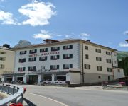
Bellevue
Videos from this area
These are videos related to the place based on their proximity to this place.
de weg van camping reiterhof naar hopfgarten op de fiets .wmv
de weg van camping Reiterhof naar Hopfgarten op de fiets door Jos Rijgersberg.
Westfield MegaBusa - Da Mesocco al passo del San Bernardino
giornata autunnale stupenda sulla strada che collega Mesocco al passo del San Bernardino. Paesaggi stupendi e auto divertentissima!
Ruine Mesocco
Fährt man zum San Bernardino Pass, sieht man von weitem bei Soazza die Ruine des Castello die Mesocco, eine schön hergerichtete Burganlage, die zum verweilen in den Schatten der Steinmauern.
Videos provided by Youtube are under the copyright of their owners.
Attractions and noteworthy things
Distances are based on the centre of the city/town and sightseeing location. This list contains brief abstracts about monuments, holiday activities, national parcs, museums, organisations and more from the area as well as interesting facts about the region itself. Where available, you'll find the corresponding homepage. Otherwise the related wikipedia article.
Val Mesolcina
The Val Mesolcina, also known as the Valle Mesolcina or Misox, is an alpine valley of the Grisons, Switzerland, stretching from the San Bernardino Pass to Grono where it joins the Calanca Valley. It is the valley of the Moesa River. Like the Bergell or the Puschlav, the Val Mesolcina is a valley lying south of the main ridge of the Alps. Although politically the Val Mesolcina belongs to the Grisons, its population is predominantly Italian-speaking and culturally oriented towards the Ticino.
Mesocco Castle
Mesocco Castle is a castle in the municipality of Mesocco of the Canton of Graubünden in Switzerland. It is a Swiss heritage site of national significance. The Castello ruins are among the largest in the canton. Originally the seat of the noble family von Sax, from the 12th century until 1480 it was held by the Freiherr of Misox/Mesocco. From 1480 until 1549 it was held by the Trivulzio family. At the foot of the castle is the Church of Santa Maria al Castello.


