Safety Score: 4,0 of 5.0 based on data from 9 authorites. Meaning please reconsider your need to travel to Switzerland.
Travel warnings are updated daily. Source: Travel Warning Switzerland. Last Update: 2024-04-27 08:23:39
Discover Kienberg
Kienberg in Bezirk Gösgen (Canton of Solothurn) is a place in Switzerland about 42 mi (or 67 km) north-east of Bern, the country's capital city.
Current time in Kienberg is now 12:43 PM (Saturday). The local timezone is named Europe / Zurich with an UTC offset of 2 hours. We know of 12 airports near Kienberg, of which 5 are larger airports. The closest is airport we know is EuroAirport Basel-Mulhouse-Freiburg Airport in France in a distance of 23 mi (or 37 km). The closest airport in Switzerland is Zürich Airport in a distance of 27 mi (or 37 km), North-West. Besides the airports, there are other travel options available (check left side).
There are several Unesco world heritage sites nearby. The closest heritage site is Prehistoric Pile dwellings around the Alps in Austria at a distance of 16 mi (or 26 km). The closest in Switzerland is Old City of Berne in a distance of 42 mi (or 26 km), South-East. We encountered 10 points of interest in the vicinity of this place. If you need a hotel, we compiled a list of available hotels close to the map centre further down the page.
While being here, you might want to pay a visit to some of the following locations: Oberhof, Woelflinswil, Wittnau, Densbueren and Aarau. To further explore this place, just scroll down and browse the available info.
Local weather forecast
Todays Local Weather Conditions & Forecast: 15°C / 60 °F
| Morning Temperature | 3°C / 37 °F |
| Evening Temperature | 15°C / 59 °F |
| Night Temperature | 8°C / 47 °F |
| Chance of rainfall | 0% |
| Air Humidity | 45% |
| Air Pressure | 1008 hPa |
| Wind Speed | Light breeze with 5 km/h (3 mph) from North-West |
| Cloud Conditions | Scattered clouds, covering 36% of sky |
| General Conditions | Scattered clouds |
Sunday, 28th of April 2024
15°C (59 °F)
10°C (50 °F)
Overcast clouds, gentle breeze.
Monday, 29th of April 2024
18°C (65 °F)
12°C (53 °F)
Light rain, light breeze, broken clouds.
Tuesday, 30th of April 2024
21°C (70 °F)
12°C (53 °F)
Overcast clouds, gentle breeze.
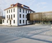
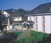
Hotels and Places to Stay
Storchen
Hotel Kettenbrücke
Traube
Platanenhof Seminarhotel
Aparthotel-T8
Traube Garni
Videos from this area
These are videos related to the place based on their proximity to this place.
Aarau, Switzerland: Wasserfluh at winter time
Flight with DJI Phantom 2 over Wasserfluh mountain near Aarau, Switzerland in winter.
DNxHD 1080p/30Hz Test
FFmpeg DNxHD 1080p Hz30 Test. Code: ffmpeg -i input_file -acodec pcm_s16le -vcodec dnxhd -b 220Mb -mbd rd -an output_file.mov.
Voller Freud
gesungen vom Jugendchor, den Fridaynightsingers und dem Wendelin-Chor aus Gipf-Oberfrick (Schweiz) - Erzeugt mit AquaSoft DiaShow für YouTube: http://www.aquasoft.de.
RC Flight Multiplex Pilatus Porter uncut 1
As Part of my unedited uncut series of my own RC Flights, this flight was done today on 22th of April 2014 in Erlinsbach SO, Switzerland. Small remark: I didn't see anything but the blink of...
MTB Trail - Speuzer Trophy - Highlights
Highlights of the Biketrail Speuzer Trophy - The Race www.speuzer-trophy.ch - Rütmatt - Rosmaregg - Schafmatt - Nesselgrabe - Salhöhe - Hard - Laurenzenbad.
2012 10 06 ATTAC 2/6 Jean-Marie Harribey
Quelle réforme fiscale pour une transformation sociale et écologique ? par Jean-Marie Harribey, membre du Conseil scientifique d'ATTAC, économiste, maître de conférences honoraire à l'univers...
Kulturzentrum Muehlehof - Die Kegelbahn aus den 1960er Jahren
Das Kulturzentrum Mühlehof bei Niedergösgen wird instand gestellt, durch Fachleute. Eine der vorläufig Highlights ist die Kegelbahn aus den 60er Jahren. Sie befindet sich nicht wie üblich...
First half year 2012 Gipf-Oberfrick - Switzerland (Webcamview)
See the webcam on http://www.schlageter.ch. Fast motion from my webcam. Homepage: http://www.schlageter.ch Blog: http://b11ck.blogspot.ch.
Videos provided by Youtube are under the copyright of their owners.
Attractions and noteworthy things
Distances are based on the centre of the city/town and sightseeing location. This list contains brief abstracts about monuments, holiday activities, national parcs, museums, organisations and more from the area as well as interesting facts about the region itself. Where available, you'll find the corresponding homepage. Otherwise the related wikipedia article.
Salhöhe Pass
Salhöhe Pass (el. 779 m. ) is a mountain pass in the Jura Mountains of Switzerland between Kienberg in the canton of Solothurn and Erlinsbach in the canton of Aargau. It connects Kienberg in Solothurn and Erlinsbach in Aargau. The pass road has a maximum grade of 9 percent. Although it is the shortest route between Aarau and Basel, traffic over the pass is moderate.
Ergolz
The Ergolz is the main river in the canton of Basel-Landschaft, Switzerland. It rises on Mount Geisflue in the Faltenjura mountains in the upper region of Basel-Landschaft, on the border with Aargau and Solothurn, and joins the Rhine at Augst. Among the tributaries of the Ergolz are Eibach, Homburgerbach, Diegterbach, Frenke (Anterior and Posterior Frenke), Orisbach, Röserenbach and Violenbach.


