Safety Score: 4,0 of 5.0 based on data from 9 authorites. Meaning please reconsider your need to travel to Switzerland.
Travel warnings are updated daily. Source: Travel Warning Switzerland. Last Update: 2024-04-26 08:02:42
Touring Waldheim
Waldheim in Nidwalden (Canton of Nidwalden) is a town located in Switzerland about 41 mi (or 66 km) east of Bern, the country's capital place.
Time in Waldheim is now 08:07 PM (Friday). The local timezone is named Europe / Zurich with an UTC offset of 2 hours. We know of 12 airports nearby Waldheim, of which 5 are larger airports. The closest airport in Switzerland is Buochs Airport in a distance of 4 mi (or 7 km), North-East. Besides the airports, there are other travel options available (check left side).
There are several Unesco world heritage sites nearby. The closest heritage site is Prehistoric Pile dwellings around the Alps in Austria at a distance of 24 mi (or 39 km). The closest in Switzerland is Swiss Alps Jungfrau-Aletsch in a distance of 33 mi (or 39 km), North. We collected 10 points of interest near this location. Need some hints on where to stay? We compiled a list of available hotels close to the map centre further down the page.
Being here already, you might want to pay a visit to some of the following locations: Stans, Sarnen, Ennetburgen, Luzern and Kussnacht. To further explore this place, just scroll down and browse the available info.
Local weather forecast
Todays Local Weather Conditions & Forecast: 12°C / 54 °F
| Morning Temperature | 3°C / 37 °F |
| Evening Temperature | 11°C / 52 °F |
| Night Temperature | 6°C / 42 °F |
| Chance of rainfall | 0% |
| Air Humidity | 56% |
| Air Pressure | 1007 hPa |
| Wind Speed | Light breeze with 5 km/h (3 mph) from North |
| Cloud Conditions | Broken clouds, covering 75% of sky |
| General Conditions | Light rain |
Saturday, 27th of April 2024
17°C (62 °F)
8°C (47 °F)
Scattered clouds, gentle breeze.
Sunday, 28th of April 2024
19°C (66 °F)
9°C (49 °F)
Broken clouds, gentle breeze.
Monday, 29th of April 2024
18°C (65 °F)
12°C (54 °F)
Light rain, light breeze, broken clouds.
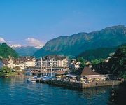
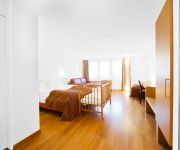
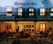
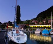
Hotels and Places to Stay
Villa Honegg Hotel
Winkelried
Seehotel Sternen
Seehotel Pilatus
Krone Sarnen
Kastanienbaum Swiss Quality Seehotel
Kreuz Sachseln
Seehotel Baumgarten
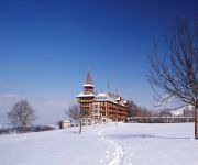
Paxmontana Jugendstilhotel
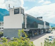
Hotel Stans-Süd
Videos from this area
These are videos related to the place based on their proximity to this place.
Steam Train over the Brünig Pass, Switzerland (1/5): Train Arrival in Alpnachstad
The Brünig Pass Railway was opened 1888 and is celebrating its 125 year anniversary this year (2013). We had the opportunity to travel like it was 125 years ago from Alpnachstad over the Brünig...
SWISSVIEW - NW, Nidwaldner Alpen, Alpnachersee bei Stansstad
Nidwalden, Nidwaldner Alpen, Alpnachersee, Stansstad, E35, Acheregg, Rotzloch.
UNTERWALDEN lowering upper-deck installations before passing under very low bridge
Of the five paddle wheel steamships operating on Lake Lucerne, there is only one, the UNTERWALDEN, equipped to pass under the low Acheregg freeway bridge. Here we first see the preparations...
Talfahrt mit der Pilatusbahn
Die Pilatusbahn (PB) ist eine Zahnradbahn in der Schweiz und die weltweit steilste ihrer Art. Sie führt von Alpnachstad auf den Pilatus.
Train approaching Alpnach
Alpnach, Obwalden, Switzerland, 2011-08-16; アルプナッハに近づく列車, スイス・オプバルデン準州アルプナッハ.
Luzern
En fait, se sont les photos de nos plusieurs visites dans cette ville magnifique et très impressionnante, à différents saisons de l'année. Здесь представлены фотогра...
Minecraft mittelalterliche Dorf
Hallo zusammen das ist mein erste Video ich bin noch unerfahren Es handelt sich über meine erste mittelalterliche Dorf wo ich lange dran gesessen bin bitte abonniert mich...
Videos provided by Youtube are under the copyright of their owners.
Attractions and noteworthy things
Distances are based on the centre of the city/town and sightseeing location. This list contains brief abstracts about monuments, holiday activities, national parcs, museums, organisations and more from the area as well as interesting facts about the region itself. Where available, you'll find the corresponding homepage. Otherwise the related wikipedia article.
Lopper Tunnel
The Lopper Tunnel is a tunnel in Switzerland, and forms part of the Autostrasse A8. The tunnel is 1,562 metres long and has two lanes (one in each direction). There is no central reservation. It lies in central Switzerland. At times, the link to the A2 motorway may be undergoing roadworks.
Winkelried
Winkelried was a family of Unterwalden, recorded as members of the lower nobility during the second half of the 13th century and as commoners during the 14th to early 16th centuries. The name is mostly associated with Arnold von Winkelried, the hero of the Battle of Sempach (1386) in Swiss historiography. Because of the importance of Arnold Winkelried in 19th-century Swiss nationalism, much research has gone into the genealogy of this family.
Pilatus railway
The Pilatus railway is a mountain railway in Switzerland and is the steepest rack railway in the world, with a maximum gradient of 48%. The line runs from Alpnachstad, on Lake Lucerne, to a terminus near the Esel summit of Mount Pilatus at an altitude of 2,073 m . At Alpnachstad, the Pilatus railway connects with steamers on Lake Lucerne and with trains on the Brünigbahn line of Zentralbahn.
Mueterschwanderberg
Mueterschwanderberg (also Mueterschwandenberg) is a ridge forming the southern shore of Alpnachersee, just northwest of Stanserhorn and west of the village of Ennetmoos, Nidwalden, Switzerland. Its peak is at an elevation of 860 m (some 425 m above the lake surface). The peak is known as Drachenflue (Drachenfluh), with the Drachenloch cave nearby, named for the dragon which according to legend was slain here by Heinrich von Winkelried.
Alpnachstad railway station
Alpnachstad is a Swiss railway station in the municipality of Alpnach in the canton of Obwalden. It is on the Brünig line, owned by the Zentralbahn, that links Lucerne and Interlaken, and is also the lower terminus of the Pilatus railway, a rack railway that ascends to the summit of Mount Pilatus. Alpnachstad station is one of two stations to serve Alpnach, the other being Alpnach Dorf, which is on the Brünig line some 1.5 kilometres to the south, and nearer the centre of Alpnach.
Alpnach Dorf railway station
Alpnach Dorf is a Swiss railway station in the municipality of Alpnach in the canton of Obwalden. It is on the Brünig line, owned by the Zentralbahn, that links Lucerne and Interlaken. Alpnach Dorf station is one of two stations to serve Alpnach, the other being Alpnachstad Dorf, which is on the Brünig line some 1.5 kilometres to the north. The station is served by the following passenger trains:
Hergiswil railway station
Hergiswil is a Swiss railway station in the municipality of Hergiswil in the canton of Nidwalden. It is at the junction of the Brünig line, which links Lucerne and Interlaken, and the Luzern–Stans–Engelberg line. Both lines are of metre gauge and owned by the Zentralbahn railway company. Hergiswil station is one of two stations to serve Hergiswil, the other being Hergiswil Matt, which is on the Brünig line some 1.5 kilometres to the north. The station is served by the following passenger trains:
Stansstad railway station
Stansstad is a Swiss railway station in the municipality of Stansstad in the canton of Nidwalden. It is on the Luzern–Stans–Engelberg line, owned by the Zentralbahn railway company, and is adjacent to the bridge that carries the line across the Alpnachersee arm of Lake Lucerne. The current railway station is the second to exist in Stansstad, having been built as a through station on the section of line opened in 1964 to connect the then Stansstad–Engelberg line to the Brünig line at Hergiswil.


