Safety Score: 4,0 of 5.0 based on data from 9 authorites. Meaning please reconsider your need to travel to Switzerland.
Travel warnings are updated daily. Source: Travel Warning Switzerland. Last Update: 2024-05-06 08:04:52
Discover Miécourt
Miécourt in Porrentruy District (Canton of Jura) with it's 454 citizens is a town in Switzerland about 35 mi (or 57 km) north of Bern, the country's capital city.
Current time in Miécourt is now 11:36 AM (Monday). The local timezone is named Europe / Zurich with an UTC offset of 2 hours. We know of 13 airports near Miécourt, of which 5 are larger airports. The closest is airport we know is Fontaine Airport in France in a distance of 18 mi (or 28 km). The closest airport in Switzerland is Grenchen Airport in a distance of 20 mi (or 28 km), North-West. Besides the airports, there are other travel options available (check left side).
There are several Unesco world heritage sites nearby. The closest heritage site in Switzerland is La Chaux-de-Fonds / Le Locle, Watchmaking Town Planning in a distance of 28 mi (or 44 km), South-West. We discovered 3 points of interest in the vicinity of this place. Looking for a place to stay? we compiled a list of available hotels close to the map centre further down the page.
When in this area, you might want to pay a visit to some of the following locations: Porrentruy, Delemont, Altkirch, Biel/Bienne and Laufen. To further explore this place, just scroll down and browse the available info.
Local weather forecast
Todays Local Weather Conditions & Forecast: 10°C / 51 °F
| Morning Temperature | 11°C / 51 °F |
| Evening Temperature | 10°C / 49 °F |
| Night Temperature | 9°C / 48 °F |
| Chance of rainfall | 29% |
| Air Humidity | 98% |
| Air Pressure | 1011 hPa |
| Wind Speed | Gentle Breeze with 8 km/h (5 mph) from East |
| Cloud Conditions | Overcast clouds, covering 100% of sky |
| General Conditions | Moderate rain |
Tuesday, 7th of May 2024
9°C (49 °F)
9°C (48 °F)
Moderate rain, light breeze, overcast clouds.
Wednesday, 8th of May 2024
15°C (59 °F)
9°C (48 °F)
Light rain, gentle breeze, broken clouds.
Thursday, 9th of May 2024
14°C (57 °F)
9°C (47 °F)
Light rain, gentle breeze, broken clouds.
Hotels and Places to Stay
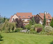
Le Petit Kohlberg
Videos from this area
These are videos related to the place based on their proximity to this place.
Large Hitachi excavator brings strength and power to Swiss quarry
This ZX870LCR-5 was delivered to Lachat by the Swiss Hitachi dealer, Probst Maveg, in July 2014. Hitachi engineers in Japan have developed the R series with reinforced components and added...
#720 Les Etangs de l'Ajoie Bike Alle/JU 11.08.2013
Diese Mountainbike-Route inmitten von zahlreichen Teichen und weiten Zonen von kultivierten landwirtschaftlichen Feldern bietet viel Abwechslung. Ein Ausflug in die Natur der schönen Ajoie...
Videos provided by Youtube are under the copyright of their owners.
Attractions and noteworthy things
Distances are based on the centre of the city/town and sightseeing location. This list contains brief abstracts about monuments, holiday activities, national parcs, museums, organisations and more from the area as well as interesting facts about the region itself. Where available, you'll find the corresponding homepage. Otherwise the related wikipedia article.
Château de Morimont
The Château de Morimont is a ruined castle in the Alsace region of France, situated in the commune of Oberlarg in the Haut-Rhin département. It is 40 km south-west of Mulhouse and 45 km west of the Swiss city Basel.
Etangs de Bonfol
Etangs de Bonfol are a series of ponds at Bonfol in the Canton of Jura, Switzerland. The main ponds are named "étang du Milieu" and "Neuf-Etang". They are separated by a dam. Since 1962, the étangs de Bonfol are a nature preserve. They are listed in the Federal Inventory of Amphibian Spawning Areas (2001), and, together with the étang at Vendlincourt, in the Federal Inventory of Landscapes and Natural Monuments (1977). The ponds were developed by bishop of Basel for fishing.
Etang de la Montoie
Étang de la Montoie is a pond at Cornol in the Canton of Jura, Switzerland. The commune of Cornol's web site describes the 1.4 hectare pond as "an idyllic place allowing one to give oneself over to fishing, walking or resting. " ("L'étang de la Montoie est un emplacement idyllique permettant de s'adonner à la pêche, aux promenades ou au repos. ") The Société de l'Étang de la Montoie includes about 50 fishermen and 100 supporting members.
Asuel Castle
Asuel Castle is a ruined castle in the municipality of La Baroche of the Canton of Jura in Switzerland. It is a Swiss heritage site of national significance.
Mont-Terri Castle
Mont-Terri Castle is a ruined castle above a prehistoric site in the municipality of Cornol of the Canton of Jura in Switzerland. It is a Swiss heritage site of national significance.


