Safety Score: 4,0 of 5.0 based on data from 9 authorites. Meaning please reconsider your need to travel to Switzerland.
Travel warnings are updated daily. Source: Travel Warning Switzerland. Last Update: 2024-05-01 08:01:32
Explore Kleindöttingen
The district Kleindöttingen of Böttstein in Bezirk Zurzach (Canton of Aargau) is located in Switzerland about 57 mi north-east of Bern, the country's capital.
If you need a place to sleep, we compiled a list of available hotels close to the map centre further down the page.
Depending on your travel schedule, you might want to pay a visit to some of the following locations: Bad Zurzach, Waldshut-Tiengen, Lauchringen, Dogern and Weilheim. To further explore this place, just scroll down and browse the available info.
Local weather forecast
Todays Local Weather Conditions & Forecast: 10°C / 49 °F
| Morning Temperature | 12°C / 54 °F |
| Evening Temperature | 9°C / 48 °F |
| Night Temperature | 8°C / 47 °F |
| Chance of rainfall | 20% |
| Air Humidity | 97% |
| Air Pressure | 1006 hPa |
| Wind Speed | Gentle Breeze with 8 km/h (5 mph) from East |
| Cloud Conditions | Overcast clouds, covering 100% of sky |
| General Conditions | Heavy intensity rain |
Friday, 3rd of May 2024
11°C (52 °F)
7°C (45 °F)
Light rain, gentle breeze, overcast clouds.
Saturday, 4th of May 2024
15°C (59 °F)
9°C (49 °F)
Light rain, light breeze, broken clouds.
Sunday, 5th of May 2024
12°C (54 °F)
10°C (51 °F)
Light rain, gentle breeze, overcast clouds.
Hotels and Places to Stay
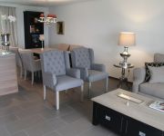
Private-Apartments
Park-Hotel
Bercher
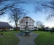
Schloss Böttstein
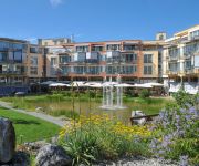
zur Therme Swiss Quality Hotel
Zurzacherhof Swiss Quality Hotel
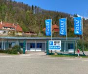
Sport Hotel Waldshut
Tenedo Swiss Quality Hotel
Zur Waag
Zur Post
Videos from this area
These are videos related to the place based on their proximity to this place.
Winzerfest Döttingen 2014 / debuechi.ch TEAM zeigts Episode #02
Ein neuer Film Winzerfest Döttingen 04.10.2014 Veröffentlicht am 09.10.2014 Die neue Episodenreihe: debuechi.ch TEAM zeigt`s ! ***********************************************************...
Handball Zurzibiet TV: Letztes Heimspiel der U17 Inter
Im letzten Heimspiel schlagen die U17 Inter Junioren den Gegner aus Genf mit 34:29. Die SG Zurzibiet/Endingen beendet die Saison auf Platz 1 und steigt in die Elite Kategorie auf.
Tour de Suisse - Stage/Etappe 5 durch Würenlingen 2013 (Buochs - Leuggern) Spitze
5. Etappe durch Würenlingen (Buochs - Leuggern) Zeit: ~17 Uhr Datum: 12.06.2013 Etappenplan: http://www.tourdesuisse.ch/tour_de_su... Führende: 1. Paulwels, ...
Multiresolution X-ray tomography, getting a clear view of the interior
Researchers at PSI have developed a technique that combines tomography measurements at different resolution levels to allow quantitative interpretation for nanoscale tomography on an interior...
Schulabschlussarbeit Murmelbahn, Berufsbildung PSI
Dieses Projekt Murmelbahn war eine Schulabschlussarbeit im 4. Lehrjahr Automatiker an der Berufsfachschule Baden. Klasse: AU08a 2011/2012. Mit dem Bau dieser Murmelbahn konnte die ...
Bligg feat. Young Blood Brass Band LIVE ON STAGE - Intro Argovia Fäscht 2012
Bligg live mit de Young Blood Brass band us Wisconsin.
Solowheel ride around the Klingnau reservoir part 1/2 unplugged
This is the first half of the ride around the Klingnau reservoir. Straight from the camera. Great to view on a 2nd screen in the office. Thumbs up if you want to see the 2nd half as well.
Jahreskonzert 2013 der Stadtmusik Klingnau: Dachdecker Polka
Zum Abschluss des konventionellen Teils: Dachdecker Polka.
Videos provided by Youtube are under the copyright of their owners.
Attractions and noteworthy things
Distances are based on the centre of the city/town and sightseeing location. This list contains brief abstracts about monuments, holiday activities, national parcs, museums, organisations and more from the area as well as interesting facts about the region itself. Where available, you'll find the corresponding homepage. Otherwise the related wikipedia article.
Aar
The Aar, a tributary of the High Rhine, is the longest river that both rises and ends entirely within Switzerland. Its total length from its source to its junction with the Rhine comprises about 295 km (183 miles), during which distance it descends 1,565 m, draining an area of 17,779 km, including the whole of central Switzerland.
Limmat
The Limmat is a river in Switzerland. It is the continuation of the Linth river, known as Limmat from the point of effluence from Lake Zurich, in the city of Zurich. From Zurich it flows in a northwesterly direction, after 35 km reaching the river Aare. The confluence is located north of the small town of Brugg, Aargau and shortly after the mouth of the Reuss. The main towns along the Limmat Valley downstream of Zurich are Dietikon, Wettingen, and Baden.
Waldshut (district)
Waldshut is a district (Kreis) in the south of Baden-Württemberg, Germany. Neighbouring districts are (clockwise from the west) Lörrach, Breisgau-Hochschwarzwald and Schwarzwald-Baar; followed in the south by the Swiss cantons of Schaffhausen, Zürich and Aargau.
Brugg District
Brugg District is a district in the Canton of Aargau, Switzerland, it is located south of the Aare and the Aargauer Jura covers the district. The capital of the district is the town of Brugg.
Paul Scherrer Institute
The Paul Scherrer Institute (PSI) is a multi-disciplinary research institute which belongs to the Swiss ETH-Komplex covering also the ETH Zurich and EPFL. It was established in 1988 by merging in 1960 established EIR (Eidgenössisches Institut für Reaktorforschung = Federal Institute for Reactor Research) and in 1968 established SIN (Schweizerisches Institut für Nuklearphysik = Swiss Institute for Nuclear Physics).
Zurzach District
Zurzach District is a district in the Swiss Canton of Aargau with the administrative capital of Zurzach. It covers the Studenlands and is located in the northeastern part of the canton. The district capital is Bad Zurzach. The main valleys are the Surb and the Aare. It has a population of 32,481 (as of 30 June 2012).
Vindonissa
Vindonissa (from a Gaulish toponym in *windo- "white") was a Roman legion camp at modern Windisch, Switzerland. It was probably established in 15 AD. In an expansion around 30, thermal baths were added. The Legio XIII Gemina was stationed at Vindonissa until 44 or 45. With the arrival of the 21st legion the camp was rebuilt with stone fortifications. After the 21st legion had looted the countryside in 69, it was replaced by the 11th legion which remained stationed until 101.
Klingnauer Stausee
The Klingnauer Stausee (or "Klingnau reservoir") is a reservoir near Böttstein, canton of Aargau, Switzerland, at {{#invoke:Coordinates|coord}}{{#coordinates:47|35|N|8|14|E|region:CH-AG_type:waterbody|| | |name= }}. The lake with a surface of 1.16 km² was formed at the construction of a power plant on the Aar river in the 1930s.
Stilli
Stilli is a former municipality of the canton of Aargau, Switzerland. On 1 January 2006, it merged with its neighbouring municipality, Villigen.
Wutach (river)
The Wutach is a river in Baden-Württemberg, Germany, partly located on the border with the canton of Schaffhausen, Switzerland. It is formed in the southern part of the Black Forest by the confluence of two smaller rivers, the Haslach and the Gutach, near the town of Lenzkirch.
Limmat Valley
The Limmat Valley is a river valley and a region in the cantons of Zürich and Aargau in Switzerland.
Iberg Castle, Aargau
Iberg Castle is a ruined castle located on Iberg mountain in the municipality of Riniken in the canton of Aargau in Switzerland. Only a few remnants of the ruins are visible.
Königsfelden Abbey
Königsfelden Abbey is a former Franciscan monastery and former Clarisse convent in the municipality of Windisch in the canton of Aargau in Switzerland. It was founded in 1308 by the Habsburgs and during the Reformation in 1528 it was secularized. The complex was then the residence of the bailiffs of Bern, and since 1868 it has been a psychiatric clinic. The church is a museum since 2009.
Klingnau Castle
Klingnau Castle is a castle in the municipality of Klingnau in the Swiss canton of Aargau. The construction of the castle, originally the seat of the Klingen family, was started in 1240. Until 1269 a manor house stood on the grounds. After 1331 the outer walls were added. In the second half of the 14th century the Bishop of Constance was often a resident in the castle. He ordered further improvements and expansions.
Waldshut–Koblenz Rhine Bridge
The Waldshut–Koblenz Rhine Bridge is a single-track railway bridge on the Turgi–Koblenz–Waldshut railway, between Waldshut and Koblenz AG, crossing the Rhine and the border between Germany and Switzerland. It was the first railway bridge built over the Rhine below Lake Constance. It is the only major railway bridge over the Rhine, which is completely preserved in its original condition and is one of Europe's few lattice truss bridges.
Klingengraben
Klingengraben is a river of Baden-Württemberg, Germany.
Schlücht
Schlücht is a river of Baden-Württemberg, Germany.
Stein Castle, Aargau
Stein Castle (German: Schloss Stein or Ruine Stein) is a castle ruin above the municipality of Baden in the canton of Aargau in Switzerland. It is a Swiss heritage site of national significance.
Liederbach (Main)
Liederbach (Main) is a river of Hesse, Germany.
Koblenz railway station (Switzerland)
Koblenz is a railway station in the Swiss canton of Aargau and municipality of Koblenz. The station is located at junction of the Turgi to Waldshut railway line with the Winterthur to Koblenz line and the Stein-Säckingen to Koblenz line. The station is served by Zurich S-Bahn line S41, which links Winterthur and Waldshut, and Aargau S-Bahn line S27, which links Baden and Koblenz, with alternate trains continuing to either Waldshut or Bad Zurzach.
Koblenz Dorf railway station
Koblenz Dorf is a railway station in the Swiss canton of Aargau and municipality of Koblenz. The station is located on the Winterthur to Koblenz line and is served by Zurich S-Bahn line S41, which links Winterthur and Waldshut, and by alternate trains on Aargau S-Bahn line S27, which link Baden and Bad Zurzach. Koblenz Dorf station should not be confused with Koblenz station, which is situated rather further from the centre of Koblenz.
Koblenz Aar railway bridge
The Koblenz Aar railway bridge, also known as the Koblenz–Felsenau railway bridge or the Aarebrücke Koblenz, is a single-track railway bridge which carries the Stein-Säckingen to Koblenz line across the River Aar in Switzerland. The bridge dates from 1892 and is listed as a Swiss heritage site of national significance. The bridge links the municipalities of Koblenz and Leuggern, both of which are in the canton of Aargau.
Bad Zurzach railway station
Bad Zurzach is a railway station in the Swiss canton of Aargau and municipality of Bad Zurzach. The station is located on the Winterthur to Koblenz line and is served by Zurich S-Bahn line S41, which links Winterthur and Waldshut, and by alternate trains on Aargau S-Bahn line S27, which link Baden and Bad Zurzach.
Brugg railway station
Brugg railway station serves the municipality of Brugg, in the canton of Aargau, Switzerland. Opened in 1856, it is owned and operated by SBB-CFF-FFS. The station forms the junction between the Bözberg railway line (German: Bözbergstrecke), which links Basel SBB with Brugg, and the former Aargauische Südbahn, which links Brugg with Zürich HB.
Baden railway station
Baden railway station serves the municipality of Baden, in the canton of Aargau, Switzerland. Opened in 1847, it is owned and operated by SBB-CFF-FFS. The station forms part of the Bözberg railway line, which links Basel with Zürich.


