Safety Score: 4,0 of 5.0 based on data from 9 authorites. Meaning please reconsider your need to travel to Switzerland.
Travel warnings are updated daily. Source: Travel Warning Switzerland. Last Update: 2024-05-14 08:25:02
Discover Riburg
The district Riburg of Möhlin in Bezirk Rheinfelden (Canton of Aargau) is a subburb in Switzerland about 47 mi north-east of Bern, the country's capital city.
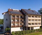
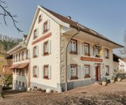
If you need a hotel, we compiled a list of available hotels close to the map centre further down the page.
While being here, you might want to pay a visit to some of the following locations: Schworstadt, Rheinfelden, Maulburg, Hasel and Sissach. To further explore this place, just scroll down and browse the available info.
Local weather forecast
Todays Local Weather Conditions & Forecast: 24°C / 75 °F
| Morning Temperature | 11°C / 52 °F |
| Evening Temperature | 17°C / 63 °F |
| Night Temperature | 13°C / 56 °F |
| Chance of rainfall | 3% |
| Air Humidity | 47% |
| Air Pressure | 1005 hPa |
| Wind Speed | Gentle Breeze with 7 km/h (5 mph) from East |
| Cloud Conditions | Clear sky, covering 5% of sky |
| General Conditions | Light rain |
Wednesday, 15th of May 2024
15°C (59 °F)
12°C (53 °F)
Moderate rain, gentle breeze, overcast clouds.
Thursday, 16th of May 2024
13°C (55 °F)
12°C (54 °F)
Moderate rain, gentle breeze, overcast clouds.
Friday, 17th of May 2024
12°C (54 °F)
10°C (51 °F)
Heavy intensity rain, light breeze, overcast clouds.
Hotels and Places to Stay
Alexandras Storchen
Hohe Flum
Landgasthof Erdmannshöhle
Zum Goldenen Wagen
Klosterhof
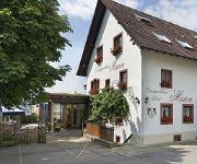
Maien
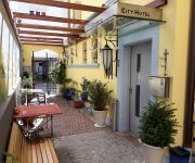
City Hotel
Sonne Landgasthof
Krone
Oberrhein Garni
Videos from this area
These are videos related to the place based on their proximity to this place.
Rheinfelden Imagefilm Städteportrait Stadtportrait Media Maxx AG
Den Imagefilm und das Stadtportrait von Rheinfelden finden Sie unter http://www.staedteportrait.de/rheinfelden/ Städteportrait : Im südwestlichen Baden-Württemberg an der Grenze zur Schweiz...
BEDROHTES Kraftwerk! Historisches Laufwasserkraftwerk in Rheinfelden Baden soll ABGERISSEN werden!!!
Das älteste Laufwasserkraftwerk in Europa steht am schönen Hochrhein bei Rheinfelden Baden. Seit 1898 produzierte dieses Kraftwerk sehr zuverlässig Strom. Jetzt wird ein neues gebaut. Obwohl...
FC Rheinfelden - BSC Old Boys Juniorinnen B, 14.5.2013
FC Rheinfelden - BSC Old Boys Juniorinnen B, 14.5.2013. Beginn 19:30 Uhr, 23°C, Sonne.
Tari Sirih Kuning (Rheinfelden, Swiss)
Note buat yg mau ngritik: 1) gw bukan penari profesional 2) gw belum pernah belajar nari seumur hidup, ini pertama kali 3) video ini pertama kali gw manggung seumur hidup 4) sebelum gw manggung ...
Dipper Truck Rheinfelden D/CH
driver chauffeur rider crawler truck dipper excavator dredger water loading rough terrain ground tide fluid aqua rhine river rheinfelden switzerland germany Fahrer Chauffeur LKW Bagger Wasser...
Am Rheinufer bei Rheinfelden (Rhein Uferweg)
Ein Spaziergang am Rhein bei Rheinfelden lohnt sich auf jeden Fall! Sich im Stadtpark entspannen, dem Gezwitscher der Vögel lauschen. Einfach herrlich die Stille!
pratteln.net
Kraftwerk Rheinfelden: Fischaufstieg. Mit den folgenden Hilfen wird der Fischaufstieg ermöglicht: Naturnahes Umgehungsgewässer mit Laichmöglichkeiten, Raugerinne-Beckenpass am Stauwehr ...
Videos provided by Youtube are under the copyright of their owners.
Attractions and noteworthy things
Distances are based on the centre of the city/town and sightseeing location. This list contains brief abstracts about monuments, holiday activities, national parcs, museums, organisations and more from the area as well as interesting facts about the region itself. Where available, you'll find the corresponding homepage. Otherwise the related wikipedia article.
Swisscom-Sendeturm St. Chrischona
Swisscom-Sendeturm St. Chrischona is a communications tower built in 1980-1984 near Basel, Switzerland. It is located at {{#invoke:Coordinates|coord}}{{#coordinates:47|34|18|N|7|41|13|E|region:CH-BS_type:landmark |primary |name= }} east of St. Chrischona, on the territory of the municipality Bettingen, Basel-Stadt. It was built as replacement for a 136 metre tall lattice tower, which was erected at the site in 1962. This lattice tower was once a part of famous Beromünster transmitter.
Augusta Raurica
Augusta Raurica is a Roman archaeological site and an open-air museum in Switzerland. Located on the south bank of the Rhine river about 20 km east of Basel near the villages of Augst and Kaiseraugst, it is the oldest known Roman colony on the Rhine.
Rheinfelden District
Rheinfelden District lies in the northwest of the canton of Aargau in Switzerland, in the Fricktal region. Its capital is Rheinfelden. Around 88% of the population live in the conurbation of Basel. There are 14 municipalities, with a population of 44,569 (as of 30 June 2012) living in an area of 112.09 km². The population density is around 355 persons per square kilometre.
Schweigmatt
Schweigmatt is a hamlet located in the southern Black Forest of Germany at an altitude of 780 metres. It belongs to the village of Raitbach and is part of the municipality of Schopfheim in the district of Lörrach. Schweigmatt lies beneath the 985 m peak of the Hohe Möhr, from which it is possible to see as far as the Swiss Alps and Jura Mountains across the Rhine River.
Feldschlösschen
Feldschlösschen is a brand of beer. The brewery, with the main facility located in Rheinfelden, Switzerland is the biggest brewery in Switzerland and was founded in 1876. It bought out Cardinal in 1991. It was bought by Carlsberg in 2000. The brewery is in the shape of a castle and Feldschlösschen means 'small castle in the fields' in German.
Liestal District
Liestal District is one of the five districts of the largely German-speaking canton of Basel-Country, Switzerland. The city of Liestal serves as capital of both the district of Liestal and the canton of Basel-Country. It has a population of 57,677 (as of 30 September 2012).
Canton of Fricktal
Fricktal was a canton of the Helvetic Republic from February 1802 to February 1803, consisting of that part of the Breisgau south of the Rhine. Now, the territories of Fricktal form the districts of Rheinfelden and Laufenburg in the canton of Aargau. In 1799, a year after the proclamation of the Helvetic Republic, French Revolutionary troops marched into the Fricktal.
Schloss Ebenrain
Schloss Ebenrain is a former country residence in Sissach, in the canton of Basel-Country, Switzerland. Built in 1774-1776, it is considered the most significant late baroque residence in northwestern Switzerland. It is now a public facility and the site of an agricultural school. It is listed as a Swiss cultural property of national significance.
Battle of Rheinfelden
The Battle of Rheinfelden was a military event in the course of the Thirty Years' War, consisting in fact of two battles fought in 1638 to the north and south of the present-day town of Rheinfelden, between a mercenary army led by Bernhard of Saxe-Weimar and an Holy Roman Empire army led by Johann von Werth. Bernhard was defeated in the first battle but managed to defeat and capture Von Werth in the second.
Ägelsee (Zeiningen)
Ägelsee (or Egelsee) is a small lake in the municipality of Zeiningen, Canton of Aargau, Switzerland. The 7500 m² nature preserve is an amphibian spawning area of national importance.
Möhlinbach
The Möhlinbach is a 15 kilometer long stream in Aargau canton, Switzerland.
Möhlintal
The Möhlintal is a 10-kilometre long valley running between Möhlin and Wegenstetten in the Rheinfelden district of Canton Aargau, Switzerland. The five municipalities in the valley have a total population of around 14,000 people. In the upper valley, the valley is also known as the "Wegenstettertal". This name was particularly used by associations and groups related to the upper Möhlintal municipalities. In Habsburg times the area Landschaft (territory) Möhlinbach was already known.
Fischingertal
The Fischingertal is a 5 kilometer long valley running between Mumpf and Schupfart in the Rheinfelden District of Canton Aargau, Switzerland.
Säckingen Abbey
Säckingen Abbey is a former Roman Catholic abbey located in Bad Säckingen, Baden-Württemberg in Germany. The Abbey was founded in the 6th or 7th Century by Fridolin of Säckingen, an Irish monk. While the Abbey had both monks and nuns, only the nuns convent grew to be an important religious, economic and cultural institution for the entire upper Rhine.
Eggberg
Eggberg is a mountain of Baden-Württemberg, Germany.
Hohe Flum
Hohe Flum is a mountain of Baden-Württemberg, Germany.
Hohe Möhr
Hohe Möhr is a mountain of Baden-Württemberg, Germany.
Dürrenbach
Durrenbach is a commune in the Bas-Rhin department in Alsace in north-eastern France.
Schöpfebach
Schöpfebach is a river of Baden-Württemberg, Germany.
Wehra
Wehra is a river of Baden-Württemberg, Germany.
Sissle
The Sissle is a 16-kilometer long river in the Swiss canton of Aargau in Switzerland. It is a tributary of the Rhine and drains the eastern part of the Fricktal. The largest town on the river is Frick. The river rises in the municipalities of Schinznach-Dorf and Thalheim at an altitude of 650 m above the sea (Switzerland) on the southern slope of Mount Dreierberg and the northern slope of Mount Zeiher Homberg, in the Jura Mountains.
Farnsburg Castle
Farnsburg Castle is a castle in the municipality of Ormalingen in the canton of Basel-Land in Switzerland. It is a Swiss heritage site of national significance.
Bischofstein Castle (Switzerland)
Bishofstein Castle (German: Burg Bischofstein or Ruine Bischofstein) is a castle in the municipality of Sissach of the canton of Basel-Land in Switzerland. It is a Swiss heritage site of national significance.
Ebenrain Castle
Ebenrain Castle is a castle in the municipality of Sissach of the Canton of Basel-Country in Switzerland. It is a Swiss heritage site of national significance.
Sissacherfluh Castle
Sissacherfluh Castle is a castle in the municipality of Sissach of the canton of Basel-Land in Switzerland. It is a Swiss heritage site of national significance.


