Safety Score: 3,0 of 5.0 based on data from 9 authorites. Meaning we advice caution when travelling to Slovenia.
Travel warnings are updated daily. Source: Travel Warning Slovenia. Last Update: 2024-05-02 08:23:34
Discover Log pod Mangartom
Log pod Mangartom in Občina Bovec with it's 137 citizens is a city in Slovenia about 50 mi (or 80 km) north-west of Ljubljana, the country's capital city.
Local time in Log pod Mangartom is now 11:53 AM (Thursday). The local timezone is named Europe / Ljubljana with an UTC offset of 2 hours. We know of 11 airports in the vicinity of Log pod Mangartom, of which 5 are larger airports. The closest is airport we know is Klagenfurt Airport in Austria in a distance of 39 mi (or 63 km). The closest airport in Slovenia is Ljubljana Jože Pučnik Airport in a distance of 43 mi (or 63 km), North-East. Besides the airports, there are other travel options available (check left side).
There are several Unesco world heritage sites nearby. The closest heritage site is Longobards in Italy. Places of the Power (568-774 A.D.) in Italy at a distance of 23 mi (or 36 km). The closest in Slovenia is Škocjan Caves in a distance of 54 mi (or 36 km), South. Looking for a place to stay? we compiled a list of available hotels close to the map centre further down the page.
When in this area, you might want to pay a visit to some of the following locations: Bovec, Tarvisio, Kobarid, Hohenthurn and Feistritz an der Gail. To further explore this place, just scroll down and browse the available info.
Local weather forecast
Todays Local Weather Conditions & Forecast: 11°C / 51 °F
| Morning Temperature | 11°C / 52 °F |
| Evening Temperature | 11°C / 51 °F |
| Night Temperature | 10°C / 50 °F |
| Chance of rainfall | 34% |
| Air Humidity | 100% |
| Air Pressure | 1008 hPa |
| Wind Speed | Light breeze with 4 km/h (2 mph) from North |
| Cloud Conditions | Overcast clouds, covering 100% of sky |
| General Conditions | Heavy intensity rain |
Friday, 3rd of May 2024
9°C (49 °F)
10°C (49 °F)
Moderate rain, calm, overcast clouds.
Saturday, 4th of May 2024
12°C (53 °F)
11°C (51 °F)
Light rain, light breeze, overcast clouds.
Sunday, 5th of May 2024
11°C (52 °F)
11°C (51 °F)
Light rain, light breeze, overcast clouds.
Hotels and Places to Stay
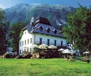
Hotel Dobra Vila Bovec
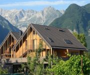
Hotel Sanje OB Soci
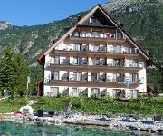
Mangart
Kanin
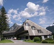
Alp Hotel
Videos from this area
These are videos related to the place based on their proximity to this place.
KAYAKING Koritnica river Sport Mix Bovec
http://www.sportmix.si Sport Mix team did kayaking on Koritnica river. Really nice part of second most popular river in SOČA VALLEY. With narrow canyon and some grade III rapids. On the day...
Museo della tradizione mineraria Cave del Predil UD
Museo della tradizione mineraria Cave del Predil UD.
Motogiro Bovec - Cave del Predil
Produzione: Video900 Riprese: Ronnie Roselli Montaggio e regia: Ronnie Roselli.
Krampus 2014
Spettacolo dei Krampus / Dic.2014 / Cave del Predil La magia dello spettacolo per le strade del paese nelle immagini dei Krampus nel giorno di San Nicolò.
Lago Del Predil
Captured with a Canon SX240 HS camera. Wiki: Lago del Predil is a lake in the Province of Udine, Friuli-Venezia Giulia, Italy near Slovenian border. At an elevation of 969 m, its surface area...
Carnia 2012 - Lago del Predil
Rilasciato sotto licenza Creative Commons 3.0 (BY-NC-SA). http://blog.tanadelgigante.altervista.org.
.. e i krampus
".. vi piacciono i miei angioletti?... e i Krampus?" nooo..si! versione a colori del Volo del Krampus 2011.. arrivederci al prossimo anno.
Predil gurulása / descending from passo Predil (FullHD)
Gurulás a Predil-hágóról (1156m), a szlovén-olasz határról a Predil-tóig. Útközben 2x is kisodródtam, de szerencsére megúsztam. Ez a kis száguldozás az idei Alpok-kalandozásom...
Videos provided by Youtube are under the copyright of their owners.
Attractions and noteworthy things
Distances are based on the centre of the city/town and sightseeing location. This list contains brief abstracts about monuments, holiday activities, national parcs, museums, organisations and more from the area as well as interesting facts about the region itself. Where available, you'll find the corresponding homepage. Otherwise the related wikipedia article.
Lago del Predil
Lago del Predil is a lake in the Province of Udine, Friuli-Venezia Giulia, Italy near Slovenian border. At an elevation of 969 m, its surface area is 1 km².
1348 Friuli earthquake
The earthquake of 25 January 1348, centered in the South Alpine region of Friuli, was felt across Europe. The quake hit in the same year that the Great Plague ravaged Italy. According to contemporary sources, it caused considerable damage to structures; churches and houses collapsed, villages were destroyed and foul odors emanated from the earth.
Cave del Predil
Cave del Predil is a frazione subdivision of the comune of Tarvisio in the Province of Udine, in the Friuli-Venezia Giulia region of northeastern Italy. The hamlet is located about 15 km (9 mi) south of the town centre, in the valley of the Rio del Lago (Seebach) river on the road to the Predil Pass of the western Julian Alps, close to the border with Slovenia.
Log pod Mangartom Mosque
The Log pod Mangartom Mosque (Slovene: Džamija v Logu pod Mangartom) was a Sunni mosque that stood from 1916 until the 1920s near the village of Log pod Mangartom in Carniola, Austria-Hungary, in the area of the nowadays Municipality of Bovec in northwestern Slovenia. It was the first—and, as of 2009, the only—purpose-built mosque ever established in the territory of Slovenia, though one converted out of a preexisting building has functioned in the town of Jesenice since 1989.


