Safety Score: 2,8 of 5.0 based on data from 9 authorites. Meaning we advice caution when travelling to Poland.
Travel warnings are updated daily. Source: Travel Warning Poland. Last Update: 2024-05-07 07:59:51
Delve into Kunice Żarskie
The district Kunice Żarskie of Gałków in Powiat żarski (Województwo Lubuskie) with it's 3,000 habitants Kunice Żarskie is a district located in Poland about 253 mi west of Warsaw, the country's capital town.
In need of a room? We compiled a list of available hotels close to the map centre further down the page.
Since you are here already, you might want to pay a visit to some of the following locations: Zary, Lipinki Luzyckie, Gozdnica, Nowogrod Bobrzanski and Jasien. To further explore this place, just scroll down and browse the available info.
Local weather forecast
Todays Local Weather Conditions & Forecast: 13°C / 56 °F
| Morning Temperature | 8°C / 46 °F |
| Evening Temperature | 13°C / 55 °F |
| Night Temperature | 10°C / 49 °F |
| Chance of rainfall | 0% |
| Air Humidity | 67% |
| Air Pressure | 1017 hPa |
| Wind Speed | Gentle Breeze with 7 km/h (4 mph) from South-West |
| Cloud Conditions | Overcast clouds, covering 100% of sky |
| General Conditions | Overcast clouds |
Wednesday, 8th of May 2024
16°C (60 °F)
8°C (47 °F)
Overcast clouds, gentle breeze.
Thursday, 9th of May 2024
18°C (64 °F)
11°C (51 °F)
Few clouds, light breeze.
Friday, 10th of May 2024
20°C (68 °F)
14°C (56 °F)
Broken clouds, light breeze.
Hotels and Places to Stay
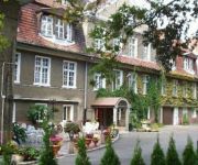
Chopin
Janków
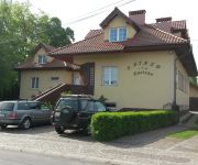
Zajazd Zacisze
Videos from this area
These are videos related to the place based on their proximity to this place.
Żary byłe koszary grudzień 18, 2011 filmik dla Andrzeja Mnicha.wmv
filmik dla Andrzeja,nie wiem czy o te budynki chodziło?
Opuszczone koszary w Żarach
Informacje o obiekcie: https://pl.wikipedia.org/wiki/42_Pu%C5%82k_Zmechanizowany https://pl.wikipedia.org/wiki/11_Brygada_Zmechanizowana.
Dworzec Kolejowy w Żarach
Żary -- jeden z większych dworców kolejowych w województwie lubuskim. Według klasyfikacji PKP ma kategorię C. Dworzec posiada budynek stacyjny, w nim - kasę biletową, zadaszone perony,...
Żary Urbex - 42 Pułk Zmechanizowany
Wizyta w byłej jednostce wojskowej w Żarach. Jednostka został zlikwidowana w 2001 roku. Część budynków została zaadoptowana na mieszkania, część została zajęta przez różne firmy....
Jasełka 2014
Jasełka 2014 - Niepubliczne Przedszkole GROSZKI w Żarach (format filmu: 16:9, rozdzielczość: 1920 × 1080).
Żary,grudzień 2011 r. Sztab byłej jednostki wojskowej po 10 latach..wmv
tak wygladają budynki i otoczenie byłych koszar.
Żary XC 2008- 24.08.2008, cz. I
Na dziewiętnastą edycję Żary XC 2008 organizatorzy przygotowali trasę wyjątkowo trudną technicznie i wytrzymałościowo. Do pokonania zwodnicy będą mieli 4 pętle po 8 km + dojazdy,...
Videos provided by Youtube are under the copyright of their owners.
Attractions and noteworthy things
Distances are based on the centre of the city/town and sightseeing location. This list contains brief abstracts about monuments, holiday activities, national parcs, museums, organisations and more from the area as well as interesting facts about the region itself. Where available, you'll find the corresponding homepage. Otherwise the related wikipedia article.
Żary
Żary is a town in western Poland with about 39,900 inhabitants (2006), situated in the Lubusz Voivodeship (since 1999, previously in Zielona Góra Voivodeship). It is the administrative seat of the Gmina Żary, although not part of it. Żary is located in the east of the historic Lower Lusatia region, in the borderland with the Silesian lowlands and Greater Poland, roughly outlined by the Bóbr and Oder rivers.
Iłowa
Iłowa is a town in Żagań County, Lubusz Voivodeship, Poland, the administrative seat of the Gmina Iłowa. It lies in the Polish part of the Upper Lusatia region at the Czerna Mała river, a tributary to the Bóbr, just south of the future A18 motorway.
Czyżówek
Czyżówek is a village in the administrative district of Gmina Iłowa, within Żagań County, Lubusz Voivodeship, in western Poland. It lies approximately 3 kilometres west of Iłowa, 17 km south-west of Żagań, and 54 km south-west of Zielona Góra. Before 1945 the area was part of Germany. The village has a population of 590.
Czerna, Żagań County
Czerna is a village in the administrative district of Gmina Iłowa, within Żagań County, Lubusz Voivodeship, in western Poland. It lies approximately 4 kilometres north-east of Iłowa, 11 km south-west of Żagań, and 49 km south of Zielona Góra. Before 1945 the area was part of Germany. The village has a population of 360.
Jankowa Żagańska
Jankowa Żagańska is a village in the administrative district of Gmina Iłowa, within Żagań County, Lubusz Voivodeship, in western Poland. It lies approximately 10 kilometres north of Iłowa, 12 km west of Żagań, and 46 km south-west of Zielona Góra. Before 1945 the area was part of Germany. The village has an approximate population of 600.
Konin Żagański
Konin Żagański is a village in the administrative district of Gmina Iłowa, within Żagań County, Lubusz Voivodeship, in western Poland. It lies approximately 5 kilometres north of Iłowa, 12 km south-west of Żagań, and 49 km south-west of Zielona Góra. Before 1945 the area was part of Germany. The village has a population of 760.
Szczepanów, Lubusz Voivodeship
Szczepanów is a village in the administrative district of Gmina Iłowa, within Żagań County, Lubusz Voivodeship, in western Poland. It lies approximately 8 kilometres north of Iłowa, 10 km south-west of Żagań, and 47 km south-west of Zielona Góra. Before 1945 the area was part of Germany.
Wilkowisko, Lubusz Voivodeship
Wilkowisko is a village in the administrative district of Gmina Iłowa, within Żagań County, Lubusz Voivodeship, in western Poland. It lies approximately 8 kilometres north of Iłowa, 9 km south-west of Żagań, and 46 km south-west of Zielona Góra. Before 1945 the area was part of Germany.
Żaganiec
Żaganiec is a village in the administrative district of Gmina Iłowa, within Żagań County, Lubusz Voivodeship, in western Poland. It lies approximately 8 kilometres north-east of Iłowa, 8 km south-west of Żagań, and 45 km south-west of Zielona Góra. Before 1945 the area was part of Germany.
Lubieszów, Żagań County
Lubieszów is a village in the administrative district of Gmina Wymiarki, within Żagań County, Lubusz Voivodeship, in western Poland. It lies approximately 6 kilometres north-east of Wymiarki, 15 km south-west of Żagań, and 52 km south-west of Zielona Góra. Before 1945 the area was part of Germany. The village has an approximate population of 230.
Witoszyn, Lubusz Voivodeship
Witoszyn is a village in the administrative district of Gmina Wymiarki, within Żagań County, Lubusz Voivodeship, in western Poland. It lies approximately 2 kilometres north-east of Wymiarki, 19 km south-west of Żagań, and 55 km south-west of Zielona Góra. Before 1945 the area was part of Germany.
Drozdów, Lubusz Voivodeship
Drozdów is a village in the administrative district of Gmina Żary, within Żary County, Lubusz Voivodeship, in western Poland. It lies approximately 10 kilometres south-west of Żary and 52 km south-west of Zielona Góra. Before 1945 the area was part of Germany.
Grabik, Lubusz Voivodeship
Grabik is a village in the administrative district of Gmina Żary, within Żary County, Lubusz Voivodeship, in western Poland. It lies approximately 3 kilometres north-west of Żary and 43 km south-west of Zielona Góra. Before 1945 the area was part of Germany.
Łaz, Żary County
Łaz is a village in the administrative district of Gmina Żary, within Żary County, Lubusz Voivodeship, in western Poland. Before 1945 the area was part of Germany. The village has a population of 480.
Kadłubia
Kadłubia is a village in the administrative district of Gmina Żary, within Żary County, Lubusz Voivodeship, in western Poland. It lies approximately 4 kilometres north-east of Żary and 40 km south-west of Zielona Góra. Before 1945 the area was part of Germany.
Lubomyśl
Lubomyśl is a village in the administrative district of Gmina Żary, within Żary County, Lubusz Voivodeship, in western Poland. It lies approximately 10 kilometres north of Żary and 35 km south-west of Zielona Góra. Before 1945 the area was part of Germany.
Lubanice
Lubanice is a village in the administrative district of Gmina Żary, within Żary County, Lubusz Voivodeship, in western Poland. It lies approximately 7 kilometres north-west of Żary and 40 km south-west of Zielona Góra. Before 1945 the area was part of Germany.
Marszów
Marszów is a village in the administrative district of Gmina Żary, within Żary County, Lubusz Voivodeship, in western Poland. It lies approximately 5 kilometres east of Żary and 40 km south-west of Zielona Góra. Before 1945 the area was part of Germany.
Miłowice, Lubusz Voivodeship
Miłowice is a village in the administrative district of Gmina Żary, within Żary County, Lubusz Voivodeship, in western Poland. It lies approximately 7 kilometres south-west of Żary and 50 km south-west of Zielona Góra. Before 1945 the area was part of Germany.
Mirostowice Dolne
Mirostowice Dolne is a village in the administrative district of Gmina Żary, within Żary County, Lubusz Voivodeship, in western Poland. It lies approximately 8 kilometres south of Żary and 49 km south-west of Zielona Góra. Before 1945 the area was part of Germany. The village has a population of 2,800.
Mirostowice Górne
Mirostowice Górne is a village in the administrative district of Gmina Żary, within Żary County, Lubusz Voivodeship, in western Poland. It lies approximately 8 kilometres south of Żary and 50 km south-west of Zielona Góra. Before 1945 the area was part of Germany. The village has a population of 445.
Olbrachtów
Olbrachtów is a village in the administrative district of Gmina Żary, within Żary County, Lubusz Voivodeship, in western Poland. It lies approximately 7 kilometres south-west of Żary and 50 km south-west of Zielona Góra. Before 1945 the area was part of Germany. The village has a population of 780.
Olszyniec, Lubusz Voivodeship
Olszyniec is a village in the administrative district of Gmina Żary, within Żary County, Lubusz Voivodeship, in western Poland. It lies approximately 8 kilometres east of Żary and 37 km south-west of Zielona Góra. Before 1945 the area was part of Germany. The village has a population of 350.
Surowa, Lubusz Voivodeship
Surowa is a village in the administrative district of Gmina Żary, within Żary County, Lubusz Voivodeship, in western Poland. It lies approximately 6 kilometres north of Żary and 39 km south-west of Zielona Góra. Before 1945 the area was part of Germany.
Złotnik
Złotnik German: Reinswalde, is a village in the administrative district of Gmina Żary, within Żary County, Lubusz Voivodeship, in western Poland. It lies approximately 8 kilometres north-east of Żary and 36 km south-west of Zielona Góra. Before 1945 the area was part of Germany. The village has a population of 870.


