Safety Score: 2,8 of 5.0 based on data from 9 authorites. Meaning we advice caution when travelling to Poland.
Travel warnings are updated daily. Source: Travel Warning Poland. Last Update: 2024-05-06 08:04:52
Delve into Ratajno
Ratajno in Powiat dzierżoniowski (Województwo Dolnośląskie) is located in Poland about 207 mi (or 333 km) south-west of Warsaw, the country's capital town.
Current time in Ratajno is now 01:38 PM (Monday). The local timezone is named Europe / Warsaw with an UTC offset of 2 hours. We know of 9 airports close to Ratajno, of which one is a larger airport. The closest airport in Poland is Copernicus Wrocław Airport in a distance of 23 mi (or 37 km), North. Besides the airports, there are other travel options available (check left side).
There are several Unesco world heritage sites nearby. The closest heritage site in Poland is Centennial Hall in Wrocław in a distance of 26 mi (or 41 km), North-East. We encountered 1 points of interest near this location. If you need a hotel, we compiled a list of available hotels close to the map centre further down the page.
While being here, you might want to pay a visit to some of the following locations: Jordanow Slaski, Pilawa Gorna, Sobotka, Dzierzoniow and Kobierzyce. To further explore this place, just scroll down and browse the available info.
Local weather forecast
Todays Local Weather Conditions & Forecast: 19°C / 65 °F
| Morning Temperature | 11°C / 52 °F |
| Evening Temperature | 17°C / 62 °F |
| Night Temperature | 12°C / 53 °F |
| Chance of rainfall | 0% |
| Air Humidity | 62% |
| Air Pressure | 1008 hPa |
| Wind Speed | Gentle Breeze with 7 km/h (5 mph) from South |
| Cloud Conditions | Overcast clouds, covering 99% of sky |
| General Conditions | Light rain |
Tuesday, 7th of May 2024
14°C (57 °F)
10°C (51 °F)
Overcast clouds, moderate breeze.
Wednesday, 8th of May 2024
13°C (55 °F)
7°C (45 °F)
Overcast clouds, gentle breeze.
Thursday, 9th of May 2024
13°C (56 °F)
9°C (48 °F)
Sky is clear, gentle breeze, clear sky.
Hotels and Places to Stay
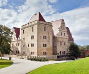
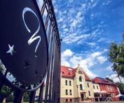
Uroczysko Siedmiu Stawów Luxury Hotel
Niemcza SPA
Videos from this area
These are videos related to the place based on their proximity to this place.
NIEMCZA I SZKOŁA 70
MAŁY FRAGMENT (OKOŁO 5%) CAŁOŚCI FILMÓW PANA KAZIMIERZA DENEGI, ZA ZGODĄ WŁAŚCICIELA.
Hotel Niemcza SPA
http://www.hotelniemcza.pl Hotel Niemcza SPA *** położony u podnóża Gór Sowich (woj. dolnośląskie) w malowniczym parku ze starodrzewem to zjawiskowe miejsce. W odrestaurowanych wnętrzach.
III Zlot im. Franciszka BondarczukaFranka- Niemcza 2014 Parada
III Zlot im. Franciszka Bondarczuka"Franka"- Niemcza 2014 Parada Parada od Kietlina do Niemczy (Stadion)
Dachowanie w Dolinie Tatarskiej
Opel corsa wypadł z drogi Niemcza - Gilów. Na szczęście nikomu nic się nie stało.
WOLYN Vergessene Wahrheit
Eine Dokumentation über die Ausmerzung der polnischen Kultur und der polnischen Bevölkerung in den ehemaligen Gebiete Polens; Ostgalizien und Wolyn. In der Zeit der kommunistischen ...
Kobierzyce - Piława Górna (PL).
Rail memories. This railway line was closed soon. The track is overgrown with trees and bushes now . Z mojego archiwum 1995.
Videos provided by Youtube are under the copyright of their owners.
Attractions and noteworthy things
Distances are based on the centre of the city/town and sightseeing location. This list contains brief abstracts about monuments, holiday activities, national parcs, museums, organisations and more from the area as well as interesting facts about the region itself. Where available, you'll find the corresponding homepage. Otherwise the related wikipedia article.
Ligota Wielka, Dzierżoniów County
Ligota Wielka is a village in the administrative district of Gmina Łagiewniki, within Dzierżoniów County, Lower Silesian Voivodeship, in south-western Poland. Prior to 1945 it was in Germany. It lies approximately 6 kilometres south-west of Łagiewniki, 18 km east of Dzierżoniów, and 45 km south-west of the regional capital Wrocław. The village has a population of 350.
Łagiewniki, Lower Silesian Voivodeship
Łagiewniki is a village in Dzierżoniów County, Lower Silesian Voivodeship, in south-western Poland. It is the seat of the administrative district called Gmina Łagiewniki. Prior to 1945 it was in Germany. It lies approximately 23 kilometres east of Dzierżoniów and 40 km south of the regional capital Wrocław. The village has a population of 2,900. From 1975 to 1998 the village was in Wrocław Voivodeship.
Młynica
Młynica is a village in the administrative district of Gmina Łagiewniki, within Dzierżoniów County, Lower Silesian Voivodeship, in south-western Poland. Prior to 1945 it was in Germany. It lies approximately 7 kilometres north-west of Łagiewniki, 19 km north-east of Dzierżoniów, and 40 km south-west of the regional capital Wrocław. The village has a population of 200.
Oleszna
Oleszna is a village in the administrative district of Gmina Łagiewniki, within Dzierżoniów County, Lower Silesian Voivodeship, in south-western Poland. Prior to 1945 it was in Germany. It lies approximately 3 kilometres north-west of Łagiewniki, 21 km north-east of Dzierżoniów, and 40 km south-west of the regional capital Wrocław. The village has a population of 900.
Przystronie, Lower Silesian Voivodeship
Przystronie is a village in the administrative district of Gmina Łagiewniki, within Dzierżoniów County, Lower Silesian Voivodeship, in south-western Poland. Prior to 1945 it was in Germany. It lies approximately 4 kilometres south-west of Łagiewniki, 20 km east of Dzierżoniów, and 43 km south of the regional capital Wrocław. The village has a population of 200.
Ratajno
Ratajno is a village in the administrative district of Gmina Łagiewniki, within Dzierżoniów County, Lower Silesian Voivodeship, in south-western Poland. Prior to 1945 it was in Germany. It lies approximately 3 kilometres south-west of Łagiewniki, 20 km east of Dzierżoniów, and 42 km south-west of the regional capital Wrocław. The village has a population of 250.
Sieniawka, Dzierżoniów County
Sieniawka is a village in the administrative district of Gmina Łagiewniki, within Dzierżoniów County, Lower Silesian Voivodeship, in south-western Poland. Prior to 1945 it was in Germany. It lies approximately 6 kilometres west of Łagiewniki, 18 km north-east of Dzierżoniów, and 43 km south-west of the regional capital Wrocław. The village has a population of 450.
Gola Dzierżoniowska Castle
Gola Castle is situated in the village of Gola Dzierżoniowska, commune of Niemcza, in Dzierżoniów County, Lower Silesian Voivodeship, in Sud-West Poland. It is located 4 km nord-west from Niemcza, 18 km from East Dzierżoniów and 47 km South of Wrocław.


