Safety Score: 3,0 of 5.0 based on data from 9 authorites. Meaning we advice caution when travelling to Germany.
Travel warnings are updated daily. Source: Travel Warning Germany. Last Update: 2024-05-06 08:04:52
Explore Westdorf
The district Westdorf of Juist in Lower Saxony is located in Germany about 277 mi west of Berlin, the country's capital.
If you need a place to sleep, we compiled a list of available hotels close to the map centre further down the page.
Depending on your travel schedule, you might want to pay a visit to some of the following locations: Lutetsburg, Wirdum, Osteel, Hagermarsch and Halbemond. To further explore this place, just scroll down and browse the available info.
Local weather forecast
Todays Local Weather Conditions & Forecast: 11°C / 53 °F
| Morning Temperature | 10°C / 51 °F |
| Evening Temperature | 12°C / 53 °F |
| Night Temperature | 11°C / 52 °F |
| Chance of rainfall | 0% |
| Air Humidity | 77% |
| Air Pressure | 1010 hPa |
| Wind Speed | Gentle Breeze with 6 km/h (4 mph) from South |
| Cloud Conditions | Overcast clouds, covering 100% of sky |
| General Conditions | Overcast clouds |
Tuesday, 7th of May 2024
11°C (51 °F)
11°C (52 °F)
Light rain, gentle breeze, overcast clouds.
Wednesday, 8th of May 2024
11°C (51 °F)
11°C (52 °F)
Light rain, moderate breeze, overcast clouds.
Thursday, 9th of May 2024
12°C (53 °F)
12°C (53 °F)
Overcast clouds, light breeze.
Hotels and Places to Stay
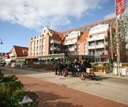
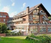
Atlantic Juist
Freese Nordsee-Hotel
Videos from this area
These are videos related to the place based on their proximity to this place.
Juist - Nordsee Insel - September 2013
Urlaub auf der Insel Juist ist Erholung pur. Das Wetter ist immer gut, außer, man ist unpassend gekleidet. Der Wind, die Luft, der Regenguss, die Sonne, all das ist inklusive. Kilometer langer...
Juist, die schönste Nordsee Insel
In den letzten Sommertagen Urlaub auf der Nordsee Insel Juist. Herrliches Sommerwetter bis zu 26 Grad Celsius. Wassertemperatur 19 Grad. Schöner kann ein Urlaubsjahr nicht enden.
Juist erleben - im Herbst und Winter
Mein vorerst letztes Juist-Video - gedreht im Oktober und Dezember 2014 mit der Sony RX10 Kamera. Danke an Claus Sörensen für Inspiration und für die tolle technische Unterstützung!
Juist in constant motion / Juist in ständiger Bewegung
Man nehme: 1x Actioncam 1x Küchenwecker 30x Zeitraffer und viel Geduld beim Filmen aufgenommen im September/Oktober 2014 auf Juist weplay-video.de.
Herrlicher Strand von Juist im November 2009
Juist ist auch im November eine Reise wert. Das Wetter ist besser als man denkt und der lange, breite und fast menschenleere Strand lädt zum Spaziergang ein.
Juist die Zauberinsel
Impressionen der Insel Juist Präsentiert von Ferienwohnungen Kalkuhl www.Traum-Urlaub-Juist.de.
Juist my Happy Place
Juist im Mai 2012 gefilmt mit der Sony Alpha 33 Kamera Musik von Julmeni - DANKE!
Teil 1. Von Haus Schönrock bis zum Ortskern Juist.
Haus Schönrock Otto & Alma Schönrock Dellertstraße 9 26571 Juist Telefon: 04935-388 E-Mail: info@haus-schoenrock.de Internet: www.haus-schoenrock.de Allergikergerechte Nichtraucher...
Videos provided by Youtube are under the copyright of their owners.
Attractions and noteworthy things
Distances are based on the centre of the city/town and sightseeing location. This list contains brief abstracts about monuments, holiday activities, national parcs, museums, organisations and more from the area as well as interesting facts about the region itself. Where available, you'll find the corresponding homepage. Otherwise the related wikipedia article.
Wadden Sea
The Wadden Sea is an intertidal zone in the southeastern part of the North Sea. It lies between the coast of northwestern continental Europe and the range of Frisian Islands, forming a shallow body of water with tidal flats and wetlands. It is rich in biological diversity. In 2009, the Dutch and German parts of the Wadden Sea were inscribed on UNESCO's World Heritage List. According to C.
Greetsiel
Greetsiel is a small port on the bight of Leybucht in western East Frisia, Germany that was first documented in letters from the year 1388. Since 1972, Greetsiel has been part of the municipality of Krummhörn, which has its administrative seat in Pewsum. The nearest railway station is at Emden, about 15–20 kilometres ( ) away, and the two towns are linked by a bus service. Although originally just a small but picturesque fishing village, Greetsiel has become a major tourist attraction.
Reception Tower Utlandshörn
The Reception Tower Utlandshörn was a 65 metre (211 ft) high wood framework tower built of oak wood on the area of the radio reception station Utlandshoern, a part of Norddeich Radio coastal station (callsign DAN). This tower carried wire antennas of four arms on its top, which were manufactured of teak wood, for the reception of short wave signals. It was built in 1935.
Lütje Hörn
Lütje Hörn is an uninhabited East Frisian Island in the North Sea. It belongs to Germany and is located approximately 3 to 4 kilometres southeast of Borkum in the East Frisian Randzelwatt. Lütje Hörn is an unincorporated area of Leer district in Lower Saxony.
Buise
Buise was one of the East Frisian Islands off the North Sea coast of Germany that was almost entirely engulfed by the sea in the second half of the 17th century. The only remaining part is the eastern end, known today as the island of Norderney. Buise itself was formed by the breakup of a bigger island. Two possible origins are mentioned: the breakup of the island Burchana in the flood of 1219, and the breakup of the island Bant in 1170, which also formed Juist, Borkum and Memmert.
Memmert
Memmert is a small East Frisian island off the northern coast of Germany, with an area of 5.2 square kilometres . Memmert is uninhabited, with only one house on the island for wildlife-spotting purposes. Occasionally, some guests from the neighboring islands visit Memmert for recreation. Memmert is officially a wildlife protected area. The island plays an important role in Erskine Childers's novel The Riddle of the Sands (1903).
Leybucht
The Leybucht is the second largest bay in East Frisia in northwest Germany after the Dollart. The Jade Bight is larger than both, but belongs historically to Oldenburg.
Pilsum Lighthouse
The Pilsum Lighthouse was built in 1891 in order to provide a beacon for the Emshörn channel on Germany's North Sea coast. It is located on a dyke near the village of Pilsum in the municipality of Krummhörn. It has guided ships through the narrow channel since 1915. In the First World War its light was extinguished in order that enemy ships could not navigate the route. After that it was no longer needed, because the channel was changed.
Norddeich Mole railway station
Norddeich Mole is a railway station located in Norddeich, Lower Saxony, Germany. The station is located on the Emsland line (Rheine - Norddeich). The train services are operated by Deutsche Bahn. Norddeich Mole is a port for combined passenger and car ferries to the islands of Norderney and Juist, both very popular among holidaymakers, many of whom arrive by train (especially during the summer).
Norder Tief
Norder Tief is a river of Lower Saxony, Germany.


