Safety Score: 3,0 of 5.0 based on data from 9 authorites. Meaning we advice caution when travelling to Germany.
Travel warnings are updated daily. Source: Travel Warning Germany. Last Update: 2024-04-29 08:03:39
Explore Gaß
The district Gaß of Altenrond in Freiburg Region (Baden-Württemberg) is located in Germany about 404 mi south-west of Berlin, the country's capital.
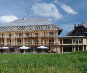
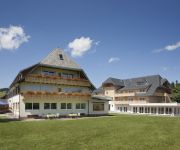
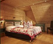
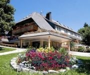
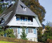
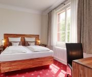
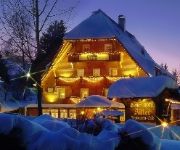
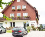
If you need a place to sleep, we compiled a list of available hotels close to the map centre further down the page.
Depending on your travel schedule, you might want to pay a visit to some of the following locations: Ibach, Todtmoos, Dachsberg, Hinterzarten and Hausern. To further explore this place, just scroll down and browse the available info.
Local weather forecast
Todays Local Weather Conditions & Forecast: 14°C / 57 °F
| Morning Temperature | 6°C / 42 °F |
| Evening Temperature | 13°C / 56 °F |
| Night Temperature | 9°C / 48 °F |
| Chance of rainfall | 0% |
| Air Humidity | 58% |
| Air Pressure | 1019 hPa |
| Wind Speed | Light breeze with 4 km/h (3 mph) from West |
| Cloud Conditions | Overcast clouds, covering 97% of sky |
| General Conditions | Light rain |
Tuesday, 30th of April 2024
18°C (64 °F)
10°C (50 °F)
Light rain, light breeze, scattered clouds.
Wednesday, 1st of May 2024
19°C (66 °F)
11°C (51 °F)
Light rain, light breeze, overcast clouds.
Thursday, 2nd of May 2024
6°C (43 °F)
4°C (40 °F)
Moderate rain, gentle breeze, overcast clouds.
Hotels and Places to Stay
Breggers Schwanen
Rössle Gasthaus
Schlehdorn
Rößle Schwarzwald Gasthof
Schlehdorn Berghaus
La Quinta
Am Kurpark
Adler Bärental
Diana
Klosterhof
Videos from this area
These are videos related to the place based on their proximity to this place.
Leaving Menzenscwand, February 2015.
Leaving our holiday apartment in Menzenschwand on a snowy Saturday morning. The first falling snow since we'd been there! This is the first part of our journ...
Zauberwald - Pfad in Bernau im Schwarzwald - Natur Pur
The legendary and mysterious adventure track follow the 'Rönischbächle', a small brooklet though the 2.5 kilometer long natural reserves 'Taubenmoos'. It bids singular hill moors, rich pads...
Mountain Bike - Bernau Schwarzwald - Hochkopf Tour 25km, 2h
Mountain Bike Tour with a very beautiful panorama. After the tour you can have the black forest greatest cake vis-à-vis of the city town hall. GPS Tour Info/Track: http://www.gps-tour.info/de/to...
black forest in germany
black forest in germany - http://www.schwarzwald-jaegerhof.de/en/index.php We welcome you to enjoy your holiday in our Pension Jägerhof Our guest house Jägerhof is situated in the heart...
Luftaufnahme/ Aerial view from St. Blasien- Menzenschwand
On the video you can also see the "Radon Revital Bad". (A visit is certainly worth :)) Flying with the Walkera QR X 350, gimbal with the DV04 Camera and Devo F7.
Hiking in the Black Forest - Jan 2011
All training done with Clicker Training techniques (with and/or without clicker) - 1) using positive reinforcement, 2) no punishments entailing physical or psychological intimidation, fear...
GTA IV Multiplayer Rank 10 + Platinum
I flew Hangman's N.O.O.S.E. about 800 times and shot in my 300 other playtroughs 7126 mostly Noose cops. My best time as a pilot was 1:56 min. with 1 teammate. I needed 2 months and 3 weeks...
Videos provided by Youtube are under the copyright of their owners.
Attractions and noteworthy things
Distances are based on the centre of the city/town and sightseeing location. This list contains brief abstracts about monuments, holiday activities, national parcs, museums, organisations and more from the area as well as interesting facts about the region itself. Where available, you'll find the corresponding homepage. Otherwise the related wikipedia article.
Sender Feldberg/Black Forest
The Sender Feldberg/Black Forest (transmitter Black Forest) is a transmission facility for FM and TV on Feldberg, Black Forest, Germany. It has an old and a new transmission tower: The old transmission tower was built at {{#invoke:Coordinates|coord}}{{#coordinates:47|51|52|N|8|01|20|E|type:landmark_region:DE | |name= }}. It is a 75 metre high concrete tower with an observation deck in a height of 36 metres and a diameter of 9.1 metres, which is nowadays closed.
Höllentalbahn (Black Forest)
There are other railway lines in German-speaking countries called Höllentalbahn HöllentalbahnHell Valley Railway 330pxTechnicalLine length 74.7 km Track gauge sgElectrification 1936 until 1960, 20 kV, 50 Hz, ACsince 1960, 15 kV, 16⅔ Hz, ACOperating speed 100 km/hHighest elevation 607 m Maximum incline 5.5%Rack system 1887 until 1933; now adhesion Route map 330px |} The Höllentalbahn (literally, "Hell Valley Railway") is a railway line that partially runs through the Höllental valley in the Black Forest of Germany.
Eugen-Keidel Tower
Eugen-Keidel Tower is a 31 metre-high observation tower location on the Schauinsland mountain near Freiburg, Germany. It was built in 1981. The Eugen-Keidel Tower has an extraordinary design with a triangular cross section.
Schule Birklehof
Schule Birklehof is a prestigious independent boarding school located in Hinterzarten in the High Black Forest region of southwestern Germany, approximately 25 km from Freiburg. It is a private coeducational secondary school. Currently, the school has approximately 240 students, 170 of whom are boarders who live on campus. The school was established by the educator Kurt Hahn in 1932 and from the beginning accepted girls and boys.
Titisee
Titisee is a lake in the southern Black Forest in Baden-Württemberg. It is said it got its name from Roman Emperor Titus. It covers an area of 1.3 km² and has an average depth of 20 m. It owes its creation to the Feldberg glacier, the moraine ploughed up by which in the Pleistocene epoch nowadays forms the lake's shores. The lake's outflow, at 840 m above sea level, is the river Gutach (or as it is called farther downstream, the Wutach).
Sankt Blasien Abbey in the Black Forest
Sankt Blaise's Abbey in the Black Forest was a Benedictine monastery in the village of St. Blasien in the Black Forest in Baden-Württemberg, Germany.
Hochfirst Tower
Hochfirst Tower is a 25 metre tall lattice observation tower on the Hochfirst mountain near Titisee-Neustadt at 47°54'04" N and 8°11'03" E. It was built in 1890 as the replacement to a wooden observation tower. Several observation decks may be accessed by the winding corrugated metal staircase, and the top deck provides panoramic views of the distant Swiss Alps and the Titisee-Neustadt valley.
Kolleg St. Blasien
The Kolleg St. Blasien is a state-recognised private Gymnasium (university preparatory school) and Catholic school with boarding facilities for boys and girls. It is situated in the town of St. Blasien in the German Black Forest. The school has 850 students, 300 of whom are boarders, and is led by members of the Jesuit order (Society of Jesus). It is considered to be one of the most prestigious schools in Germany with a rich and long history.
Gustav Siewerth Academy
The Gustav-Siewerth Academy (GSA) is a private university with state recognition, based in Weilheim-beer Bronnen in Baden-Wuerttemberg. The Academy is named after the philosopher and pedagogue Gustav Siewerth. With only 16 students, it is the smallest state-recognized institution of higher education in Germany. The Academy was created in an effort to the neo-Marxism of the Frankfurt School of Theodor W. Adorno and Max Horkheimer counteract.
Ravenna Bridge
Ravenna Bridge is the name of a 58-metre high and 225-metre long railway viaduct on the Höllentalbahn line in the Black Forest, in Breitnau, Breisgau-Hochschwarzwald, Baden-Württemberg, Germany. The bridge crosses the Ravenna gorge that ends in the upper Höllental, and has a grade of 12 metres . The origin of the name most likely comes from the French ravin for gorge.
Windgfällweiher
Windgfällweiher is a lake in Südschwarzwald, Baden-Württemberg, Germany. At an elevation of, its surface area is 19.81 ha.
Höllental (Black Forest)
The Höllental in the Black Forest is a deep valley - in places like a gorge - in the state of Baden-Württemberg in Germany. The valley, which is about 9 kilometres long, is located in the southern part of the Southern Black Forest Nature Park about 18 km southeast of Freiburg im Breisgau between Hinterzarten and Buchenbach-Himmelreich. The Rotbach stream (also called Höllenbach in the upper Höllental) runs through the valley. "Hölle" is the German word for "hell".
Hasenhorn
Hasenhorn is a mountain of Baden-Württemberg, Germany.
Hinterwaldkopf
Hinterwaldkopf is a mountain of Baden-Württemberg, Germany.
Hochfirst
Hochfirst is a mountain of Baden-Württemberg, Germany.
Hochkopf (Südschwarzwald)
Hochkopf (Südschwarzwald) is a mountain of Baden-Württemberg, Germany.
Rappeneck
Rappeneck is a mountain of Baden-Württemberg, Germany.
Rohrenkopf
Rohrenkopf is a mountain of Baden-Württemberg, Germany.
Seebuck
Seebuck is a mountain of Baden-Württemberg, Germany.
Stollenbach (Schwarzwald)
Stollenbach (Schwarzwald) is a mountain of Baden-Württemberg, Germany.
Stübenwasen
Stübenwasen is a mountain of Baden-Württemberg, Germany.
Kirchzarten Airfield
Kirchzarten Airfield (in German Segelfluggelände Kirchzarten-Oberried) is an unpaved airfield located approximately 10 km southeast of Freiburg im Breisgau, Germany, in the town of Kirchzarten. The airfield is home to Freiburg and Kirchzarten based gliding club Breisgauverein für Segelflug (BVS), which has also constructed the airfield and the facilities in the 70s. Until 2009, two other gliding clubs shared the airfield with the BVS, AKA Flieg Freiburg and CFM Emmendingen.
Alb (Southern Black Forest)
The Alb is a river in the Black Forest. It arises from two headwaters, the Menzenschwander Alb and Bernauer Alb and flows in a southerly direction. It ends after 42.8 km at a confluence with the High Rhine at Albbruck.
Sagebach
Sagebach is a river of North Rhine-Westphalia, Germany. It is 4.5 kilometres long and passes through the Egge Hills.
Gersbach (Schopfheim)
Gersbach is a nationally recognized resort and district of Schopfheim, a town in the district of Lörrach in Baden-Württemberg, Germany. Gersbach is situated in a mountain valley basin to the south from the eponymous river in the Black Forest at an altitude of 800-1170 m above sea level. The old town of Schopfheim is roughly 17 km away. The formerly independent village, together with the six associated hamlets forms one of Baden-Württemberg's largest Gemarkung, with an area of 2009 hectares.


