Safety Score: 3,2 of 5.0 based on data from 9 authorites. Meaning please reconsider your need to travel to Czech Republic.
Travel warnings are updated daily. Source: Travel Warning Czechia. Last Update: 2024-04-25 08:17:04
Explore Jílové
Jílové in Okres Děčín (Ústecký kraj) with it's 5,307 inhabitants is a city in Czechia about 49 mi (or 78 km) north of Prague, the country's capital.
Local time in Jílové is now 07:05 AM (Friday). The local timezone is named Europe / Prague with an UTC offset of 2 hours. We know of 10 airports in the vicinity of Jílové, of which 5 are larger airports. The closest is airport we know is Dresden Airport in Germany in a distance of 30 mi (or 48 km). The closest airport in Czechia is Ruzyně International Airport in a distance of 46 mi (or 48 km), North-West. Besides the airports, there are other travel options available (check left side).
There are several Unesco world heritage sites nearby. The closest heritage site is Dresden Elbe Valley in Germany at a distance of 23 mi (or 37 km). The closest in Czechia is Historic Centre of Prague in a distance of 48 mi (or 37 km), North-West. We found 2 points of interest in the vicinity of this place. If you need a place to sleep, we compiled a list of available hotels close to the map centre further down the page.
Depending on your travel schedule, you might want to pay a visit to some of the following locations: Usti nad Labem, Rathmannsdorf, Struppen, Dohma and Lohmen. To further explore this place, just scroll down and browse the available info.
Local weather forecast
Todays Local Weather Conditions & Forecast: 13°C / 56 °F
| Morning Temperature | 2°C / 35 °F |
| Evening Temperature | 13°C / 55 °F |
| Night Temperature | 7°C / 45 °F |
| Chance of rainfall | 0% |
| Air Humidity | 48% |
| Air Pressure | 1009 hPa |
| Wind Speed | Gentle Breeze with 6 km/h (4 mph) from North |
| Cloud Conditions | Scattered clouds, covering 32% of sky |
| General Conditions | Scattered clouds |
Saturday, 27th of April 2024
17°C (63 °F)
9°C (48 °F)
Scattered clouds, gentle breeze.
Sunday, 28th of April 2024
19°C (66 °F)
12°C (53 °F)
Broken clouds, gentle breeze.
Monday, 29th of April 2024
20°C (68 °F)
16°C (62 °F)
Broken clouds, light breeze.
Hotels and Places to Stay
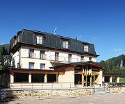
Ostrov Hotel
Videos from this area
These are videos related to the place based on their proximity to this place.
Die Tyssaer Wände im NP Sächsisch-Böhmische-Schweiz
Die Tyssaer Wände sind nach der naheliegenden tschechischen Gemeinde Tyssa benannt und befinden sich nur wenige Kilometer von der deutschen (sächsischen) Grenze entfernt. Die Entstehung ...
Karosa C 734 ev.č. 270 - Dopravní podnik města Ústí nad Labem a.s.
Jízda na l. 21 (cyklobus) mezi obcemi Tisá a Libouchec. Původní autobus C 734.20 tohoto čísla byl v roce 2007 odeslán do firmy Zliner, odkud se výměnou vrátil tento vůz po GO a moderniza...
XBoxUser.de - Batman Arkham Assylum Poison Ivy Trailer
xboxuser.de - Batman Arkham Assylum Poison Ivy Trailer.
ArmA II - MH-6 Flying
In Combined Operations 1.60RC2, running ACE2 as well) Flying a low course around Chernarus's northwest airfield.
Mikulášský karneval MC Sovička o.s. Jílové - 4.12.2011
Mikulášský karneval MC Sovička o.s. Jílové - 4.12.2011.
RC EXPEDITION TEAM EXPEDICE Schneeberg 001 Axial Jeep Wrangler RUBICON SCX 10
Czech republic on Jun 12. - DĚČÍN - North territory of Czech rep. by border with Germany - beautiful landscape.
Videos provided by Youtube are under the copyright of their owners.
Attractions and noteworthy things
Distances are based on the centre of the city/town and sightseeing location. This list contains brief abstracts about monuments, holiday activities, national parcs, museums, organisations and more from the area as well as interesting facts about the region itself. Where available, you'll find the corresponding homepage. Otherwise the related wikipedia article.
Děčínský Sněžník
The Děčínský Sněžník is a mountain in the Czech Republic and, at 722.8 m above sea level, the highest peak in the Elbe Sandstone Mountains. The Sněžník is located in the Jílové municipality, west of Děčín in the Ústí nad Labem Region, in the mountainous area of Bohemian Switzerland, close to the border with Germany. One of the first historical figures to visit Děčínský Sněžník was Emperor Joseph II of Habsburg, who climbed the peak in September 1779.


