Safety Score: 3,0 of 5.0 based on data from 9 authorites. Meaning we advice caution when travelling to Austria.
Travel warnings are updated daily. Source: Travel Warning Austria. Last Update: 2024-05-05 08:24:42
Explore Aschenberg
Aschenberg in Politischer Bezirk Schärding (Oberösterreich) is located in Austria about 127 mi (or 204 km) west of Vienna, the country's capital.
Local time in Aschenberg is now 07:49 PM (Sunday). The local timezone is named Europe / Vienna with an UTC offset of 2 hours. We know of 10 airports in the wider vicinity of Aschenberg, of which 4 are larger airports. The closest airport in Austria is Linz Airport in a distance of 31 mi (or 50 km), South-East. Besides the airports, there are other travel options available (check left side).
There are several Unesco world heritage sites nearby. The closest heritage site is Historic Centre of Český Krumlov in Czechia at a distance of 38 mi (or 62 km). The closest in Austria is Historic Centre of the City of Salzburg in a distance of 55 mi (or 62 km), North-East. If you need a place to sleep, we compiled a list of available hotels close to the map centre further down the page.
Depending on your travel schedule, you might want to pay a visit to some of the following locations: Andorf, Thyrnau, Zell an der Pram, Peuerbach and Salzweg. To further explore this place, just scroll down and browse the available info.
Local weather forecast
Todays Local Weather Conditions & Forecast: 20°C / 68 °F
| Morning Temperature | 12°C / 53 °F |
| Evening Temperature | 18°C / 65 °F |
| Night Temperature | 12°C / 53 °F |
| Chance of rainfall | 0% |
| Air Humidity | 70% |
| Air Pressure | 1013 hPa |
| Wind Speed | Gentle Breeze with 8 km/h (5 mph) from East |
| Cloud Conditions | Overcast clouds, covering 99% of sky |
| General Conditions | Light rain |
Monday, 6th of May 2024
22°C (72 °F)
12°C (53 °F)
Heavy intensity rain, fresh breeze, broken clouds.
Tuesday, 7th of May 2024
12°C (53 °F)
11°C (51 °F)
Moderate rain, gentle breeze, overcast clouds.
Wednesday, 8th of May 2024
11°C (52 °F)
10°C (49 °F)
Light rain, light breeze, overcast clouds.
Hotels and Places to Stay
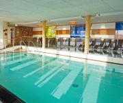
Landrefugium Obermüller Selfness & Balancehotel
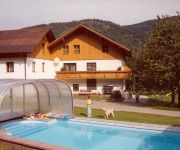
Pension Bernhard´s - das Restaurant an der Donau
Zur Post
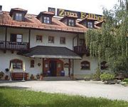
Zum Edlhof Landgasthof
Videos from this area
These are videos related to the place based on their proximity to this place.
Rad Total im Donautal 2009
Gesperrte Straßen von Passau bis nach Jochenstein, wo sich das Haus am Strom befindet. Ein Event für Radsport-Begeisterte! Hier ein paar kurze Einblicke in das diesjährige Rad Total.
[GoPro] Frühjahrsarbeiten mit New Holland und Fendt!! (HD)
Wieseneggen mit New Holland TD5010 und Wölfleder 6,2m Wiesenegge und Fendt 260S mit 3,5m Wiesenegge. Kamera: Sony HDR CX 200E und GoPro Hero 3+ Black Schnitt: Adobe Premiere ...
hei solar light Champ NG 190-2400-hybrid version
Installation off-grid lighting system with circular light distribution ideal for squares and promenades. Part-solar, hybrid version for locations with poor lighting conditions.
Höhenrettung St. Aegidi in Münzkirchen
Die Höhenrettungsgruppe St. Aegidi wurde von der Marktgemeinde Münzkirchen zu einer Schauübung anlässlich eines Jubiäums am 27.06.2009 geladen. Zu sehen sind: - Menschenrettung von...
Videos provided by Youtube are under the copyright of their owners.
Attractions and noteworthy things
Distances are based on the centre of the city/town and sightseeing location. This list contains brief abstracts about monuments, holiday activities, national parcs, museums, organisations and more from the area as well as interesting facts about the region itself. Where available, you'll find the corresponding homepage. Otherwise the related wikipedia article.
Burg Vichtenstein
Burg Vichtenstein is a castle in Upper Austria, Austria. The Vichtenstein castle sits in the "sow forest" (upper Austria) above the Danube valley opposite to the market municipality of Upper Cell (Lower Bavaria). The castle is in the centre of the municipality Vichtenstein. There is no documentary for the construction of the castle but it is believed to have been started around the year 1100.


!['[GoPro] Frühjahrsarbeiten mit New Holland und Fendt!! (HD)' preview picture of video '[GoPro] Frühjahrsarbeiten mit New Holland und Fendt!! (HD)'](https://img.youtube.com/vi/TX-2g8n2kfU/mqdefault.jpg)


