Safety Score: 3,0 of 5.0 based on data from 9 authorites. Meaning we advice caution when travelling to Austria.
Travel warnings are updated daily. Source: Travel Warning Austria. Last Update: 2024-04-28 08:22:10
Touring Innerödt
Innerödt in Politischer Bezirk Rohrbach (Oberösterreich) is a town located in Austria about 117 mi (or 189 km) west of Vienna, the country's capital place.
Time in Innerödt is now 10:10 AM (Sunday). The local timezone is named Europe / Vienna with an UTC offset of 2 hours. We know of 10 airports nearby Innerödt, of which 4 are larger airports. The closest airport in Austria is Linz Airport in a distance of 28 mi (or 46 km), South-East. Besides the airports, there are other travel options available (check left side).
There are several Unesco world heritage sites nearby. The closest heritage site is Historic Centre of Český Krumlov in Czechia at a distance of 26 mi (or 41 km). The closest in Austria is Historic Centre of the City of Salzburg in a distance of 67 mi (or 41 km), North-East. Need some hints on where to stay? We compiled a list of available hotels close to the map centre further down the page.
Being here already, you might want to pay a visit to some of the following locations: Atzesberg, Nebelberg, Breitenberg, Sonnen and Neureichenau. To further explore this place, just scroll down and browse the available info.
Local weather forecast
Todays Local Weather Conditions & Forecast: 19°C / 66 °F
| Morning Temperature | 7°C / 44 °F |
| Evening Temperature | 16°C / 61 °F |
| Night Temperature | 10°C / 50 °F |
| Chance of rainfall | 0% |
| Air Humidity | 37% |
| Air Pressure | 1012 hPa |
| Wind Speed | Light breeze with 4 km/h (3 mph) from North |
| Cloud Conditions | Broken clouds, covering 70% of sky |
| General Conditions | Broken clouds |
Monday, 29th of April 2024
20°C (68 °F)
11°C (52 °F)
Broken clouds, light breeze.
Tuesday, 30th of April 2024
21°C (70 °F)
11°C (51 °F)
Sky is clear, gentle breeze, clear sky.
Wednesday, 1st of May 2024
21°C (69 °F)
13°C (55 °F)
Scattered clouds, moderate breeze.
Hotels and Places to Stay
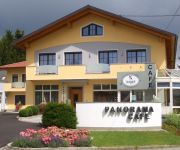
Pernsteiner Gasthof
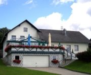
Pension Panoramablick
Pröll
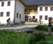
Bauernhof Natschläger
Videos from this area
These are videos related to the place based on their proximity to this place.
Gasteiner 3-Länder Crosstriathlon, 10.08.2013
Nachbericht von LT1 (© www.LT1.at) zum Gasteiner 3-Länder Crosstriathlon am 10. August 2013 in Kollerschlag, Wegscheid und Horní Planá.
Four NoHemi Euro Cup Kollerschlag 2013
Follow us on Twitter https://twitter.com/RoccoPowerTeam Follow us on Facebook https://www.facebook.com/pages/Rocco-Power-Team/112998205437298?ref=hl.
Brennpunkt - LF 6x6 der FF Hinterschiffl
Erstes LF 6x6 auf Mercedes Sprinter steht bei der Freiw. Feuerwehr Hinterschiffl in Oberösterreich. Begleitvideo "Making of" zur Reportage im Feuerwehrmagazin Brennpunkt, Ausgabe 7/2012 -...
Lembacher Hof
Vitalhotel Lembacherhof im Mühlviertel - Wellness & Wandern mit Mühlviertler Genuss. http://www.lembacherhof.at.
FJ Rannariedl - Jugendlager 2008
Eine höhere Qualität ist unter diesem Link verfügbar: http://www.youtube.com/watch?v=m7HZI9uvZnI&fmt=18 Bezirksjugendlager 2008 in Ulrichsberg.
Videos provided by Youtube are under the copyright of their owners.


