Safety Score: 3,0 of 5.0 based on data from 9 authorites. Meaning we advice caution when travelling to Austria.
Travel warnings are updated daily. Source: Travel Warning Austria. Last Update: 2024-05-03 08:06:06
Delve into Gattersdorf
Gattersdorf in Politischer Bezirk Völkermarkt (Kärnten) is a city located in Austria about 134 mi (or 215 km) south-west of Vienna, the country's capital town.
Current time in Gattersdorf is now 01:33 PM (Friday). The local timezone is named Europe / Vienna with an UTC offset of 2 hours. We know of 12 airports closer to Gattersdorf, of which 5 are larger airports. The closest airport in Austria is Klagenfurt Airport in a distance of 12 mi (or 20 km), West. Besides the airports, there are other travel options available (check left side).
There are several Unesco world heritage sites nearby. The closest heritage site in Austria is City of Graz – Historic Centre and Schloss Eggenberg in a distance of 46 mi (or 74 km), North-East. We saw 1 points of interest near this location. In need of a room? We compiled a list of available hotels close to the map centre further down the page.
Since you are here already, you might want to pay a visit to some of the following locations: Diex, Voelkermarkt, Bruckl, Eberstein and Eberndorf. To further explore this place, just scroll down and browse the available info.
Local weather forecast
Todays Local Weather Conditions & Forecast: 11°C / 51 °F
| Morning Temperature | 10°C / 50 °F |
| Evening Temperature | 9°C / 47 °F |
| Night Temperature | 8°C / 47 °F |
| Chance of rainfall | 24% |
| Air Humidity | 96% |
| Air Pressure | 1011 hPa |
| Wind Speed | Light breeze with 3 km/h (2 mph) from South-East |
| Cloud Conditions | Overcast clouds, covering 100% of sky |
| General Conditions | Moderate rain |
Saturday, 4th of May 2024
10°C (49 °F)
10°C (50 °F)
Moderate rain, calm, overcast clouds.
Sunday, 5th of May 2024
17°C (63 °F)
11°C (52 °F)
Overcast clouds, light breeze.
Monday, 6th of May 2024
17°C (63 °F)
11°C (52 °F)
Light rain, light breeze, overcast clouds.
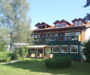
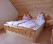
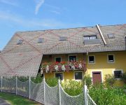
Hotels and Places to Stay
Klopein
Rosenberger Völkermarkt
Bauernhof Slamanig Oswald vlg Zukaunig
Elisabeth
Noreia
Videos from this area
These are videos related to the place based on their proximity to this place.
video2.mov: Sapotnikofen bei Diex
See the entire trip at http://www.everytrail.com. Eine herrliche Osterwanderung durch das hügelige Kärnten.
Feuerwehrübung Verkehrsunfall mit Brand im Lilienbergtunnel
Übung: Verkehrsunfall mit Brand im Lilienbergtunnel „Verkehrsunfall mit Brand im Lilienbergtunnel Südportal B82 Seeberg Bundestraße" lautete die Einsatzmeldung am Mittwoch den 30. Okt....
Weizer beim Bungee Jumping !!2003 Weiz
Starring:1.Redl 2.Pfanni 3.David Die härtesten unter der Sonne!!!
Videos provided by Youtube are under the copyright of their owners.
Attractions and noteworthy things
Distances are based on the centre of the city/town and sightseeing location. This list contains brief abstracts about monuments, holiday activities, national parcs, museums, organisations and more from the area as well as interesting facts about the region itself. Where available, you'll find the corresponding homepage. Otherwise the related wikipedia article.
Inner Austria
Inner Austria was a term used from the late 14th to the early 17th century for the Habsburg hereditary lands south of the Semmering Pass, referring to the Imperial duchies of Styria, Carinthia, Carniola and the Austrian Littoral. The residence of the Inner Austrian dukes was at Graz.
Burgruine Waisenberg
Burgruine Waisenberg is a castle in Carinthia, Austria.





!['My Paseo Sound :]' preview picture of video 'My Paseo Sound :]'](https://img.youtube.com/vi/6-rheK9vkt8/mqdefault.jpg)


