Safety Score: 2,7 of 5.0 based on data from 9 authorites. Meaning we advice caution when travelling to United States.
Travel warnings are updated daily. Source: Travel Warning United States. Last Update: 2024-05-18 08:26:29
Explore Three Oaks
The district Three Oaks of Coal Grove in Lawrence County (Ohio) is located in United States about 303 mi west of Washington DC, the country's capital.
If you need a place to sleep, we compiled a list of available hotels close to the map centre further down the page.
Depending on your travel schedule, you might want to pay a visit to some of the following locations: Ironton, Catlettsburg, Greenup, Huntington and Wayne. To further explore this place, just scroll down and browse the available info.
Local weather forecast
Todays Local Weather Conditions & Forecast: 24°C / 75 °F
| Morning Temperature | 14°C / 58 °F |
| Evening Temperature | 24°C / 75 °F |
| Night Temperature | 17°C / 62 °F |
| Chance of rainfall | 1% |
| Air Humidity | 60% |
| Air Pressure | 1013 hPa |
| Wind Speed | Light breeze with 3 km/h (2 mph) from South |
| Cloud Conditions | Broken clouds, covering 83% of sky |
| General Conditions | Moderate rain |
Sunday, 19th of May 2024
27°C (81 °F)
17°C (63 °F)
Sky is clear, light breeze, clear sky.
Monday, 20th of May 2024
30°C (86 °F)
18°C (65 °F)
Sky is clear, light breeze, clear sky.
Tuesday, 21st of May 2024
31°C (87 °F)
21°C (69 °F)
Few clouds, light breeze.
Hotels and Places to Stay
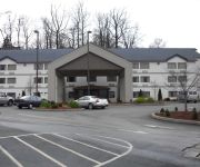
Fairfield Inn & Suites Ashland
Southern Hills Inn
ASHLAND PLAZA HOTEL
Holiday Inn Express & Suites IRONTON
BEST WESTERN RIVER CITIES
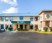
Quality Inn Ashland
Country Hearth Inn and Suites
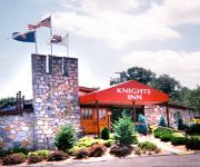
KNIGHTS INN ASHLAND
Videos from this area
These are videos related to the place based on their proximity to this place.
Real Kickboxing in Ashland, Kentucky - www.AshlandKickboxing.com
Learn real, Muay Thai style kickboxing in Ashland, KY. Train with professional fighters and coaches. Check out www.AshlandKickboxing.com for more information and to schedule a FREE Workout.
A Trip To Sargent's Tire Shop
Time to get the rubber put on my Dad's wheels for his '76 model V-Dub Bus.
S.S.B.T.C New Directive-I'm on a mission!
I found another Sears Roto-Spader and had to make another road trip, I thought I'd show the S.S.B.T.C. some "love" while I was at it....lol.
Adventure with AJ
I needed to spend some time with my awesome son A.J. It had been a few days since we had just hung out just him & I, so we decided to grab a few burgers and take a 'lil road trip!
1600 shots 3 mins..backyard firework grand finale 2010.avi
1600 shots 3 boards 3 minutes and all 500 gram consumer class cakes. fun stuff...sorry about the shaky video. This is the last 3 minutes of a 33 minute show.
Gravely-finally running
Well the Gravely is running, just few odds and ends then she'll be ready for spring!
Child Rescued From Quicksand
My son got stuck in Kentucky quicksand. After half an hour to 45 minutes he was free!
Superior Chrysler Dodge Jeep Ram - Nobody Beats a Superior Deal
This is the latest Bulldog Creative Services production we completed for our friends at Superior Chrysler Dodge Jeep Ram. Allan Thacker and his team at Superior do a fantastic job with all...
Weber ICT Rebuild-part 2
Time to scrub up all of the parts after a good soak in the carburetor cleaner.
Videos provided by Youtube are under the copyright of their owners.
Attractions and noteworthy things
Distances are based on the centre of the city/town and sightseeing location. This list contains brief abstracts about monuments, holiday activities, national parcs, museums, organisations and more from the area as well as interesting facts about the region itself. Where available, you'll find the corresponding homepage. Otherwise the related wikipedia article.
Westwood, Boyd County, Kentucky
Westwood is a census-designated place (CDP) in Boyd County, Kentucky, United States. The population was 4,746 at the 2010 census. It serves as a suburb of the city of Ashland. Westwood is closely affiliated with Ashland, as it shares its ZIP code and bus system with the city. Westwood is located on a flat to hilly elevation just west of the Ohio River.
Ashland, Kentucky
Ashland, formerly known as Poage Settlement, is a city in Boyd County, Kentucky, United States, nestled along the banks of the Ohio River. The population was 21,684 at the 2010 census. Ashland is a part of the Huntington-Ashland, WV-KY-OH, Metropolitan Statistical Area (MSA). As of the 2010 census, the MSA had a population of 287,702. New definitions from February 28, 2013 placed the population at 363,000. Ashland is the second largest city within the MSA, after Huntington, West Virginia.
Bellefonte, Kentucky
Bellefonte is a residential city in Greenup County, Kentucky, United States. The population was 837 at the 2000 census. Bellefonte is a part of the Huntington-Ashland, WV-KY-OH Metropolitan Statistical Area (MSA). As of the 2000 census, the MSA had a population of 288,649. Locally, Bellefonte is known for its upscale neighborhoods and the private Bellefonte Country Club, which has a championship level 18 hole golf course and formal ballroom.
Flatwoods, Kentucky
Flatwoods is a suburban city of the larger and nearby Ashland, Kentucky, although located in a different county from Ashland, in Greenup County, Kentucky, United States. The population was 10,983 at the 2010 census. Bobby Crager is the city's mayor. Flatwoods is a part of the Huntington-Ashland, WV-KY-OH, Metropolitan Statistical Area (MSA). As of the 2000 census, the MSA had a population of 288,649.
Russell, Kentucky
Russell is a city in Greenup County, Kentucky, United States, along the Ohio River. The population was 3,645 at the 2000 census. Russell is a part of the Huntington-Ashland, WV-KY-OH, Metropolitan Statistical Area (MSA). As of the 2000 census, the MSA had a population of 288,649. Russell has close economic affiliations with its neighbors, Ashland, Flatwoods, and Ironton, Ohio. Part of the city is located within one of Ashland's postal ZIP codes.
Hanging Rock, Ohio
Hanging Rock is a village in Lawrence County, Ohio, United States, along the Ohio River. The population was 221 at the 2010 census. It is regularly labeled a speed trap as the state auditor reported $109,186 in mayor's court receipts in 2000 compared with $3,106 in property taxes. Hanging Rock is a part of the Huntington-Ashland, WV-KY-OH, Metropolitan Statistical Area (MSA); it had a population of 288,649 at the 2000 census.
Coal Grove, Ohio
Coal Grove is a village in Lawrence County, Ohio, United States, along the Ohio River. The population was 2,165 at the 2010 census. It borders the city of Ironton and lies across the Ohio River from Ashland, Kentucky. It is linked to Ashland by the Ben Williamson Memorial Bridge and Simeon Willis Memorial Bridge. Coal Grove is a part of the Huntington-Ashland, WV-KY-OH, Metropolitan Statistical Area (MSA). As of the 2000 census, the MSA had a population of 288,649.
Ironton, Ohio
Ironton is a city in the U.S. state of Ohio and the county seat of Lawrence County. The municipality is located in southern Ohio along the Ohio River. The population was 11,129 at the 2010 census. Ironton is part of the Huntington-Ashland, WV-KY-OH, Metropolitan Statistical Area (MSA). As of the 2010 census, the MSA had a population of 287,702. New definitions from February 28, 2013 placed the population at 363,000..
Ohio University Southern Campus
Ohio University Southern Campus is located at 1804 Liberty Avenue in Ironton, Ohio. While not as large as the main Ohio University campus located in Athens, Ohio, several degree programs are offered. The Southern Campus also features an extension located in Proctorville, Ohio, a Nature Center, and the Ohio Horse Park located in Franklin Furnace, Ohio just off U.S. 52. OUS also has an on campus eating area called "The Paddock".
South Point High School (Ohio)
South Point High School is a public high school in South Point, Ohio. It is the only high school in the South Point Local School District. The school is operated by principal Jayshree Shah and assistant principal Greg Sullivan. The district's mascot nickname is the Pointers. The school district recently passed a bond issue for new buildings. A new building was currently completed as well as a new football complex.
Ben Williamson Memorial Bridge
Completed in 1932, the two-lane Ben Williamson Bridge connects Coal Grove, Ohio to Ashland, Kentucky, crossing the Ohio River. Named for Senator Ben M. Williamson, it was formerly a two-way span before the parallel Simeon Willis Memorial Bridge was completed upstream in 1985, it is used for Kentucky-bound traffic today. In 1989, the bridge was closed and renovated during which time traffic in both directions was diverted to the Willis Bridge.
Ironton–Russell Bridge
The Ironton–Russell Bridge opened in 1922 as the first highway bridge along the Ohio River between Parkersburg, West Virginia and Cincinnati, Ohio. Soon, the Ironton-Russell bridge was followed by numerous others at Ashland, Portsmouth, and Huntington. This light-blue cantilever bridge carries two lanes of traffic and a narrow sidewalk. In 2000, the Ohio Department of Transportation released a report recommended the replacement of the then 78 year old span.
Simeon Willis Memorial Bridge
Simeon Willis Memorial Bridge is a bridge constructed in 1985 over the Ohio River connecting Winchester Ave. and 13th St. at Ashland, Kentucky to US 52 at Coal Grove, Ohio. It is named for Kentucky Governor Simeon S. Willis. The bridge was planned, at one point, to cross at 45th St. and connect to a proposed Ashland bypass. The Willis bridge, however, was built one block from the existing Ben Williamson Memorial Bridge and generally carries only Ohio-bound traffic.
WIRO
WIRO is a commercial radio station serving the Ironton, Ohio, Flatwoods, Kentucky, Ashland, Kentucky and Huntington, West Virginia areas. The station currently is affiliated with Fox Sports Radio, beginning on April 6, 2009. Previously it repeated WVHU in Huntington. The station's antenna system uses a single tower that results in an omnidirectional signal pattern. According to the Antenna Structure Registration database, the tower is 62.4 m tall.
WLRX
WLRX (107.1 FM, "Comedy 107.1") is a station covering the Huntington, West Virginia area. The Clear Channel Communications outlet broadcasts at 107.1 MHz with an ERP of 3.1 kW and is licensed to Ironton, Ohio.
Saint Joseph Central High School (Ironton, Ohio)
Saint Joseph Central Catholic High School is a private, Catholic high school in Ironton, Ohio. It is operated by the Roman Catholic Diocese of Steubenville. The school's sports teams are known as the Flyers. In addition to housing the high school grades of 9-12, the school also houses junior high grades 7-8.
Dawson-Bryant High School
Dawson-Bryant High School is a public high school in Coal Grove, Ohio. It is the only high school in the Dawson-Bryant Local School District. Their mascot is the Hornets; and the school's colors are red, black, and white.
Ironton High School
Ironton High School is a public high school in Ironton, Ohio. It is the only high school in the Ironton City School District. Their nickname is the Fighting Tigers. Their school colors are orange and black.
Kitts Hill, Ohio
Kitts Hill is an unincorporated community in western Lawrence Township, Lawrence County, Ohio, United States. Although it is unincorporated, it has a post office, with the ZIP code of 45645. It lies along State Route 141 northeast of the city of Ironton, the county seat of Lawrence County. The majority of Pre-K through 12th grade education is provided by the Rock Hill Local School District, although very small portions of the area are served by the Dawson-Bryant Local School District.
WCMI-FM
WCMI-FM is a radio station broadcasting an Album Oriented Rock format. Licensed to Catlettsburg, Kentucky, USA, it serves the Huntington-Ashland radio market. The station is currently owned by Kindred Communications, Inc.
Boyd County Middle School
Boyd County Middle School is a public middle school located in Ashland, Kentucky. The school has 69 staff and faculty members and 727 students in grades 6 to 8. It is part of the Boyd County Public Schools school district. Boyd County Middle School opened in 1976. Construction on the school began in 1975. The name choice for the school mascot was either the "Patriots" or the "Rebels. " The students chose the Rebels, they have now changed their mascot to the Wildcats.
Our Lady of Bellefonte Hospital
Our Lady of Bellefonte Hospital is a 214-bed not-for-profit acute care hospital located in Ashland, Kentucky in the Tri-State region of Northeast Kentucky, Southern Ohio, and Western West Virginia. Part of the Catholic-based Bon Secours Health System Inc. , Our Lady of Bellefonte Hospital employs approximately 1,200 healthcare professionals, making the hospital the largest employer in Greenup County.
Sugar Creek Christian Academy
Sugar Creek Christian Academy is a private, Baptist high school in Ironton, Ohio.
Pollard Baptist Church
Pollard Baptist Church is a church in Ashland, Kentucky. Organized on January 3, 1892 with fifty-four charter members by S. Hensley, L. Mutters, J. D. Crum, N. B. Adkins, and J. S. Gilpin, it was originally called the First Baptist Church at Pleasant Springs, before being given its present name in August 1900.
Federal Correctional Institution, Ashland
The Federal Correctional Institution, Ashland (FCI Ashland) is a low-security United States federal prison for male inmates in Kentucky. It is operated by the Federal Bureau of Prisons, a division of the United States Department of Justice. It also includes a satellite prison camp for minimum-security male offenders. FCI Ashland is located approximately 125 miles east of Lexington, Kentucky.


