Safety Score: 2,7 of 5.0 based on data from 9 authorites. Meaning we advice caution when travelling to United States.
Travel warnings are updated daily. Source: Travel Warning United States. Last Update: 2024-05-14 08:25:02
Discover Village of Nagog Woods
Village of Nagog Woods in Middlesex County (Massachusetts) is a town in United States about 386 mi (or 621 km) north-east of Washington DC, the country's capital city.
Current time in Village of Nagog Woods is now 07:43 AM (Tuesday). The local timezone is named America / New York with an UTC offset of -4 hours. We know of 10 airports near Village of Nagog Woods, of which 4 are larger airports. The closest airport in United States is Laurence G Hanscom Field in a distance of 8 mi (or 13 km), South-East. Besides the airports, there are other travel options available (check left side).
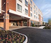
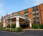
Also, if you like playing golf, there are a few options in driving distance. Looking for a place to stay? we compiled a list of available hotels close to the map centre further down the page.
When in this area, you might want to pay a visit to some of the following locations: Dedham, Boston, Worcester, Brentwood and Allenstown. To further explore this place, just scroll down and browse the available info.
Local weather forecast
Todays Local Weather Conditions & Forecast: 24°C / 74 °F
| Morning Temperature | 10°C / 50 °F |
| Evening Temperature | 20°C / 68 °F |
| Night Temperature | 15°C / 60 °F |
| Chance of rainfall | 0% |
| Air Humidity | 46% |
| Air Pressure | 1012 hPa |
| Wind Speed | Moderate breeze with 10 km/h (6 mph) from North-East |
| Cloud Conditions | Few clouds, covering 23% of sky |
| General Conditions | Light rain |
Tuesday, 14th of May 2024
14°C (58 °F)
12°C (54 °F)
Light rain, light breeze, overcast clouds.
Wednesday, 15th of May 2024
18°C (64 °F)
11°C (52 °F)
Light rain, gentle breeze, overcast clouds.
Thursday, 16th of May 2024
20°C (68 °F)
11°C (53 °F)
Overcast clouds, gentle breeze.
Hotels and Places to Stay
Residence Inn Boston Westford
WESTFORD REGENCY INN AND CONFERENCE
Hampton Inn - Suites Westford-Chelmsford
Courtyard Boston Littleton
Residence Inn Boston Concord
Concord's Colonial Inn
MA Radisson Hotel and Suites Chelmsford
BW AT HISTORIC CONCORD
Videos from this area
These are videos related to the place based on their proximity to this place.
Witch's Woods Stage Show, Fire Performers Practice 2012
The fire performers of Witch's Woods practice for the stage show. The stage show runs every hour at Witch's Woods with dance-off competitions and air-guitar contests. There will be multiple...
Dec 29, 2011 Park Report from Nashoba Valley Ski Area
We are building the new park on Sundance, starting tonight. Before he head over there are get some larger features installed, we thought we'd look back at the jib grove on Nashoba Slope this...
Westford, MA: Bechwith (Monty) Man-Powered Elevator @ The Outlook, Nashoba Valley Ski Area
This is the Beckwith (Monty) Man-Powered Elevator, serving The Outlook Restaurant, at Nashoba Valley Ski Area, Westford, Massachusetts. This was rushed, due to it being very busy, and recorded...
Acroyoga Practice - Putting together some transitions
We have Acroyoga classes every Friday night in Acton from 7:30-9:00 PM at Moncreaff's Martial Arts, Yoga, and Fitness located at 485 Great Road in Acton, MA 01720. We also have classes every...
Sundance City Video Recap
Thanks again to everyone who came out and had a blast with us! Results from contest Sundance City Rail Jam Podiums Men's Ski 1st Place __Dan Gardner 2ndPlace__Will Young 3rdPlace__Cooper.
February 17, 2014 Snow Report
It's February vacation & we're seeing lots of happy faces out here on this beautiful President's Day morning! We're 100% open today with 17 trails, 10 lifts, & 19 tubing park lanes with great...
Nara Ridge
Property for Your Consideration More Information: http://www.smartfloorplan.com/il/v310331.
Jan 1, 2012 - Snow Report from Nashoba Valley Ski Area
65% open with 11/17 trails, 8/10 lifts running, 7 terrain park features, 8/18 tubing lanes open, and 2/4 tubing lifts running. 50 degrees today, beautiful weather, awesome ski conditions, gotta...
Videos provided by Youtube are under the copyright of their owners.
Attractions and noteworthy things
Distances are based on the centre of the city/town and sightseeing location. This list contains brief abstracts about monuments, holiday activities, national parcs, museums, organisations and more from the area as well as interesting facts about the region itself. Where available, you'll find the corresponding homepage. Otherwise the related wikipedia article.
Middlesex County, Massachusetts
Middlesex County, in the Commonwealth of Massachusetts, is the twenty-third most populous county in the United States and the most populous county in New England. As of the 2010 census, the population was 1,503,085, making it more populous than any other New England state except for Connecticut. The center of population of Massachusetts is in Natick, Middlesex County.
Acton, Massachusetts
Acton is a suburban town in Middlesex County, Massachusetts, United States about twenty-one miles west-northwest of Boston along Route 2 west of Concord and about ten miles (18 km) southwest of Lowell. The population was 21,924 at the 2010 census. It is bordered by Westford and Littleton to the north, Concord and Carlisle to the east, Stow and Maynard to the south, and Boxborough to the west. Acton became an incorporated town in 1735.
Acton-Boxborough Regional High School
Acton-Boxborough Regional High School (ABRHS) is an open enrollment high school in Acton, Massachusetts. It serves the Massachusetts towns of Acton and Boxborough and has students in grades 9 through 12. It is situated downhill from the Raymond J. Grey Junior High School, at 36 Charter Road in Acton. Raymond J. Grey Junior High School occupies the facility that, until 1973, was the high school. ABRHS underwent an $80 million dollar renovation and expansion in 2005.
Nashoba Valley Ski Area
Nashoba Valley Ski Area is a small ski area in Westford, Massachusetts. Operating continuously since its opening in 1964, it has 17 trails including a variety of terrain. There is also a terrain park with jumps, boxes and rails, as well as a small beginner terrain park with rails. The area also features a tubing park with 16 runs served by 4 Poma handle tows, this is on the same property, but has a separate entrance on Route 119 in Littleton, Massachusetts
Nashoba Brook Stone Chamber
The Nashoba Brook Stone Chamber is an underground stone structure in the woods of the Nashoba Brook Conservation Area of Acton, Massachusetts. Its more common name is the "potato cave", which comes from the traditional assumption that it was once used as a root cellar. Research and excavation from 2006 supports this assertion, finding evidence of construction from the 18th or 19th century for the purpose of storing food.
Nashoba Brook Pencil Factory Site
The Nashoba Brook Pencil Factory Site contains the ruins of a 19th century dam-powered pencil factory. This factory was one of several in Acton and Concord, Massachusetts at the time that brought important developments to pencil manufacturing. All that remain today of the factory are the ruins of its dam and a few mechanical components. The site is in the Nashoba Brook Conservation Area in Acton, Massachusetts, along Nashoba Brook and the old Davis Road Dam.
WHAB
WHAB is a high school radio station licensed to serve Acton, Massachusetts. The station is owned by Acton-Boxborough Regional High School and licensed to the Acton-Boxborough Regional School District. It airs a high school radio format. WHAB is one of more than a dozen FCC-licensed high school radio stations in the state of Massachusetts. The station was assigned the WHAB call letters by the Federal Communications Commission.


