Safety Score: 2,7 of 5.0 based on data from 9 authorites. Meaning we advice caution when travelling to United States.
Travel warnings are updated daily. Source: Travel Warning United States. Last Update: 2024-05-13 08:03:22
Discover Parkerville
Parkerville in Middlesex County (Massachusetts) is a city in United States about 387 mi (or 623 km) north-east of Washington DC, the country's capital city.
Local time in Parkerville is now 06:47 PM (Monday). The local timezone is named America / New York with an UTC offset of -4 hours. We know of 10 airports in the vicinity of Parkerville, of which 4 are larger airports. The closest airport in United States is Laurence G Hanscom Field in a distance of 9 mi (or 15 km), South-East. Besides the airports, there are other travel options available (check left side).
Also, if you like golfing, there are a few options in driving distance. Looking for a place to stay? we compiled a list of available hotels close to the map centre further down the page.
When in this area, you might want to pay a visit to some of the following locations: Dedham, Boston, Worcester, Brentwood and Allenstown. To further explore this place, just scroll down and browse the available info.
Local weather forecast
Todays Local Weather Conditions & Forecast: 19°C / 67 °F
| Morning Temperature | 7°C / 45 °F |
| Evening Temperature | 15°C / 59 °F |
| Night Temperature | 11°C / 53 °F |
| Chance of rainfall | 0% |
| Air Humidity | 42% |
| Air Pressure | 1016 hPa |
| Wind Speed | Gentle Breeze with 6 km/h (4 mph) from North-West |
| Cloud Conditions | Clear sky, covering 2% of sky |
| General Conditions | Light rain |
Monday, 13th of May 2024
24°C (74 °F)
15°C (60 °F)
Light rain, moderate breeze, few clouds.
Tuesday, 14th of May 2024
14°C (58 °F)
12°C (54 °F)
Light rain, light breeze, overcast clouds.
Wednesday, 15th of May 2024
18°C (64 °F)
11°C (51 °F)
Light rain, gentle breeze, broken clouds.
Hotels and Places to Stay
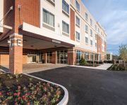
Residence Inn Boston Westford
WESTFORD REGENCY INN AND CONFERENCE
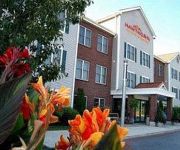
Hampton Inn - Suites Westford-Chelmsford
Courtyard Boston Littleton
HAWTHORN SUITES BY WYNDHAM CHE
Videos from this area
These are videos related to the place based on their proximity to this place.
Witch's Woods Stage Show, Fire Performers Practice 2012
The fire performers of Witch's Woods practice for the stage show. The stage show runs every hour at Witch's Woods with dance-off competitions and air-guitar contests. There will be multiple...
Dec 29, 2011 Park Report from Nashoba Valley Ski Area
We are building the new park on Sundance, starting tonight. Before he head over there are get some larger features installed, we thought we'd look back at the jib grove on Nashoba Slope this...
Westford, MA: Bechwith (Monty) Man-Powered Elevator @ The Outlook, Nashoba Valley Ski Area
This is the Beckwith (Monty) Man-Powered Elevator, serving The Outlook Restaurant, at Nashoba Valley Ski Area, Westford, Massachusetts. This was rushed, due to it being very busy, and recorded...
Westford, MA: Beckwith (Monty) Hydraulic Elevator @ 319 Littleton Road Office Building
This is the "Bouncy Beckwith" (Monty) Hydraulic Elevator, at 319 Littleton Road (Route 2A), Westford, Massachusetts. It's like and 3rd-Party Monty they install, flawed. It is a little shaky,...
Sundance City Video Recap
Thanks again to everyone who came out and had a blast with us! Results from contest Sundance City Rail Jam Podiums Men's Ski 1st Place __Dan Gardner 2ndPlace__Will Young 3rdPlace__Cooper.
270 Littleton Rd Ste 29 Westford MA
http://www.exite-listings.com/46563 GREAT Commercial Investment for Business proprieter, across from New Boch Dealership! ! ! Purchase or LEASE this great...
270 Littleton Rd Ste 3 Westford MA
http://www.exite-listings.com/65768 OLDE BOSTON SQUARE Professional office suite of twelve hundred square feet is for Sale or Lease Purchase this great sp...
Feb. 22, 2011 - Nashoba Valley Video Snow Report, new stair set, Happy Vacation Week!
We just added a new stair set with complimentary features to the Sundance Terrain Park. We currently have 15 features and are adding more tonight. It's been a busy week with February school...
February 17, 2014 Snow Report
It's February vacation & we're seeing lots of happy faces out here on this beautiful President's Day morning! We're 100% open today with 17 trails, 10 lifts, & 19 tubing park lanes with great...
Videos provided by Youtube are under the copyright of their owners.
Attractions and noteworthy things
Distances are based on the centre of the city/town and sightseeing location. This list contains brief abstracts about monuments, holiday activities, national parcs, museums, organisations and more from the area as well as interesting facts about the region itself. Where available, you'll find the corresponding homepage. Otherwise the related wikipedia article.
Littleton Common, Massachusetts
Littleton Common is a census-designated place (CDP) in the town of Littleton in Middlesex County, Massachusetts, United States. The population was 2,789 at the 2010 census.
Nashoba Valley Ski Area
Nashoba Valley Ski Area is a small ski area in Westford, Massachusetts. Operating continuously since its opening in 1964, it has 17 trails including a variety of terrain. There is also a terrain park with jumps, boxes and rails, as well as a small beginner terrain park with rails. The area also features a tubing park with 16 runs served by 4 Poma handle tows, this is on the same property, but has a separate entrance on Route 119 in Littleton, Massachusetts
Westford Academy
Westford Academy is the public high school (grades 9-12) for the town of Westford, Massachusetts. It was founded in 1792, and is one of the oldest public high schools in the United States. Westford Academy was originally established as a private school and was changed to a public school in 1928. Westford maintained the name "Academy" as it maintained the board of trustees to allow students to continue being eligible to receive scholarships established by Westford Academy trustees.
Nashoba Valley Technical High School
Nashoba Valley Technical High School is a public, four-year, career-focused high school located on Route 110 in Westford, MA. Following a $25 million renovation and expansion, its service area covers 14 communities including the seven District towns of Chelmsford, Groton, Littleton, Pepperell, Shirley, Townsend and Westford.


