Safety Score: 4,0 of 5.0 based on data from 9 authorites. Meaning please reconsider your need to travel to Switzerland.
Travel warnings are updated daily. Source: Travel Warning Switzerland. Last Update: 2024-04-27 08:23:39
Delve into Griesenberg
Griesenberg in Weinfelden District (Thurgau) is located in Switzerland about 85 mi (or 137 km) north-east of Bern, the country's capital town.
Current time in Griesenberg is now 07:27 PM (Saturday). The local timezone is named Europe / Zurich with an UTC offset of 2 hours. We know of 9 airports close to Griesenberg, of which 3 are larger airports. The closest airport in Switzerland is Zürich Airport in a distance of 23 mi (or 37 km), West. Besides the airports, there are other travel options available (check left side).
There are several Unesco world heritage sites nearby. The closest heritage site is Monastic Island of Reichenau in Germany at a distance of 9 mi (or 15 km). The closest in Switzerland is Abbey of St Gall in a distance of 20 mi (or 15 km), North. We encountered 8 points of interest near this location. If you need a hotel, we compiled a list of available hotels close to the map centre further down the page.
While being here, you might want to pay a visit to some of the following locations: Weinfelden, Munchwilen, Steckborn, Frauenfeld and Gaienhofen. To further explore this place, just scroll down and browse the available info.
Local weather forecast
Todays Local Weather Conditions & Forecast: 18°C / 64 °F
| Morning Temperature | 3°C / 37 °F |
| Evening Temperature | 17°C / 63 °F |
| Night Temperature | 8°C / 46 °F |
| Chance of rainfall | 0% |
| Air Humidity | 42% |
| Air Pressure | 1007 hPa |
| Wind Speed | Light breeze with 5 km/h (3 mph) from North-West |
| Cloud Conditions | Few clouds, covering 21% of sky |
| General Conditions | Few clouds |
Sunday, 28th of April 2024
18°C (64 °F)
10°C (51 °F)
Overcast clouds, gentle breeze.
Monday, 29th of April 2024
17°C (63 °F)
12°C (53 °F)
Broken clouds, gentle breeze.
Tuesday, 30th of April 2024
19°C (67 °F)
13°C (55 °F)
Light rain, light breeze, broken clouds.
Hotels and Places to Stay
Golf Panorama Wellnesshotel
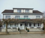
Linde
Videos from this area
These are videos related to the place based on their proximity to this place.
Bonanza Sylvester 2012, The NadaCowboys, Little Yellow Blanket, Catalan Style
Gefilmt von Walter Fischer.
The NadaCowboys, Mercury Blues, Video Debut am Sylvester 2012 13, im Bonanza
Gefilmt von Walter Fischer.
Videos provided by Youtube are under the copyright of their owners.
Attractions and noteworthy things
Distances are based on the centre of the city/town and sightseeing location. This list contains brief abstracts about monuments, holiday activities, national parcs, museums, organisations and more from the area as well as interesting facts about the region itself. Where available, you'll find the corresponding homepage. Otherwise the related wikipedia article.
Amlikon
Amlikon is a village and former municipality in the canton of Thurgau, Switzerland.
Bissegg
Bissegg is a village and former municipality in the canton of Thurgau, Switzerland.
Griesenberg
Griesenberg is a village and former municipality in the canton of Thurgau, Switzerland.
Strohwilen
Strohwilen is a village and former municipality in the canton of Thurgau, Switzerland. In 1995 the municipality was merged with the other, neighboring municipalities Amlikon, Bissegg and Griesenberg to form a new and larger municipality Amlikon-Bissegg.
Fimmelsberg
Fimmelsberg is a village in the canton of Thurgau, Switzerland. It was first recorded in year 1228 as Vilmarsperc. Fimmelsberg is located in the former municipality Griesenberg. In 1995 Griesenberg municipality merged with its neighbor to form a new and larger municipality Amlikon-Bissegg.
Holzhäusern
Holzhäusern is a village in the canton of Thurgau, Switzerland. It was first recorded in year 1397 as Holtzhusern. Holzhäusern is located in the former municipality Bissegg. In 1995 Bissegg municipality merged with its neighbor to form a new and larger municipality Amlikon-Bissegg.
Junkholz
Junkholz is a village in the canton of Thurgau, Switzerland. It was first recorded in year 1324 as Junkholtz. Junkholz is located in the former municipality Bissegg. In 1995 Bissegg municipality merged with its neighbor to form a new and larger municipality Amlikon-Bissegg.
Zezikon
Zezikon is a village and former municipality in the district of Frauenfeld in the canton of Thurgau, Switzerland. It was first recorded in 827 as Zezinchova. The municipality also contained the villages Battlehausen, Kaltenbrunnen, Maltbach and Wildern. It had 375 inhabitants in 1860, which decreased to 293 in 1900, 233 in 1950 and 220 in 1970. It then increased again, to 299 in 1990. In 1995 the municipality was incorporated into the larger, neighboring municipality Affeltrangen.


