Safety Score: 4,0 of 5.0 based on data from 9 authorites. Meaning please reconsider your need to travel to Switzerland.
Travel warnings are updated daily. Source: Travel Warning Switzerland. Last Update: 2024-05-17 08:07:57
Discover Mätteli
Mätteli in Leventina District (Canton Ticino) is a town in Switzerland about 58 mi (or 94 km) south-east of Bern, the country's capital city.
Current time in Mätteli is now 02:27 PM (Friday). The local timezone is named Europe / Zurich with an UTC offset of 2 hours. We know of 10 airports near Mätteli, of which 4 are larger airports. The closest airport in Switzerland is Buochs Airport in a distance of 28 mi (or 44 km), North. Besides the airports, there are other travel options available (check left side).
There are several Unesco world heritage sites nearby. The closest heritage site in Switzerland is Swiss Alps Jungfrau-Aletsch in a distance of 26 mi (or 42 km), West. We discovered 1 points of interest in the vicinity of this place. Looking for a place to stay? we compiled a list of available hotels close to the map centre further down the page.
When in this area, you might want to pay a visit to some of the following locations: Formazza, Altdorf, Flueelen, Bauen and Emmetten. To further explore this place, just scroll down and browse the available info.
Local weather forecast
Todays Local Weather Conditions & Forecast: 8°C / 47 °F
| Morning Temperature | 5°C / 41 °F |
| Evening Temperature | 9°C / 49 °F |
| Night Temperature | 7°C / 44 °F |
| Chance of rainfall | 11% |
| Air Humidity | 91% |
| Air Pressure | 1011 hPa |
| Wind Speed | Light breeze with 3 km/h (2 mph) from South-East |
| Cloud Conditions | Overcast clouds, covering 100% of sky |
| General Conditions | Rain and snow |
Saturday, 18th of May 2024
13°C (55 °F)
8°C (46 °F)
Light rain, gentle breeze, scattered clouds.
Sunday, 19th of May 2024
14°C (57 °F)
8°C (47 °F)
Light rain, gentle breeze, overcast clouds.
Monday, 20th of May 2024
15°C (58 °F)
10°C (50 °F)
Light rain, light breeze, overcast clouds.
Hotels and Places to Stay
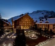
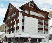
The Chedi Andermatt
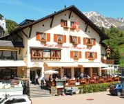
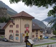
Drei Könige & Post
Forni
Pension Egg
Badus
Sust Lodge am Gotthard
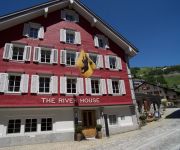
THE RIVER HOUSE BOUTIQUE HOTEL
Videos from this area
These are videos related to the place based on their proximity to this place.
Regio der Matterhorn Gotthard Bahn an der Furkareuss zwischen Andermatt und Realp
Regio der Matterhorn Gotthard Bahn an der Furkareuss zwischen Andermatt und Realp.
Ferrovie Svizzere - Goschenen, Andermatt, Biasca - 1/5
compilation fotografica in 65 scatti di una bella escursione con l'amico Andrea in Svizzera a Goschenen, Andermatt e Biasca -- sabato 24.07.2010 -- dedicata all'amico Gigi260890.
microdrones md4-1000 alps crossing teaser
A type md4-1000 microdrone managed something that no other quadrocopter has yet been able to achieve: equipped with an HD camera, and in adverse conditions, it set off from Switzerland and...
BikeCam.ch - Gotthardpass 2108m, Switzerland
Starting in 2006, www.BikeCam.ch built an impressive collection of over 100 bike videos of all Swiss passes. In addition, the passes were rated by BikeCam.ch as well as by visitors. Unfortunately,...
Andermatt a Passo San Gottardo 29 07 12
Gita in moto del 29-07-12 , salita da Andermatt al passo del San Gottardo.
Gotthard pass descend towards Andermatt on a quiet day
Gotthard pass descend towards Andermatt on a quiet day, filmed on board of a Triumph Tiger 1050 SE with a Drift HD camera on a Fat Gecko mini camera mount fitted on the windscreen of the Tiger....
Polizeieinsatz im Gotthardtunnel
Am Abend des 24.6.08 war der Gotthardtunnel wegen einem Pannenfahrzeug Gesperrt. Zu sehen ist die Ankunft der Polizei im Tunnel.
Videos provided by Youtube are under the copyright of their owners.
Attractions and noteworthy things
Distances are based on the centre of the city/town and sightseeing location. This list contains brief abstracts about monuments, holiday activities, national parcs, museums, organisations and more from the area as well as interesting facts about the region itself. Where available, you'll find the corresponding homepage. Otherwise the related wikipedia article.
Swiss Alps
The Swiss Alps are the portion of the Alps mountain range that lies within Switzerland. Because of their central position within the entire Alpine range, they are also known as the Central Alps. The highest summit in the Swiss Alps is Monte Rosa (4,634 metres) near the Swiss-Italian border. The highest mountain which lies entirely on Swiss territory is the Dom (4,545 metres). Other main summits can be found in the list of mountains in Switzerland.
Urserental
The Urserental (also Urseren) is the valley of the upper Reuss River in Uri, Switzerland, running southwest to northeast, from Realp to Hospental and Andermatt. Separated from the main valley of Uri, it connects to the Valais via the Furkapass, to the Grisons via the Oberalppass and to the Ticino via the Gotthard Pass. The valley was in possession of Disentis Abbey from 800. It was colonized by Walser settlers prior to the 12th century.
Lago di Lucendro
Lago di Lucendo is a reservoir at the St. Gotthard Pass in the municipality of Airolo of the canton of Ticino, Switzerland. The dam Lucendro with a height of 73 m was completed in 1947.
Lago della Sella
Lago della Sella is a reservoir near St. Gotthard Pass in the canton of Ticino, Switzerland. The gravity dam with a height of 36 m was completed in 1947. The dam was planned and built under control of the Swiss engineer Fritz Gigax.


