Safety Score: 4,0 of 5.0 based on data from 9 authorites. Meaning please reconsider your need to travel to Switzerland.
Travel warnings are updated daily. Source: Travel Warning Switzerland. Last Update: 2024-05-01 08:01:32
Discover Gumefens
Gumefens in Gruyère District (Canton of Fribourg) is a town in Switzerland about 26 mi (or 41 km) south-west of Bern, the country's capital city.
Current time in Gumefens is now 12:24 AM (Thursday). The local timezone is named Europe / Zurich with an UTC offset of 2 hours. We know of 13 airports near Gumefens, of which 5 are larger airports. The closest airport in Switzerland is Neuchatel Airport in a distance of 22 mi (or 35 km), North-West. Besides the airports, there are other travel options available (check left side).
There are several Unesco world heritage sites nearby. The closest heritage site in Switzerland is Lavaux, Vineyard Terraces in a distance of 20 mi (or 33 km), South-West. We discovered 6 points of interest in the vicinity of this place. Looking for a place to stay? we compiled a list of available hotels close to the map centre further down the page.
When in this area, you might want to pay a visit to some of the following locations: Broc, Matran, Marly, Fribourg and Tafers. To further explore this place, just scroll down and browse the available info.
Local weather forecast
Todays Local Weather Conditions & Forecast: 17°C / 63 °F
| Morning Temperature | 8°C / 46 °F |
| Evening Temperature | 16°C / 61 °F |
| Night Temperature | 8°C / 47 °F |
| Chance of rainfall | 0% |
| Air Humidity | 63% |
| Air Pressure | 1001 hPa |
| Wind Speed | Light breeze with 5 km/h (3 mph) from North-West |
| Cloud Conditions | Overcast clouds, covering 100% of sky |
| General Conditions | Light rain |
Thursday, 2nd of May 2024
6°C (43 °F)
5°C (40 °F)
Rain and snow, light breeze, overcast clouds.
Friday, 3rd of May 2024
7°C (44 °F)
3°C (38 °F)
Rain and snow, light breeze, overcast clouds.
Saturday, 4th of May 2024
10°C (50 °F)
7°C (44 °F)
Moderate rain, light breeze, overcast clouds.
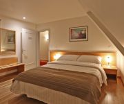
Hotels and Places to Stay
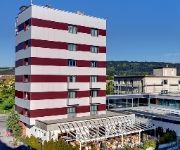
Best Western Rallye
ibis Bulle La Gruyère
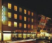
Des Alpes
Hine Adon Hotel Cheval Blanc Hotel
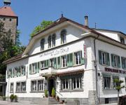
HOTEL DE LA TOUR
Videos from this area
These are videos related to the place based on their proximity to this place.
Cliff diving Rossens 2011
Les 9bar de la Team Cugy sont de retour pour une petite session jump à Rossens.
DJI Phantom Vision | Le Lac de la Gruyère et le golf de Pont-la-Ville
Premiers vols d'essais avec le drone DJI Phantom Vision Celui-ci est effectué à Pont-la-Ville (Suisse). Vue sur le golf de Pont-la-Ville, le Lac de la Gruyère et le village de Pont-la-Ville....
DJI Phantom Vision | L'Ile d'Ogoz sur le Lac de la Gruyère
Avec le drone DJI Pantom Vision, vue aérienne de l'Ile d'Ogoz sur le Lac de la Gruyère. 31 décembre 2013. http://www.lyoba.ch.
Sick basketball shots '07-'08!
Big FAT long shots! Missed shots edited out, made by us over 2007 and 2008 at "le terrain" RossensFR Switzerland, enjoy :) Watch in HighQ.
Premiers vols du Fenec
Planeur d'un mètre cinquante d'envergure entièrement perso, de la géométrie aux profils. La vido a été faite sur la pente d'Avry entre Bulle et Fribourg.
speed riding toto
une tit journée au diablerets lors d un trip en solo dans les "Vrai montagnes" et oui je suis un sudiste (06) ! 6 runs, pas trop de déchet! bon le dernier :départ a l aveuglette j ai du...
Longboarding in the Cloud
Rouler sur des cloud ride c'est comme être sur un nuage...c'est tout doux. http://cloudridewheels.com/ ****************************************************************************** SET...
Videos provided by Youtube are under the copyright of their owners.
Attractions and noteworthy things
Distances are based on the centre of the city/town and sightseeing location. This list contains brief abstracts about monuments, holiday activities, national parcs, museums, organisations and more from the area as well as interesting facts about the region itself. Where available, you'll find the corresponding homepage. Otherwise the related wikipedia article.
Lake of Gruyère
Lake of Gruyère (French: Lac de la Gruyère; German: Lac de la Gruyère or Greyerzersee) is a lake in the La Gruyère region of the Canton of Fribourg, Switzerland. The reservoir was formed between the cities of Bulle and Fribourg, by building the Rossens Dam on the Sarine river in 1948. The arch dam has a height of 83 m and a crest length of 320 m. The reservoir filled in about four months after completion. The dam is operated by the Groupe E SA.
Gibloux Radio Tower
Gibloux Radio Tower is built on the 1204 metre Gibloux mountain above Sorens, west of Fribourg, Switzerland. The concrete tower has a height of 118.7 m . The observation deck is at 37 m .
A12 motorway (Switzerland)
The A12 motorway, an Autobahn in western Switzerland, is a divided highway connecting the A9 to the A1. The A12 runs from the A9 in Vevey along the Freiburger Alps via Fribourg to the A1 in Bern and thus represents an important link to Western Switzerland. The A12 acts as the main route of the Canton of Freiburg and crosses the Canton area in the diagonal of Chatel-Saint-Denis (in the southwest) to the Flamatt in the northeast. Since 1981, the entire highway has been open to traffic.
Baillival Castle (Corbières)
Baillival Castle (Corbières) is a bailiff's castle in the municipality of Corbières of the Canton of Fribourg in Switzerland. It is a Swiss heritage site of national significance.
Baillival Castle (Vuippens)
Baillival Castle (Vuippens) is a bailiff's castle in the village of Vuippens in the municipality of Marsens of the Canton of Fribourg in Switzerland. It is a Swiss heritage site of national significance.


!['Ile d'Ogoz, Lac de la Gruyère [HD] Fribourg, Switzerland' preview picture of video 'Ile d'Ogoz, Lac de la Gruyère [HD] Fribourg, Switzerland'](https://img.youtube.com/vi/qQgLyIdzT7A/mqdefault.jpg)


