Safety Score: 4,0 of 5.0 based on data from 9 authorites. Meaning please reconsider your need to travel to Switzerland.
Travel warnings are updated daily. Source: Travel Warning Switzerland. Last Update: 2024-05-01 08:01:32
Explore Wältiberg
Wältiberg in Canton of Bern is a city in Switzerland about 16 mi (or 26 km) east of Bern, the country's capital.
Local time in Wältiberg is now 04:09 AM (Thursday). The local timezone is named Europe / Zurich with an UTC offset of 2 hours. We know of 12 airports in the vicinity of Wältiberg, of which 5 are larger airports. The closest airport in Switzerland is Bern Belp Airport in a distance of 15 mi (or 24 km), West. Besides the airports, there are other travel options available (check left side).
There are several Unesco world heritage sites nearby. The closest heritage site in Switzerland is Old City of Berne in a distance of 16 mi (or 26 km), West. We found 10 points of interest in the vicinity of this place. If you need a place to sleep, we compiled a list of available hotels close to the map centre further down the page.
Depending on your travel schedule, you might want to pay a visit to some of the following locations: Langnau, Schuepfheim, Taegertschi, Willisau and Wangen an der Aare. To further explore this place, just scroll down and browse the available info.
Local weather forecast
Todays Local Weather Conditions & Forecast: 5°C / 42 °F
| Morning Temperature | 8°C / 46 °F |
| Evening Temperature | 7°C / 44 °F |
| Night Temperature | 4°C / 39 °F |
| Chance of rainfall | 12% |
| Air Humidity | 96% |
| Air Pressure | 1008 hPa |
| Wind Speed | Gentle Breeze with 5 km/h (3 mph) from East |
| Cloud Conditions | Overcast clouds, covering 100% of sky |
| General Conditions | Moderate rain |
Friday, 3rd of May 2024
7°C (45 °F)
5°C (40 °F)
Moderate rain, light breeze, overcast clouds.
Saturday, 4th of May 2024
11°C (51 °F)
5°C (41 °F)
Moderate rain, light breeze, overcast clouds.
Sunday, 5th of May 2024
9°C (48 °F)
4°C (39 °F)
Light rain, light breeze, overcast clouds.
Hotels and Places to Stay
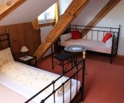
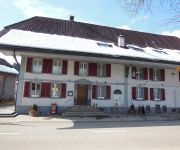
Bären Gasthof
Emmental
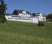
Hotel Moosegg
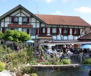
Hotel-Landgasthof Adler
Koi-Gartenteich
Videos from this area
These are videos related to the place based on their proximity to this place.
Radtour Herzroute (1) Zug - Thun / Route 99
Vier (von sieben) Etappen der Herzroute / Route du Cœur von Zug nach Thun. rund 250km und 4000 Höhenmeter. Hervorragend beschildert mit der Routennummer 99. Ein ständiges hügelauf- und...
Gotthelfmärit Sumiswald 2012: Schmieden für Anfänger ;-)
Meine ersten "Gehversuche" im Schmieden: Eine Spitze schmieden.
Gotthelfmärit Sumiswald 2012: Schmied an der Esse
Schmieden wie zu Gotthelfs Zeiten. Der Schmied treibt das Gebläse der Esse mit einem Fusspedal an.
Gotthelfmärit Sumiswald 2012: Schmieden
Schmieden wie zu Gotthelfs Zeiten. Hier wird ein Kunstgegenstand geschmiedet.
Jugendblasorchester VBJ 2009: Teil 1 (Flöten)
Das Jugendblasorchester VBJ 2009 probt vom 10. bis 17. April in Sumiswald. Das Video beinhaltet einige Impressionen vom Flötenregister. Weitere Informationen: www.vbj.ch.
Tour de Suisse 2008 Etappe 1, Spitzentrio (Durchfahrt in Langnau)
2. Durchfahrt des Spitzentrios in Langnau.
Videos provided by Youtube are under the copyright of their owners.
Attractions and noteworthy things
Distances are based on the centre of the city/town and sightseeing location. This list contains brief abstracts about monuments, holiday activities, national parcs, museums, organisations and more from the area as well as interesting facts about the region itself. Where available, you'll find the corresponding homepage. Otherwise the related wikipedia article.
Emmental
For the cheese made in the region, see Emmental (cheese). The Emmental is a region in west central Switzerland, forming part of the canton of Bern. It is a hilly landscape comprising the basins of the Emme and Ilfis rivers. The region is mostly devoted to farming, particularly dairy farming. Its notable cities are Burgdorf and Langnau.


