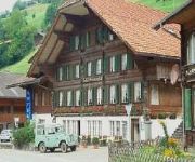
Safety Score: 4,0 of 5.0 based on data from 9 authorites. Meaning please reconsider your need to travel to Switzerland.
Travel warnings are updated daily. Source: Travel Warning Switzerland. Last Update: 2024-05-12 08:29:37
Discover Bad Weissenburg
Bad Weissenburg in Frutigen-Niedersimmental District (Canton of Bern) is a city in Switzerland about 19 mi (or 31 km) south of Bern, the country's capital city.
Local time in Bad Weissenburg is now 07:12 PM (Sunday). The local timezone is named Europe / Zurich with an UTC offset of 2 hours. We know of 13 airports in the vicinity of Bad Weissenburg, of which 5 are larger airports. The closest airport in Switzerland is Bern Belp Airport in a distance of 17 mi (or 28 km), North. Besides the airports, there are other travel options available (check left side).
There are several Unesco world heritage sites nearby. The closest heritage site in Switzerland is Old City of Berne in a distance of 19 mi (or 31 km), North. We discovered 3 points of interest in the vicinity of this place. Looking for a place to stay? we compiled a list of available hotels close to the map centre further down the page.
When in this area, you might want to pay a visit to some of the following locations: Thun, Taegertschi, Bern, Tafers and Ostermundigen. To further explore this place, just scroll down and browse the available info.
Local weather forecast
Todays Local Weather Conditions & Forecast: 22°C / 71 °F
| Morning Temperature | 13°C / 55 °F |
| Evening Temperature | 19°C / 66 °F |
| Night Temperature | 13°C / 56 °F |
| Chance of rainfall | 6% |
| Air Humidity | 52% |
| Air Pressure | 1015 hPa |
| Wind Speed | Light breeze with 4 km/h (2 mph) from North |
| Cloud Conditions | Broken clouds, covering 79% of sky |
| General Conditions | Moderate rain |
Monday, 13th of May 2024
21°C (70 °F)
11°C (52 °F)
Moderate rain, gentle breeze, overcast clouds.
Tuesday, 14th of May 2024
22°C (71 °F)
13°C (55 °F)
Moderate rain, light breeze, broken clouds.
Wednesday, 15th of May 2024
12°C (54 °F)
11°C (52 °F)
Moderate rain, light breeze, overcast clouds.
Hotels and Places to Stay
Simmental
Videos from this area
These are videos related to the place based on their proximity to this place.
Packrafting Simme River in Switzerland
Packrafting on Simme River, Switzerland from Boltigen to Därstetten. September 5, 2014 - 12.5 m2 / s.
Eine Hängebrücke zur Alp Leiternweide im Simmental
Die Alp Leiternweide war seit Jahrhunderten nur über abenteuerliche steile Leitern oder mit einem grossen Umweg erreichbar. Die Älpler suchten nach einer Lösung zur besseren Erschliessung...
Feldschiessen 2013, Blumenstein Schnellfeuer
Ein Freund war so nett und hat mich, -die in der orangen Jacke;-) - beim Schiessen des "Schnellfeuers" (6Schuss/ 1min) gefilmt. Wie ihr sehen könnt war das Wetter total beschissen, alles war...
Mentor 2 an der Mentschelen
Schöner Flug an der Stockhornkette. Start: Mentschelenalp, Landung: Wattenwil Glider: Mentor 2 Pilot: gp Datum: 26.05.2012.
I'm scared...
Recorded on Panorama-Aussichtsplattform in Stockhorn, Switzerland. My journey continues till the end of this June.
Alpin Rush Bungy Jump
The highest bungy jump in the Swiss Alps 134m/450ft! Trip starts from Interlaken Switzerland at 4.30 pm on monday,wednesday,friday and saturday with: http://www.alpinraft.ch/
Up in the air @ home
Freezing my ass off during my first testflight in February 2012 with the Sky Atis 3 glider at home in Simmental. Bimene Haar ds Füdle abgfrohre bi mim gmüetliche erschte Teschtflug mit em...
Zwitserland - 01 - Berner Oberland - Simmental - Weissenburgberg / 2007
Vakantie in Zwitserland, in twee verschillende streken. Eerst het Berner Oberland en dan door met de autotrein naar Wallis. Via de Links Rheinische Autobahn, komen we aan het eind van de middag...
Videos provided by Youtube are under the copyright of their owners.


