Safety Score: 4,0 of 5.0 based on data from 9 authorites. Meaning please reconsider your need to travel to Palestinian Territory.
Travel warnings are updated daily. Source: Travel Warning Palestinian Territory. Last Update: 2024-04-28 08:22:10
Discover Kalandia
Kalandia in West Bank is a city in Palestinian Territory about 3,183 mi (or 5,122 km) north-east of , the country's capital city.
Local time in Kalandia is now 05:40 AM (Monday). The local timezone is named Asia / Hebron with an UTC offset of 3 hours. We know of 11 airports in the vicinity of Kalandia, of which 5 are larger airports. The closest is airport we know is Ben Gurion International Airport in Israel in a distance of 22 mi (or 35 km). Besides the airports, there are other travel options available (check left side).
There are several Unesco world heritage sites nearby. The closest heritage site in Palestinian Territory is Birthplace of Jesus: Church of the Nativity and the Pilgrimage Route, Bethlehem in a distance of 11 mi (or 18 km), South. We discovered 8 points of interest in the vicinity of this place. Looking for a place to stay? we compiled a list of available hotels close to the map centre further down the page.
When in this area, you might want to pay a visit to some of the following locations: Jerusalem, Jericho, Karney Shomron, Ramla and Ash Shunah al Janubiyah. To further explore this place, just scroll down and browse the available info.
Local weather forecast
Todays Local Weather Conditions & Forecast: 24°C / 75 °F
| Morning Temperature | 13°C / 55 °F |
| Evening Temperature | 18°C / 65 °F |
| Night Temperature | 16°C / 60 °F |
| Chance of rainfall | 0% |
| Air Humidity | 44% |
| Air Pressure | 1011 hPa |
| Wind Speed | Moderate breeze with 12 km/h (8 mph) from South-East |
| Cloud Conditions | Scattered clouds, covering 34% of sky |
| General Conditions | Light rain |
Tuesday, 30th of April 2024
23°C (73 °F)
14°C (58 °F)
Light rain, fresh breeze, scattered clouds.
Wednesday, 1st of May 2024
23°C (73 °F)
15°C (59 °F)
Few clouds, moderate breeze.
Thursday, 2nd of May 2024
21°C (69 °F)
13°C (55 °F)
Scattered clouds, strong breeze.
Hotels and Places to Stay
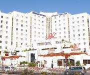
Crowne Plaza JERUSALEM
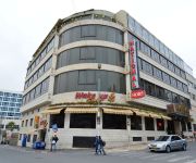
Millennium Palestine Ramallah ( formerly Moevenpick Ramallah )
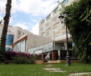
DAN JERUSALEM
American Colony Hotel
Addar
Grand Park Hotel Ramallah
JERUSALEM GATE HOTEL
National Hotel Jerusalem
Ambassador Jerusalem
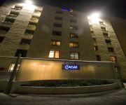
CAESAR PREMIER JERUSALEM
Videos from this area
These are videos related to the place based on their proximity to this place.
شاهدوقوع جندي إسرائيلي خلال مواجهات في بلدة الرام شمال القدس
شاهدوقوع جندي إسرائيلي خلال مواجهات في بلدة الرام شمال القدس.
Ramallah - Ein Musbah رام الله - عين مصباح
Ramallah - Ein Musbah رام الله - عين مصباح 9-3-2014 9 3 2014 6:10 PM FROM : AL-ERSAL STREET.
Funeral ceremony of Mohammed Karakra in Ramallah
Palestinians carry the body of Mohammed Karakra, who was shot dead by Israeli forces after stabbing two Israeli soldiers, during his funeral ceremony in the Sinjil village of Ramallah, West...
Holy Fire Parade ahead of Easter in Ramallah
Christians attend the "Holy Fire" parade on Holy Saturday, the day preceding the Easter, with the shows of bands at the streets of Ramallah in West Bank on April 11, 2015. Holy Fire is described...
لاول مرة شركة ادوبي في فلسطين
مدحت عيد خلال لقائه مع قناة الفلسطنية بعد حدث Adobe Meetup Ramallah Event 2014 http://www.youtube.com/watch?v=D3VQ0bWx3Ew.
هنا رام الله
Time Lapse From Palestine Trade Tower - Ramallah . https://www.facebook.com/mohammad.ar.photography By : Mohammad Abu Rabah Samsung Galaxy Note 3.
Palestinian killed after knife attack on Israeli soldiers
Relatives of Palestinian Mohamed Jassim Karakreh who killed by Israel after he stabbed knife two Israeli soldiers, mourn for him in Ramallah, West Bank on 12 April, 2015.
فيديو مؤثر من جنازة الشهيدين محمد عودة أبو ظاهر .. ونديم صيام نوارة .. شهداء يوم النكبة 15/5/2014
فيديو مؤثر من جنازة الشهيدين محمد عودة أبو ظاهر .. ونديم صيام نوارة مقدم من أذارة صفحة مدينة رام الله لأرواح...
جمال الياس - عرس الغالي - Jamal Elias - Oors Elghalli
Jamal Elias - Oors Elghalli جمال الياس - عرس الغالي ألحان و كلمات: الفنان جمال إلياس توزيع: كريم النوباني نيوساوند - New Sound.
Lesson 2.3 ( Ari-shiko Dachi ) Stance | Mohanna Najjar Shihan
يحتوي الفيديو على : - معنى وضع ( آريشيكو داتشي ) - شرح كيفية أداء الوقفة - توضيح شكل الوقفة كاملاً من جميع...
Videos provided by Youtube are under the copyright of their owners.
Attractions and noteworthy things
Distances are based on the centre of the city/town and sightseeing location. This list contains brief abstracts about monuments, holiday activities, national parcs, museums, organisations and more from the area as well as interesting facts about the region itself. Where available, you'll find the corresponding homepage. Otherwise the related wikipedia article.
Palestinian territories
The Palestinian territories or occupied Palestinian territories (OPT or oPt) comprise the West Bank and the Gaza Strip. In 1993, following the Oslo Accords, parts of the territories politically came under the jurisdiction of the Palestinian National Authority (Areas A and B). In 2007, the Hamas-ruled Gaza Strip violently split from the Palestinian Authority, governing the area of Gaza independently since.
Ramathaim-Zophim
Ramathaim-Zophim, also called Ramah and Ramatha in the Douay-Rheims, is a town that has been identified with the modern Neby Samwil, about 4 or 5 miles north-west of Jerusalem. But there is no certainty as to its precise locality. The home of Elkanah, Samuel’s father, the birthplace of Samuel and the seat of his authority, the town is frequently mentioned in the history of that prophet and of David . Here Samuel died and was buried .
Atarot Airport
Atarot Airport, (also Kalandia Airport, Qalandia Airport, and Jerusalem Airport) was a small airport located between Jerusalem and Ramallah. It was the first airport in the British Mandate for Palestine. It has been closed since the Second Intifada.
Mateh Binyamin Regional Council
Mateh Binyamin Regional Council is a regional council covering 42 Israeli settlements in the southern Samarian hills of the West Bank. The seat of the council is Psagot. The council is named for the ancient Israelite tribe of Benjamin, whose territory roughly corresponds to that of the council. In November 2007, Avi Roeh was elected head of the council. The previous head, Pinchas Wallerstein stepped down after being in the position for 28 years.
Mizpah in Benjamin
Mizpah ("watch-tower; the look-out") was a city of Benjamin. Tell en-Nasbeh is one of two sites often identified with Biblical Mizpah of Benjamin, and is located about 8 miles north of Jerusalem. The other suggested location is Neby Samwil, which is some 4 miles north-west of Jerusalem, and situated on the loftiest hill in the vicinity, some 600 feet above the plain of Gibeon.
Ofer Prison
Ofer Prison, formerly officially known as Incarceration Facility 385 (מתקן כליאה 385), is an Israeli incarceration facility (מתקן כליאה mitkan kli'a, abbr. Matak) located in the West Bank, between Ramallah/Beituniya and Giv'at Ze'ev. It is one of three facilities of the same nature, including the Megiddo and Ktzi'ot prisons. Ofer Prison is run by the Israel Prison Service and like the other two facilities, used to be operated by the Israel Defense Forces' Military Police Corps.
Faisal Al-Husseini International Stadium
Faisal Al-Husseini International Stadium is an association football stadium in Al-Ram, West Bank. It is the home stadium of the Palestine national football team. It is named for Faisal Husseini, a Palestinian politician who died in 2001. The stadium seats 12,500.
Highway 45 (Israel)
Highway 45 is the official designation of a 3.4 km stretch of highway forming a continuous connection between Route 443 from Lod via the Ben Shemen Interchange and Highway 50 (Begin Expressway) to central Jerusalem. At its junction with Highway 50, the officially numbered "45" takes a 90-degree turn eastwards running 0.8 km to the Atarot Industrial Zone. Originally, the road was supposed to originate in the Dan Region, passing slightly north of Beit Horon and Beit Ur al-Fauqa.


