Safety Score: 4,0 of 5.0 based on data from 9 authorites. Meaning please reconsider your need to travel to Palestinian Territory.
Travel warnings are updated daily. Source: Travel Warning Palestinian Territory. Last Update: 2024-04-25 08:17:04
Explore Ar Rām wa Ḑāḩiyat al Barīd
Ar Rām wa Ḑāḩiyat al Barīd in West Bank with it's 24,838 inhabitants is located in Palestinian Territory about 3,183 mi (or 5,122 km) north-east of , the country's capital.
Local time in Ar Rām wa Ḑāḩiyat al Barīd is now 09:12 PM (Thursday). The local timezone is named Asia / Hebron with an UTC offset of 3 hours. We know of 11 airports in the wider vicinity of Ar Rām wa Ḑāḩiyat al Barīd, of which 5 are larger airports. The closest is airport we know is Ben Gurion International Airport in Israel in a distance of 23 mi (or 37 km). Besides the airports, there are other travel options available (check left side).
There are several Unesco world heritage sites nearby. The closest heritage site in Palestinian Territory is Birthplace of Jesus: Church of the Nativity and the Pilgrimage Route, Bethlehem in a distance of 10 mi (or 16 km), South. We found 8 points of interest in the vicinity of this place. If you need a place to sleep, we compiled a list of available hotels close to the map centre further down the page.
Depending on your travel schedule, you might want to pay a visit to some of the following locations: Jerusalem, Jericho, Karney Shomron, Ramla and Ash Shunah al Janubiyah. To further explore this place, just scroll down and browse the available info.
Local weather forecast
Todays Local Weather Conditions & Forecast: 33°C / 92 °F
| Morning Temperature | 23°C / 74 °F |
| Evening Temperature | 34°C / 92 °F |
| Night Temperature | 25°C / 77 °F |
| Chance of rainfall | 0% |
| Air Humidity | 11% |
| Air Pressure | 1007 hPa |
| Wind Speed | Gentle Breeze with 8 km/h (5 mph) from North-West |
| Cloud Conditions | Overcast clouds, covering 95% of sky |
| General Conditions | Overcast clouds |
Friday, 26th of April 2024
25°C (77 °F)
19°C (66 °F)
Overcast clouds, moderate breeze.
Saturday, 27th of April 2024
22°C (72 °F)
19°C (65 °F)
Overcast clouds, gentle breeze.
Sunday, 28th of April 2024
22°C (71 °F)
19°C (65 °F)
Light rain, gentle breeze, overcast clouds.
Hotels and Places to Stay
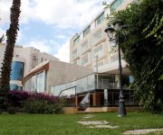
Millennium Palestine Ramallah ( formerly Moevenpick Ramallah )
DAN JERUSALEM
Grand Park Hotel Ramallah
American Colony Hotel
Addar
Ambassador Jerusalem
Commodore Hotel
National Hotel Jerusalem
House 57
Aladdin Hotel
Videos from this area
These are videos related to the place based on their proximity to this place.
13.12.2013 Jerusalem, Pisgat Ze'ev, Snow
Israel, Jerusalem, Pisgat Ze'ev, Snow Израиль, снег в Иерусалиме צלם: ודים מיכיילוב Photohrapher: Vadim Mikhailov 0547-400212 072-2126424 www.vadimm.com.
Israeli Desecration of Christian Cemetery of Beit Jala
A Christian Cemetery in village of Beit Jala desecrated by Jewish Settlers after Israel confiscates land and builts settlement of Gilo.
Jerusalem LRT returns to service after the arab riots
The Palestinians destroyed 2 tram stations, tried to saw the tracks and the catenary poles. For now the service in this area is conducted without signaling and communications.
איפה הספרייה?
לפני חצי שנה נפתחה בפסגת זאב ספרייה חדשה, אלא שדבר אחד שכחו לשים שם, שלט. אורי ארליך הלך לאיבוד במדור הגיאוגרפ...
Путешествие по Израилю. Израильский цикл. 480p.
Фильм-путешествие абхазского журналиста Мананы Кокоскир по Израилю. Библейская история Израиля. Сегодняшн...
شاهدوقوع جندي إسرائيلي خلال مواجهات في بلدة الرام شمال القدس
شاهدوقوع جندي إسرائيلي خلال مواجهات في بلدة الرام شمال القدس.
Menachem Shapiro's hanachat tefillin
Menachem Shapiro at the Kotel wearing tefillin for the first time.
وصول جثمان الشهيد محمد حسين ابو خضير الى شعفاط
لحظة وصول جثمان شهيد الفجر "محمد ابو خضير" رحمه الله, الذي حرق حيا على يد مستوطنين بعد طعنه عدة طعنات و بتر...
الجزيرة توك - الراصد - حول دوار المنارة برام الله !
الراصد هو فكرة قيد التطوير والتعديل حيث يعمل على رصد أمورا لها علاقة بحدث يحدث أو قضية أمرها مستمر بحيث تضع...
Videos provided by Youtube are under the copyright of their owners.
Attractions and noteworthy things
Distances are based on the centre of the city/town and sightseeing location. This list contains brief abstracts about monuments, holiday activities, national parcs, museums, organisations and more from the area as well as interesting facts about the region itself. Where available, you'll find the corresponding homepage. Otherwise the related wikipedia article.
Ramathaim-Zophim
Ramathaim-Zophim, also called Ramah and Ramatha in the Douay-Rheims, is a town that has been identified with the modern Neby Samwil, about 4 or 5 miles north-west of Jerusalem. But there is no certainty as to its precise locality. The home of Elkanah, Samuel’s father, the birthplace of Samuel and the seat of his authority, the town is frequently mentioned in the history of that prophet and of David . Here Samuel died and was buried .
Neve Yaakov
Neve Yaakov also Neve Ya'aqov, (lit. Jacob's Oasis), is a neighborhood located in northern East Jerusalem, north of Pisgat Ze'ev and south of al-Ram. Established in 1924 during the period of the British Mandate, it was abandoned during the 1948 Arab-Israeli War. The area was captured by Israel in the Six Day War and a new neighborhood was built there, at which time international opposition to its legitimacy began.
Atarot Airport
Atarot Airport, (also Kalandia Airport, Qalandia Airport, and Jerusalem Airport) was a small airport located between Jerusalem and Ramallah. It was the first airport in the British Mandate for Palestine. It has been closed since the Second Intifada.
Adasa
Adasa is a city referred to the Maccabees and the site of the Syrian-Seleucid General Nicanor's death and Judas Maccabeus's post in the battle of Adasa. It is said to be just opposite Beth-Horon, at a 3½ mile distance.
Yeshivas Bais Yisroel
There are two yeshivas with the name Bais Yisroel. This article deals with the Bais Yisroel yeshiva located in the Neve Yaakov neighborhood of Jerusalem, Israel. ‹ The template below is being considered for possible deletion. See templates for discussion to help reach a consensus. › Bais Yisroel Hebrew: בית ישראל Address 9 Zevin St.
Sultan Ibrahim Ibn Adham Mosque
The Sultan Ibrahim Ibn Adham Mosque is the largest mosque in the Palestinian town of Beit Hanina, located northeast of Jerusalem. It is named after a Muslim who lived in the town and worked as collector of olive products. An engraving in a stone in front of the mosque reads, "this mosque was built by Suwaid Abul Hamayel in the year 336 after Hijrah". The area of the mosque was expanded in 1938 by the residents of Beit Hanina. In 1993, a boys primary school was built alongside the mosque.
Faisal Al-Husseini International Stadium
Faisal Al-Husseini International Stadium is an association football stadium in Al-Ram, West Bank. It is the home stadium of the Palestine national football team. It is named for Faisal Husseini, a Palestinian politician who died in 2001. The stadium seats 12,500.
Jerusalem Road 20
Jerusalem Road 20, is the designation of a combination of existing roads and new construction creating a continuous route between Jerusalem's Begin Highway (Highway 50) and Pisgat Ze'ev via Beit Hanina. The final cost expected to be NIS 150 million and be completed by April 2013.


