Safety Score: 4,0 of 5.0 based on data from 9 authorites. Meaning please reconsider your need to travel to Palestinian Territory.
Travel warnings are updated daily. Source: Travel Warning Palestinian Territory. Last Update: 2024-04-27 08:23:39
Delve into Surdā
Surdā in West Bank with it's 1,017 habitants is located in Palestinian Territory about 3,185 mi (or 5,126 km) north-east of , the country's capital town.
Current time in Surdā is now 12:35 PM (Saturday). The local timezone is named Asia / Hebron with an UTC offset of 3 hours. We know of 11 airports close to Surdā, of which 5 are larger airports. The closest is airport we know is Ben Gurion International Airport in Israel in a distance of 19 mi (or 31 km). Besides the airports, there are other travel options available (check left side).
There are several Unesco world heritage sites nearby. The closest heritage site in Palestinian Territory is Birthplace of Jesus: Church of the Nativity and the Pilgrimage Route, Bethlehem in a distance of 16 mi (or 26 km), South. We encountered 8 points of interest near this location. If you need a hotel, we compiled a list of available hotels close to the map centre further down the page.
While being here, you might want to pay a visit to some of the following locations: Jerusalem, Jericho, Karney Shomron, Ramla and Ash Shunah al Janubiyah. To further explore this place, just scroll down and browse the available info.
Local weather forecast
Todays Local Weather Conditions & Forecast: 18°C / 64 °F
| Morning Temperature | 14°C / 57 °F |
| Evening Temperature | 18°C / 65 °F |
| Night Temperature | 14°C / 57 °F |
| Chance of rainfall | 0% |
| Air Humidity | 60% |
| Air Pressure | 1012 hPa |
| Wind Speed | Moderate breeze with 10 km/h (6 mph) from South-East |
| Cloud Conditions | Overcast clouds, covering 100% of sky |
| General Conditions | Overcast clouds |
Sunday, 28th of April 2024
21°C (70 °F)
14°C (58 °F)
Light rain, gentle breeze, broken clouds.
Monday, 29th of April 2024
21°C (69 °F)
15°C (59 °F)
Light rain, moderate breeze, overcast clouds.
Tuesday, 30th of April 2024
22°C (71 °F)
15°C (59 °F)
Light rain, moderate breeze, few clouds.
Hotels and Places to Stay
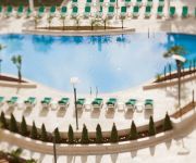
Millennium Palestine Ramallah ( formerly Moevenpick Ramallah )
Grand Park Hotel Ramallah
Aladdin Hotel
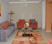
Garden Suite
Videos from this area
These are videos related to the place based on their proximity to this place.
BetElTours.com: David Weiss and kids Tova and Mordechai In Bet El and Binyamin
David Weiss and kids Tova and Mordechai leave Kew Garden Hills way behind on this excursion to Eretz Binyamin including Givat Shaul, The Psagot Winery, The valley between Michmas and Geva,...
אוקראינה מתחזקת? מלחמה ברקע והאוקראינים מתעניינים בתפילין.
צוות צילום מערוץ אינטר אוקראינה הגיע לארץ לצילומים. היום צולמה תוכנית אודות התפילין ותשמישי הקדושה בתפילין...
Visite d'écoles à Ramallah, Bir Zeit et Jifna
Une visite, en février 2007, de deux écoles chrétiennes à Ramallah. Les sœurs de Saint-Joseph partagent leurs préoccupations éducatives et la situation locale ; un professeur évoque...
תפילין בית אל
מפעל תפילין בית אל, הוקם בשנת תשל"ט, על ידי הרב ישי באב"ד. המפעל קיבל את ברכתם של גדולי ישראל שבאו לבקר במפעל...
Directions Prank In Ramallah كاميرة خفية في رام الله
مقلب في رام الله مزحة في رام الله subscribe to my channel : https://www.youtube.com/channel/UC1lV... follow me on: instagram: http://instagram.com/qandild_d fasebook:...
Lunar eclipse from Ramallah on 10/12/2011 , خسوف القمر في سماء رام الله
خسوف القمر في سماء رام الله ، ليلة السبت 10\12\2011.
Sukkot with Samaritan, Mount Gerizim (Nablus)
http://nakaryak.livejournal.com/25639.html Праздничная молитва самаритян, первый день Суккота, 22/10/2010. Гора Гризим (около Шхем...
Videos provided by Youtube are under the copyright of their owners.
Attractions and noteworthy things
Distances are based on the centre of the city/town and sightseeing location. This list contains brief abstracts about monuments, holiday activities, national parcs, museums, organisations and more from the area as well as interesting facts about the region itself. Where available, you'll find the corresponding homepage. Otherwise the related wikipedia article.
Mukataa
See muqata'ah for the Ottoman instrument for financing state expenses. 50x40pxThis article needs additional citations for verification. Please help improve this article by adding citations to reliable sources. Unsourced material may be challenged and removed. Mukataa is the name used to refer to the offices and administrative centers of the Palestinian National Authority.
Birzeit University
Birzeit University (BZU) is a public university located in Birzeit, near Ramallah. BZU's official language is English. Most courses are taught in English, with some in Arabic.
Ramallah Friends Schools
The Ramallah Friends Schools are two elite Private Schools founded by Quakers in the city of Ramallah, in the West Bank. The Friends Girls' School was inaugurated in 1869; the construction of the Friends Boy's School began in 1901 and opened in 1918. The Schools were run by American Quakers. The schools are now co-educational and divided into Senior and Junior sections; a Meeting House was built in 1910.
Beit El yeshiva
For the ancient Sephardic and Yemenite yeshiva in the Old City of Jerusalem well known for the study of Kabbalah, see Beit El Synagogue The Beit El Yeshiva is a Religious Zionist yeshiva situated in the Israeli settlement of Beit El, a community in the Binyamin region near Ramallah in the West Bank.
Al-Quds Open University
Al-Quds Open University is an administratively, academically and financially independent public university. According to the university's website, it was established in Amman, Jordan, by a decree issued by the Palestinian Liberation Organization (PLO) and started operating in the Palestinian territories in 1991. http://www. qou. edu/homePage/english/index. jsp?pageId=4 QOU is the only open distance education institute in the Palestinian territories.
Ramallah and al-Bireh Governorate
The Ramallah and al-Bireh Governorate is one of 16 Governorates of the West Bank and Gaza Strip. It covers a large part of the central West Bank, on the northern border of the Jerusalem Governorate. Its district capital or muhfaza (seat) is the city of al-Bireh. According to the Palestinian Central Bureau of Statistics (PCBS), the district had a population of 279,730 in 2007. Its governor is Dr. Laila Ghannam, the first Female Governor.
American School of Palestine
The American School of Palestine is an k-12 bilingual school in al-Bireh and Ramallah, West Bank, Palestine.
Jamal Abdel Nasser Mosque
Jamal Abdel Nasser Mosque is the largest mosque in Ramallah, in the central West Bank. Located in the Downtown district of the city, the mosque is named after the late Egyptian president and Arab leader Gamal Abdel Nasser. On March 14, 2002, the Israeli Army (IDF) took over the mosque and used its minaret for sniping, killing four Palestinians.


