Safety Score: 3,0 of 5.0 based on data from 9 authorites. Meaning we advice caution when travelling to New Zealand.
Travel warnings are updated daily. Source: Travel Warning New Zealand. Last Update: 2024-05-06 08:04:52
Delve into Glenside
The district Glenside of Johnsonville in Wellington City (Wellington) is a subburb in New Zealand a little north of Wellington, the country's capital town.
If you need a hotel, we compiled a list of available hotels close to the map centre further down the page.
While being here, you might want to pay a visit to some of the following locations: Wellington, Blenheim, Palmerston North, Nelson and Richmond. To further explore this place, just scroll down and browse the available info.
Local weather forecast
Todays Local Weather Conditions & Forecast: 12°C / 53 °F
| Morning Temperature | 9°C / 48 °F |
| Evening Temperature | 8°C / 46 °F |
| Night Temperature | 6°C / 43 °F |
| Chance of rainfall | 0% |
| Air Humidity | 52% |
| Air Pressure | 1027 hPa |
| Wind Speed | Moderate breeze with 13 km/h (8 mph) from North |
| Cloud Conditions | Scattered clouds, covering 29% of sky |
| General Conditions | Scattered clouds |
Wednesday, 8th of May 2024
13°C (55 °F)
10°C (50 °F)
Light rain, moderate breeze, few clouds.
Thursday, 9th of May 2024
10°C (49 °F)
8°C (46 °F)
Light rain, strong breeze, overcast clouds.
Friday, 10th of May 2024
11°C (52 °F)
10°C (50 °F)
Light rain, fresh breeze, few clouds.
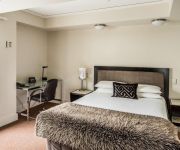
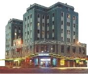
Hotels and Places to Stay
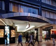
CITYLIFE WELLINGTON
Sofitel Wellington
Bolton Hotel
Quest on Thorndon
Acorns Wellington Apartment
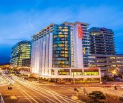
RYDGES WELLINGTON
Hotel Waterloo & Backpackers (formerly Downtown Backpackers)
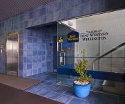
BEST WESTERN WELLINGTON
Fernhill Motor Lodge
Kenlea Cottage
Videos from this area
These are videos related to the place based on their proximity to this place.
The Spice Island Kris's photos around St. George, Grenada (spiceisle/images of st georges town)
Preview of Kris's blog at TravelPod. Read the full blog here: http://www.travelpod.com/travel-blog-entries/kris/nostophobia/1168008000/tpod.html This blog preview was made by TravelPod using...
Segway off-road adventure around Woodridge
Segway off-road adventure Wandering around Woodridge, Wellington, NZ Time-lapse movie, picture taken with a GoPro Hero Wide camera mounted on a Segway.
Great Souljahs team try
U11's Onepoto Souljahs vs Tawa North City Hiab Hire 12th June 2010 A great team try scored by Anthony. Some strong running by Andrew from Tawa and a great break by Cullen. Commentary...
Ja 1271 steam loco Takapu Road 1 Dec 2013
Steam Incorporated's Ja 1271 steam loco hauling a special train from Wellington to Paekakariki to commemorate 150 years of railways in New Zealand. The train is seen passing through Takapu...
New Zealand Timelapse
I do not own the original content or the enchanting musical entertainment performed by David Bowie. I also do not own New Zealand. Or anything else new for that matter. This video was custom...
LauraLivesOn in Tawa.
Laura from http://www.youtube.com/LauraLivesOn took part in a channel-takeover challenge with me. This week kiwi YouTubers were invited to pair up and share videos on each other's channel....
Ngauranga Gorge, Wellington, New Zealand.
State Highway 1 runs through the gorge, a vital link between Wellington City and the Kapiti Coast and the main route north out of Wellington. It is 2 kilometres long and has a grade of approximatel...
Videos provided by Youtube are under the copyright of their owners.
Attractions and noteworthy things
Distances are based on the centre of the city/town and sightseeing location. This list contains brief abstracts about monuments, holiday activities, national parcs, museums, organisations and more from the area as well as interesting facts about the region itself. Where available, you'll find the corresponding homepage. Otherwise the related wikipedia article.
Tawa, New Zealand
Tawa is the northernmost suburb of Wellington, located between Churton Park and Porirua in the North Island of New Zealand. It takes its name from the broadleaf tree, which was once prolific throughout the area, although its most famous tree is the Bucket Tree, a group of large macrocarpa with the topiary of an upside-down bucket. Tawa is also known for its large number of churches, representing a wide range of Christian denominations. The suburb of Tawa occupies the Tawa Basin.
Johnsonville, New Zealand
Johnsonville is a large suburb in northern Wellington, New Zealand. It is seven kilometres north of the city centre, at the top of the Ngauranga Gorge, on the main route to Porirua. The population of "J'ville" (as it is commonly known) was about 6,500 at the 2001 census.
Onslow College
Onslow College is a decile‑10 co-educational state secondary school located in Johnsonville, a suburb of Wellington, New Zealand. The school opened in 1956 to serve the city's rapidly growing northern suburbs. The current principal is Mr Peter Leggat.
Khandallah
Khandallah is a suburb of Wellington, the capital city of New Zealand. It is located four kilometres northeast of the city centre, on hills overlooking Wellington Harbour. The suburb's name, which means "Resting place of God", comes from a homestead built in the area in 1884 by Captain James Andrew, who had recently returned from duty in India. For this reason the suburb and those surrounding it have many place names connected with the Indian subcontinent.
Mount Kaukau
Mount Kaukau, also known as Tarikaka, is in Wellington, New Zealand on the western side of Wellington harbour near Johnsonville and Khandallah. The summit is 445 metres above sea level and is the most visible high point in the Wellington landscape further accentuated by Wellington's main television transmitter tower the Kordia TV transmitter mast, which stands a little over 100m tall. There is also a compass pedestal placed at the top.
Newlands, New Zealand
Newlands is one of the northern suburbs of Wellington, New Zealand. It lies approximately 8km north of the city centre and to the east of its nearest neighbour Johnsonville. Newlands is located in a valley and covers two ridgelines, the side of one of which overlooks Wellington Harbour and up to the Hutt Valley. This leaves many of the houses exposed to either the cold southerly or the predominant north-westerly winds, or both, that Wellington is known for.
Tawa College
Tawa College is a coeducational school (year 9 - year 13) situated in Tawa, New Zealand, and its principal is Murray Lucas. The Tawa College magazine is called Tawahi (pronounced tawa - he). There are currently around 80 teaching staff and 20 support staff. Tawa College was officially opened in July 1961 and has always maintained a close involvement with the life of the local community, particularly through music and sport.
Churton Park
Churton Park is a suburb located 1.5 km north of Johnsonville in the Northern Suburbs district of Wellington, the capital city of New Zealand. It was established in the 1970s, and as of 2009 has a population of 6,260 residents. The suburb includes over 1500 households, 'Churton Park' (a recreational sports field), two primary schools and a kindergarten. A local community center with shops is planned and construction began in February 2011.
Ngauranga Gorge
The Ngauranga Gorge is in the Wellington Region of New Zealand. State Highway 1 runs through the gorge, a vital link between Wellington City and the Kapiti Coast and the main route north out of Wellington. It is 2 kilometres long and has a grade of approximately 8%. 65,000 vehicles a day travel through it, and it connects the Wellington Urban Motorway with the Johnsonville–Porirua Motorway. The road up the gorge was upgraded in 1940 as the Centennial Highway.
Ngauranga
Ngauranga is a suburb of New Zealand's capital city, Wellington, in the lower North Island. Situated on the western bank of Wellington Harbour, it lies to the north of the centre of the city. It is a Maori name meaning "the landing place", and the original spelling was "Nga-Uranga". The Ngauranga Railway Station was known as "Ngahauranga" when it opened in 1874. It is lightly populated, and for statistical purposes is divided into Ngauranga East and Ngauranga West by Statistics New Zealand.
Ngauranga Railway Station
Ngauranga railway station is a single island platform railway station in the mainly industrial and commercial suburb of Ngauranga on the Wairarapa Line in Wellington, New Zealand. It is served by the trains of the Melling Line and Hutt Valley Line of the Wellington suburban rail network. Wairarapa Connection trains pass this station but do not stop. All trains are run by KiwiRail under the Tranz Metro brand as part of the Metlink network.
Takapu Road Railway Station
Takapu Road Railway Station is on the suburban rail network of Wellington, New Zealand, on the North Island Main Trunk Railway (NIMT). It is double tracked with side platforms. It serves the suburbs of Redwood and Grenada North.
Redwood Railway Station
Redwood Railway Station on the suburban rail network of Wellington, New Zealand is on the North Island Main Trunk Railway (NIMT). It is double tracked with staggered side platforms; the up platform is on the north side of the Tawa Street level crossing, the down platform on the south.
Tawa Railway Station
Tawa Railway Station, originally called Tawa Flat, is on the North Island Main Trunk Railway (NIMT) and is part of the suburban rail network of Wellington, New Zealand. It is double tracked with an island platform, and is 13.75 kilometres from Wellington Railway Station, the southern terminus of the NIMT.
Simla Crescent Railway Station
Simla Crescent railway station is one of eight stations on the Johnsonville Branch, a branch railway north of Wellington in New Zealand’s North Island, and is one of two stations that were added to the line when it was upgraded prior to being reopened as the Johnsonville Branch. It serves the suburbs of Ngaio and Te Kainga.
Box Hill Railway Station, Wellington
Box Hill railway station is one of eight stations on the Johnsonville Branch, a commuter branch railway north of Wellington in New Zealand's North Island. It serves the suburbs of Khandallah and Te Kainga. It is the only station on the line to be set below street level, and one of four on the line which is on a curve.
Khandallah Railway Station
Khandallah railway station is one of eight stations on the Johnsonville Line, a commuter branch railway north of Wellington in New Zealand’s North Island. The station was erected and operated by the Wellington and Manawatu Railway Company (WMR) on their line from Wellington to Longburn. From the acquisition of the WMR by the New Zealand Railways Department in 1908 until the opening of the Tawa Flat deviation in 1937, the station was on the North Island Main Trunk Railway.
Raroa Railway Station
|} Raroa Railway Station is one of eight stations on the Johnsonville Branch, a commuter branch railway north of Wellington in New Zealand's North Island. It serves the suburbs of Raroa and Broadmeadows, and is one of four stations on the line to be located on a curve. Electric multiple unit trains are operated by Tranz Metro under the Metlink brand through this station in both directions to Johnsonville (to the north) and Wellington (to the south).
Johnsonville Railway Station
Johnsonville railway station is the terminus of the Johnsonville Line, one of eight stations on the commuter branch railway north of Wellington in New Zealand’s North Island. It serves the suburb of Johnsonville, and as a bus interchange attracts traffic from other suburbs to the north and east. The station is beside Johnsonville Mall, a major regional shopping centre, which incorporates a Countdown supermarket.
Beach Railway Station, New Zealand
Beach railway station was a station on the privately owned but government operated Hutt Park Railway in Petone, a suburb of the city of Lower Hutt in the Wellington region of New Zealand’s North Island. It was located at the junction of the Wairarapa Line and the Hutt Park Railway, a short distance south of the government-owned Petone Railway Station.
Ngauranga Interchange
The Ngauranga Interchange is a major interchange in the suburb of Ngauranga, in Wellington City, New Zealand. The Ngauranga interchange connects State Highways 1 and 2 with each other, and also allows traffic to connect to Hutt Road, for access to the interisland ferry terminals. The majority of traffic in and out of Wellington City use this interchange. It is the southern terminus of State Highway 2.
Redwood, Wellington
Redwood is a part of Tawa, a suburb of Wellington, New Zealand. It is on the North Island Main Trunk Railway and is served by two stations, Redwood Railway Station and Takapu Road Railway Station. The Redwood subdivision was built on land acquired from the Catholic Church, on the condition that it be named in honour of the late Archbishop Francis Redwood.
Daisy Hill Farm House
Daisy Hill Farm House is a historic building in Johnsonville, Wellington, New Zealand. The house was built in about 1860 for Robert Bould, a pioneer farmer. He came to New Zealand with the New Zealand Company in the early 1840s and bought land, for a sheep farm, in Johnsonville in 1853. Built in a simplified Georgian style it is one of the few remaining houses of this type in Wellington.
Churton Park School
Churton Park School is a primary school in Wellington, the capital city of New Zealand. It will be one of two primary schools in Churton Park when Amesbury Drive School opens in 2012.
Glenside, New Zealand
Glenside is a suburb of Wellington, New Zealand. It is bounded by Tawa to the North, Churton Park to the West/South and Grenada Village across the motorway to the East. Glenside was first settled in 1840. Ngāti Toa are the mana whenua. The area was known as "The Halfway" from 1840 until 1928. {{#invoke:Coordinates|coord}}{{#coordinates:-41.199355|174.81919||||||| |primary |name= }}


