Safety Score: 3,3 of 5.0 based on data from 9 authorites. Meaning please reconsider your need to travel to Netherlands.
Travel warnings are updated daily. Source: Travel Warning Netherlands. Last Update: 2024-05-15 08:00:47
Discover Blankenburg
The district Blankenburg of Rozenburg in Gemeente Rotterdam (South Holland) is a district in Netherlands about 43 mi south-west of Amsterdam, the country's capital city.
Looking for a place to stay? we compiled a list of available hotels close to the map centre further down the page.
When in this area, you might want to pay a visit to some of the following locations: The Hague, Haarlem, Heemskerk, Sint-Niklaas and Middelburg. To further explore this place, just scroll down and browse the available info.
Local weather forecast
Todays Local Weather Conditions & Forecast: 17°C / 63 °F
| Morning Temperature | 15°C / 59 °F |
| Evening Temperature | 15°C / 58 °F |
| Night Temperature | 14°C / 57 °F |
| Chance of rainfall | 3% |
| Air Humidity | 85% |
| Air Pressure | 1006 hPa |
| Wind Speed | Gentle Breeze with 6 km/h (4 mph) from East |
| Cloud Conditions | Overcast clouds, covering 100% of sky |
| General Conditions | Light rain |
Thursday, 16th of May 2024
14°C (58 °F)
12°C (53 °F)
Moderate rain, gentle breeze, overcast clouds.
Friday, 17th of May 2024
17°C (63 °F)
13°C (56 °F)
Light rain, gentle breeze, broken clouds.
Saturday, 18th of May 2024
17°C (63 °F)
13°C (56 °F)
Light rain, light breeze, overcast clouds.
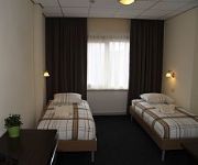
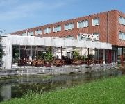
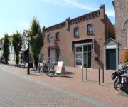
Hotels and Places to Stay
Carlton Oasis Hotel
Rozenburg
Bastion Hotel Brielle-Europoort
ibis Rotterdam Vlaardingen
Atlas
Apartments Brielle
Fletcher Hotel Restaurant de Zalm
Atlas Village
Videos from this area
These are videos related to the place based on their proximity to this place.
MSTS Maassluis West naar Schiedam Centrum met SGM Sprinter
Van Maassluis West naar Schiedam Centrum met SGMm 2138. Tijdens het rijden zorgt het Reizigers Informatie Systeem voor de omroepberichten. Route downloaden kan op: ...
Dag van de Zeesleepvaart 2010 Maassluis (part 2)
Several companies showed their tugs and gave a nice show on the Nieuwe Waterweg at Maassluis, The Netherlands.
Maassluis dag v-d Zeesleepvaart 2010.mp4
Several companies showed their tugs at Maassluis, The Netherlands. Svitzer next year too?
Furieade 2014 Maassluis, Netherlands - 2014-10-04
Saterday oktober 4, 2014 - Furieade 2014 in Maassluis, Netherlands. Some of the ships: Blankenburg (pont) Elbe Oasis of the Seas MS Rigel (Zeekadetkorps) Anna Bugsier 5 SS Furie Maassluis...
Veerpont Maassluis - Rozenburg - 2008-11-02
Veerpont Maassluis - Rozenburg. Rijkswaterstaat heeft wat te vieren / uit te geven, vandaag was het gratis. Wat zijn die automoblisten netjes tegenwoordig, m'n pa maakte er vroeger een sport...
Compilatie gebouwbrand Albert Hein Rozenburg
De CE59-1, CE53-1 en de HW65-1 werden opgeroepen voor een gebouwbrand aan de molenweg, dit betrof de Albert Hein. Toen de Merseyweg ter plaatse kwam werd er middelbrand gemaakt ...
*Speelt met de sirene* Ambulance naar aanrijding Rozenburg Zh
En fietser was tegen een openstaand auto-portier gereden en raakte hierdoor gewond. Zij is met de ambulance naar een ziekenhuis vervoerd.
OCEAN TUG HOLLAND.wmv
A short 2 hour trip on board of the Legendary Ocean Tug HOLLAND, This floating 59 old monument is still in good shape thanks to many Volunteers and Donations. Date of the trip: June the 5th...
Videos provided by Youtube are under the copyright of their owners.
Attractions and noteworthy things
Distances are based on the centre of the city/town and sightseeing location. This list contains brief abstracts about monuments, holiday activities, national parcs, museums, organisations and more from the area as well as interesting facts about the region itself. Where available, you'll find the corresponding homepage. Otherwise the related wikipedia article.
Nieuwe Waterweg
The Nieuwe Waterweg ("New Waterway") is a ship canal in the Netherlands from het Scheur (a branch of the Rhine-Meuse-Scheldt delta) west of the town of Maassluis to the North Sea at Hook of Holland: the Maasmond, where the Nieuwe Waterweg connects to the Maasgeul. It is the artificial mouth of the river Rhine.
Vlaardingen
Vlaardingen is a city in South Holland in the Netherlands. It is located on the north bank of the Nieuwe Maas/Nieuwe Waterweg river at the confluence with the Oude Maas. The municipality administers an area of 26.71 square kilometres, of which 23.81 square kilometres is land, with 71,938 residents (in May 2006).
De Lier
De Lier is a village in the Dutch province of South Holland. It is a part of the municipality of Westland, and lies about 5 km north of Maassluis. It also lies about 6 feet below sea level. The village of De Lier obtained its name from the name of an old river called De Lee. De Lier used to be a separate municipality. On 26 March 1963 it was granted their coat of arms and on 14 April 1965, it adopted their modern-day flag.
Maasland
Maasland is a town in the western Netherlands, in the province of South Holland. It lies in the municipality of Midden-Delfland and covers an area of 24.42 km² (of which 0.64 km² water). Maasland was a separate municipality until 2004, when it became part of Midden-Delfland. The first signs of a community started back in 925 when the area became part of the county of Graaf Dirk II and a church was built.
Het Scheur
Het Scheur (Dutch for "The Rip") is a branch of the Rhine-Meuse delta in South Holland, Netherlands, that flows west from the confluence of the Oude Maas and Nieuwe Maas branches past the towns of Rozenburg and Maassluis. It continues as the Nieuwe Waterweg (New Waterway) to the North Sea.
Brielse meer
The Brielse Meer ("Lake Den Briel") is a long, narrow lake between the Dutch estuary islands of Voorne and Rozenburg in the province of Zuid-Holland. The lake takes its name from Den Briel, a town on its shore. It was formerly a Meuse branch known as Brielse Maas (Den Briel Meuse), which ran from the Botlek strait near Rotterdam into the North Sea.
Botlek
The Botlek originally was the name of a stretch of the Nieuwe Maas river, part of the Rhine-Meuse delta near the Dutch cities of Vlaardingen and Spijkenisse in the province of Zuid-Holland. Specifically, it was the name of the strait that separated the island of Rozenburg from the sand bar of Welplaat.
Voorne-Putten
Voorne-Putten is an island between the North Sea, the Brielse meer and the rivers Oude Maas, Spui and Haringvliet in the province of South Holland in the Netherlands. Voorne-Putten consists of the two former islands Voorne (the larger, western part) and Putten (the smaller, eastern part). It used to be separated by the river Bernisse which silted up and made the two islands one. It has 160,000 inhabitants (2008). Recently the riverbed has been dredged, and the two islands have been reformed.
Heenvliet
Heenvliet is a town in the Dutch province of South Holland. It is a part of the municipality of Bernisse, and lies about 7 km south of Maassluis, on the Brielse Maas. Heenvliet was a separate municipality until 1980, when it became part of Bernisse. In 2001, the town of Heenvliet had 2675 inhabitants. The built-up area of the town was 0.36 km², and contained 1064 residences.
Geervliet
Geervliet is a town in the Dutch province of South Holland. It is a part of the municipality of Bernisse, and lies about 6 km northwest of Spijkenisse on the Brielse Maas. It received city rights in 1381. Geervliet was a separate municipality until 1980, when it became part of Bernisse. In 2001, the town of Geervliet had 1670 inhabitants. The built-up area of the town was 0.34 km², and contained 687 residences.
Oudenhoorn
Oudenhoorn is a village in the Dutch province of South Holland. It is a part of the municipality of Bernisse, and lies about 3 km east of Hellevoetsluis. In 2001, the village of Oudenhoorn had 584 inhabitants. The built-up area of the village was 0.11 km², and contained 247 residences. The wider statistical area of Oudenhoorn has a population of around 1210.
Simonshaven
Simonshaven is a town in the Dutch province of South Holland. It is a part of the municipality of Bernisse, and lies about 4 km southwest of Spijkenisse. In 2001, the town of Simonshaven had 231 inhabitants. The built-up area of the town was 0.06 km², and contained 103 residences. The somewhat larger statistical area of Simonshaven has a population of around 290.
Port of Rotterdam
The Port of Rotterdam is the largest port in Europe, located in the city of Rotterdam, Netherlands. From 1962 until 2002 it was the world's busiest port, now overtaken by first Singapore and then Shanghai. In 2009, Rotterdam was the world's tenth-largest container port in terms of twenty-foot equivalent units (TEU) handled . In 2011 Rotterdam was the world's fifth-largest port in terms of annual cargo tonnage.
Capture of Brielle
The Capture of Brielle by the Sea Beggars, or Watergeuzen, on 1 April 1572 marked a turning point in the uprising of the Low Countries against Spain in the Eighty Years' War. Militarily the success was minor, as Brielle was not being defended at the time. It did, however, provide the first foothold on land for the rebels at a time when the rebellion was all but crushed, and it offered the sign for a new revolt throughout the Netherlands.
Biert, Bernisse
Biert is a hamlet in the Dutch province of South Holland. It is located in the municipality of Bernisse, about 3 km west of Spijkenisse. Biert was a separate municipality between 1817 and 1855, when it became part of Geervliet.
Langebakkersoord
Langebakkersoord is a former municipality in the Dutch province of South Holland. It was located northwest of Hoogvliet, on the confluence of the Oude Maas and Nieuwe Maas rivers. Langebakkersoord was a separate municipality between 1817 and 1826, when it merged with Pernis.
Schuddebeurs en Simonshaven
Schuddebeurs en Simonshaven is a former municipality in the Dutch province of South Holland. It was located about 4 km southwest of the town of Spijkenisse, and covered the two polders Schuddebeurs and Simonshaven, including the (still existing) village of Simonshaven. The municipality existed between 1817 and 1855, when it became part of Geervliet.
Vlaardinger-Ambacht
Vlaardinger-Ambacht is a former municipality in the Dutch province of South Holland. It covered the countryside around the city of Vlaardingen. The municipality existed between 1817 and 1941, when it became part of Vlaardingen.
Blaker, Netherlands
Blaker is a hamlet in the Dutch province of South Holland. It is located in the municipality of Westland, about 2 km northeast of the village of De Lier. The hamlet consists of a single road, stretching between the Leê canal and the Noord Lierweg road. The area in which the hamlet is located, the "Oude Lierpolder", used to be called "Blaker" as well.
Historisch Museum Den Briel
The Historisch Museum Den Briel is a Dutch museum located in Brielle. The museum was previously known as the Trompmuseum, after Brielle-born Maarten Tromp who defeated the Spanish fleet in the Eighty Years' War.
De Akkers (Rotterdam Metro)
De Akkers is the westernmost subway station of the Rotterdam Metro and is located in the Dutch city of Spijkenisse. The station, with one island platform, opened on April 25, 1985 as a terminus of the North-South Line (also formerly called Erasmus line), nowadays line D. Since the extension of the East-West Line (Caland line) opened on November 4, 2002, the station also serves as terminus of that line. The station is named for the adjacent neighborhood.
Oude Maas
The Oude Maas ("Old Meuse") is a distributary of the Rhine River, and a former distributary of the Maas River, in the Dutch province of South Holland. It begins at the city of Dordrecht where the Beneden Merwede river splits into the Noord River and the Oude Maas. It ends when it joins the Nieuwe Maas to form Het Scheur
Nieuwe Maas
The Nieuwe Maas ("New Meuse") is a distributary of the Rhine River, and a former distributary of the Maas River, in the Dutch province of South Holland. It runs from the confluence of the rivers Noord and Lek, and flows west through Rotterdam. It ends west of the city where it meets the Oude Maas ("Old Meuse"), near Vlaardingen, to form Het Scheur. The total length is approximately 24 kilometres .
Rozenburg (island)
Rozenburg is an island in the western Netherlands, in the province of South Holland. Rozenburg Island was formed centuries ago from several sand bars in the mouth of the river Maas. In 1568 construction started on the first set of dikes and in 1586 the land known as Roosenburgh was leased to Dirk Ariensz. Bisdommer and Son, the first permanent inhabitant of Rozenburg.
Hartelkering
The Hartelkering is a storm surge barrier in Spijkenisse, Netherlands. The barrier is part of the Europoortkering, itself part of the Delta Works project and is designed to close the Hartelkanaal in case of a storm surge. The barrier consists of two vertical lift gates, 49.3 metres and 98 metres in length. The gates have a height of 3 metres above NAP when closed.


