Safety Score: 3,0 of 5.0 based on data from 9 authorites. Meaning we advice caution when travelling to France.
Travel warnings are updated daily. Source: Travel Warning France. Last Update: 2024-05-18 08:26:29
Explore Clans
Clans in Alpes-de-Haute-Provence (Provence-Alpes-Côte d'Azur Region) is located in France about 360 mi (or 579 km) south-east of Paris, the country's capital.
Local time in Clans is now 03:38 PM (Saturday). The local timezone is named Europe / Paris with an UTC offset of 2 hours. We know of 11 airports in the wider vicinity of Clans, of which 4 are larger airports. The closest airport in France is Gap - Tallard Airport in a distance of 12 mi (or 19 km), North. Besides the airports, there are other travel options available (check left side).
There are several Unesco world heritage sites nearby. The closest heritage site in France is Roman Theatre and its Surroundings and the "Triumphal Arch" of Orange in a distance of 60 mi (or 96 km), West. If you need a place to sleep, we compiled a list of available hotels close to the map centre further down the page.
Depending on your travel schedule, you might want to pay a visit to some of the following locations: Gap, Digne-les-Bains, Forcalquier, Le Devoluy and Barcelonnette. To further explore this place, just scroll down and browse the available info.
Local weather forecast
Todays Local Weather Conditions & Forecast: 19°C / 67 °F
| Morning Temperature | 10°C / 49 °F |
| Evening Temperature | 16°C / 61 °F |
| Night Temperature | 11°C / 52 °F |
| Chance of rainfall | 4% |
| Air Humidity | 50% |
| Air Pressure | 1012 hPa |
| Wind Speed | Gentle Breeze with 7 km/h (4 mph) from North-East |
| Cloud Conditions | Broken clouds, covering 61% of sky |
| General Conditions | Moderate rain |
Sunday, 19th of May 2024
21°C (70 °F)
14°C (57 °F)
Few clouds, light breeze.
Monday, 20th of May 2024
21°C (70 °F)
14°C (57 °F)
Light rain, gentle breeze, overcast clouds.
Tuesday, 21st of May 2024
20°C (67 °F)
11°C (53 °F)
Moderate rain, light breeze, clear sky.
Hotels and Places to Stay
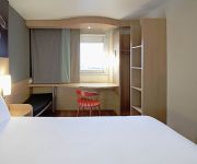
ibis Sisteron
ibis budget Sisteron
Videos from this area
These are videos related to the place based on their proximity to this place.
WRC Rallye Monte Carlo 2014 ES10 Sisteron -- Col de Fontbelle -- Thoard (36,85 km)
Petite vidéo de notre journée de Vendredi 17 Janvier 2014 Le temps n'étais pas trop au rendez vous mais tout c'est très bien passé Dans cette vidéo vous découvrirez presque tout les...
Electro-Light 2
Démonstration de l'Electro-Light, motoplaneur électrique réalisé par Electravia à Sisteron-Vaumeilh. Renseignements sur : http://electravia.fr/ELIGHT2.php.
Passage près du sommet de Hongrie en planeur
Un passage en planeur à l'ouest du sommet de Hongrie, vers 1300m, à bord du Twin Astir du Club de Sisteron. Le vent est pratiquement nul et l'ascendance est très faible.
Gliding - York GC - French Alps, Mont Blanc, Pic de Bure
York Gliding Centre (UK). From Aeroclub Sisteron around the Massif des Ecrins, June 08. 3 Mile Mark formating with Aerobatty on final glide. Thanks to Tristan and Jean Paul. La Motte 0.12...
bendini clip tutorial.wmv
Scunci Bendini Hair clip, as seen on television You bend it and it snaps in place. Two simple steps to add some glamour with the Scunci Bendini Hair clip. Easily slide it into your hair to...
Site de parapente de St Geniez Alpes du Sud
Site de parapente de St Geniez dans les Alpes du Sud à proximité de Sisteron (04 Alpes de Haute Provence). Images et réalisation par Thibaut de Rosnay. Retrouvez d'autres images et informations...
Videos provided by Youtube are under the copyright of their owners.


