Safety Score: 3,0 of 5.0 based on data from 9 authorites. Meaning we advice caution when travelling to Austria.
Travel warnings are updated daily. Source: Travel Warning Austria. Last Update: 2024-05-01 08:01:32
Delve into Pirchanger
The district Pirchanger of Arzberg in Politischer Bezirk Schwaz (Tirol) is a subburb in Austria about 225 mi west of Vienna, the country's capital town.
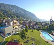
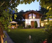
If you need a hotel, we compiled a list of available hotels close to the map centre further down the page.
While being here, you might want to pay a visit to some of the following locations: Schwaz, Pill, Stans, Terfens and Buch bei Jenbach. To further explore this place, just scroll down and browse the available info.
Local weather forecast
Todays Local Weather Conditions & Forecast: 19°C / 66 °F
| Morning Temperature | 11°C / 52 °F |
| Evening Temperature | 13°C / 55 °F |
| Night Temperature | 9°C / 48 °F |
| Chance of rainfall | 3% |
| Air Humidity | 48% |
| Air Pressure | 1000 hPa |
| Wind Speed | Gentle Breeze with 6 km/h (3 mph) from North |
| Cloud Conditions | Broken clouds, covering 73% of sky |
| General Conditions | Light rain |
Friday, 3rd of May 2024
11°C (51 °F)
8°C (46 °F)
Light rain, light breeze, overcast clouds.
Saturday, 4th of May 2024
15°C (58 °F)
8°C (46 °F)
Light rain, light breeze, overcast clouds.
Sunday, 5th of May 2024
14°C (57 °F)
10°C (49 °F)
Light rain, light breeze, overcast clouds.
Hotels and Places to Stay
STAY.inn
Plankenhof
Schwarzbrunn 4* sup
Der Brandstetterhof **** - Adults only
Biohotel Grafenast
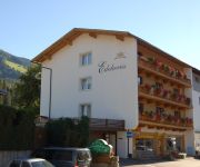
Edelweiss
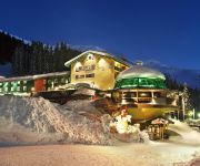
Berghotel Hochfügen
Appart Montana
Rieder Gasthof
Huber Hochland ***s
Videos from this area
These are videos related to the place based on their proximity to this place.
PILL (A) - Pfarrkirche St. Anna
Die Pfarrkirche wurde 1518 fertiggestellt und erlebte im 18. Jh. eine Barockisierung des Inneren und der Turm erhielt sein heutiges Aussehen. 2001-2003 erfolgte eine gründliche Renovierung....
Parkplatz Grafenast für 100 Fahrzeuge
Im November 2010 wurde mit den Arbeiten für den neuen Parkplatz, etwa 30 Höhenmeter oberhalb der Kellerjochliftstation "Grafenast" gelegen, begonnen. Knapp 100 Fahrzeuge finden Platz, 250.000.
Vomp in Tirol (A) - Glocken im Friedhof
Diese Glocken wurden durch ein neues Geläute ersetzt. Wann weiss ich leider nicht. Die kleinste Glocke stammt von Grassmayr von 1920, die übrigen von Oberascher von 1948. Ich finde...
Haibike eQ Xduro - 760 Höhenmeter mit Speed und Stufe 3
Wer Pedelec-MTBs kennt, sollte unbedingt auch mal dieses Modell von Haibike probefahren - und am besten gleich im stärksten Unterstützungsmodus, also Fahrprogramm "Speed" und Stufe 3. Da...
Rennszenen (archiviert) - Schwazer Radsporttage 2012
Von ca. 10 Uhr bis etwa 13:30 Uhr fanden am 2. September 2012 die Rennen des 16. Schwazer Straßenpreises statt. Begleitet mit einem Pedelec, entstanden diese ca. 30 min umfassenden ...
Föhn im Dezember - Blick von Freundsberg oberhalb Schwaz
Eine Woche vor Weihnachten wird das Inntal immer noch von einer viel zu milden Wetterlage beherrscht. Hinzu kamen am 19. und 20. Dezember 2013 Föhneffekte, die die Temperaturen im Bereich...
Sony Cyber-shot DSC-HX300 test steinbrücke schwaz in tirol austria
1200mm zoom lowest video quality seting= VGA 480p 25 frps.
Silberbergwerk Schwaz/ Tirol/ Zillertal
Facebook: https://www.facebook.com/pages/Reise-Schau-Platz/621538294628452?ref_type=bookmark -----------------------...
Polytechnische Schule Schwaz - Ganztagesklasse in Tirol TV
Fernsehbeitrag im Tirol TV über die Ganztagesklasse an der PTS.
Videos provided by Youtube are under the copyright of their owners.
Attractions and noteworthy things
Distances are based on the centre of the city/town and sightseeing location. This list contains brief abstracts about monuments, holiday activities, national parcs, museums, organisations and more from the area as well as interesting facts about the region itself. Where available, you'll find the corresponding homepage. Otherwise the related wikipedia article.
Schwaz District
The Bezirk Schwaz is an administrative district in Tyrol, Austria. It borders Bavaria in the north, the districts of Kufstein, Kitzbühel and Pinzgau in the east, South Tyrol in the south, and the Innsbruck-Land district in the west. Area of the district is 1,887.49 km², with a population of 79,511 (January 1, 2012), and population density of 42 persons per km². Administrative center of the district is Schwaz.
Zillertal
The Zillertal is the biggest valley branching off the Inn valley in Tyrol, Austria drained by the river Ziller. It is surrounded by the strongly glaciated Zillertal Alps to the south and east, the lower grass peaks of the Kitzbühel Alps to the east and Tux Alps to the west. The largest settlement is Mayrhofen.
St. Georgenberg-Fiecht Abbey
St. Georgenberg-Fiecht Abbey, the successor of St. Georgenberg Abbey, is a Benedictine monastery situated since 1708 in Fiecht in the community of Vomp in Tyrol, Austria; a pilgrimage church still stands on the original site on the Georgenberg. Founded in 1138, it is the oldest extant monastery in the Tyrol.
Pertisau
Pertisau is a small village on the Achensee Lake in the Tyrol region of Austria. Pertisau is in the Schwaz (district). It is located in the Karwendel Alpine Park, one of the oldest, cross-border, protected areas of the Eastern Alps. The picturesque town was used by English school story writer Elinor M. Brent-Dyer as the first setting for her Chalet School series, under the fictionalised name of Briesau am Tiernsee; a plaque on the wall of the village bookshop commemorates her writings.
Vomperbach
The Vomperbach rises in the Karwendel mountain range and flows first from West to East. Above the village of Vomp - which it passes through - it changes its course and flows from North to South into the Inn River. It has a length of 15 kilometers.
Lake Moels
The Mölssee or Lake Moels can be found at the upper part of the Wattental valley at a height of 2,240 metres. With an area of 0.0346 km², it is one larger lakes in the area. The lake can be reached by following the Wattental Road beginning in Wattens. Then above the Moels Alp the lake may be gained by walking up a pretty steep trail heading for the Moels col (Mölser Scharte). The mountain lake lies within a military training area, so it can be only visited at certain particular times.
Volderer See
The small Volderer See or Lake Volders had formerly been a bigger lake but it lost a large part of its total size. Now the Lake looks like a bigger pond. It lies left by the Karls Church at the motorway bridge by the entrance to the village of Volders. The Lake has no natural in- and outflow and mainly receives groundwater of the Inn River and from rain. It has a moderate water quality between B and C. Therefore the Lake is often plagued by alga creation.
Penken
The Penken is a mountain area in the Ziller Valley located in the Austrian Tyrol. The Penken can be reached by modern cable car from the village of Mayrhofen.
Achensee Railway
|} The Achensee Railway is a 6.78 kilometres long metre gauge railway running between Jenbach and Seespitz on Lake Achensee in Tyrol. Within its length it rises some 440 metres in height, with the steeper sections using the Riggenbach rack system. It is Europe's oldest cog railway which is still steam operated.
Ziller
The Ziller is an approximately 47 km long right-side tributary to the Inn River, in the Zillertal in Tyrol, Austria. It springs from the ridge of the Zillertal Alps, and feeds the Zillergründl Dam. In Mayrhofen it receives the Zemmbach (that in turn receives the Tuxerbach). By Zell am Ziller it receives the Gerlosbach, before it flows into the Inn by Strass im Zillertal.
Achensee
The Lake Achen is a lake north of Jenbach in Tyrol, Austria. It is the largest lake within the federal state, and has a maximal depth of 133 metres. Together with the Achental valley it parts the Karwendel mountain range in the west from the Brandenberg Alps in the east. Water quality is near drinking water, with sight up to 10 m below the surface. An alpine lake, water temperature is accordingly low, rarely above 20 °C. Its size and wind conditions make it suitable for windsurfing.
Burg Freundsberg
Burg Freundsberg is a castle in Tyrol, Austria, that was constructed in the year of 1150 by the lords of Freundsberg. Originally the castle consisted out of a single keep, which is still intact up to this date. The chapel next to it was built afterwards in the year 1117. In 1467 the castle was sold to Archduke Sigismund of Austria, who rebuilt the castle and called it Sigismundruh for the duration of his reign. From 1634/37 on, the castle was retrofitted as a "castle church" or Schlosskirche.
Burg Kropfsberg
Burg Kropfsberg is a castle in Tyrol, Austria.
Burg Lichtenwerth
Burg Lichtenwerth is a castle in Tyrol, Austria.
Tratzberg Castle
Tratzberg Castle is a castle in Jenbach, Tyrol, Austria.
Innsbruck bypass
|} The Innsbruck bypass is a 14.853 kilometre-long double-track electrified main line of the Austrian railways. It connects the Lower Inn Valley railway with the Brenner railway, bypassing Innsbruck. It was opened on 29 May 1994. The line is at a major part of the rail freight network of Austrian Federal Railways (ÖBB). The bypass is part of the Line 1 of Trans-European Transport Networks (TEN-T).
Harakiri (ski piste)
The Harakiri is a slope in the ski resort of Mayrhofen Ski Zillertal 3000. It is named after the Japanese vulgar term for seppuku, ritual suicide by samurai. With an average incline of 78% and a length of about 150 metres, it is the steepest groomed slope in Austria. Thus the slope is steeper than the initial trace of a ski jump. Because of this extreme inclination, the slope can only be maintained with a special secured slope unit.
Jenbach railway station
Jenbach railway station serves the municipality of Jenbach, in the Schwaz district of the Austrian federal state of Tyrol. It is the only station in Austria at which railway lines of three different gauges meet. The most important line leading to Jenbach station is the Austrian Federal Railways (ÖBB) standard gauge Lower Inn Valley railway, which passes through the station.
Schlitterer See
Schlitterer See is a lake of Tyrol, Austria.
Zireiner See
Zireiner See is a lake of Tyrol, Austria.
Wattentaler Lizum
The Wattentaler Lizum (locally also Wattener Lizum) is the name of the head of the Wattental valley which branches off the lower Inn valley near Wattens. Lizum' means "alpine pasture at the head of the valley" in Tyrolese. The Wattentaler Lizum lies at the eastern end of the valley in the municipality of Wattenberg.
Tuxertal
The Tuxertal ("Tux Valley") lies in Tyrol, Austria and is a side valley of the Zillertal, from which it branches at Mayrhofen. It is about 13 km long and accessible on the Tux Road (Tuxer Straße). From Mayrhofen to Hintertux (1500 m) in the municipality of Tux, the village that gives the valley its name, there is a height difference of about 850 m. The valley ends in Hintertux at the Hintertux Glacier.
Wattental
The Wattental is a southern side valley of the Inn valley. The valley, through which the Wattenbach stream flows, is incised deeply into the quartz-phyllite rock of the Tux Prealps. The two dispersed settlements of Wattenberg and Vögelsberg (in the municipality of Wattens) sprawl across the outer part of the valley. At the head of the valley is the Wattentaler Lizum and its military training area of Lizum Walchen which is run by the Austrian Armed Forces.
Schloss Matzen
Schloss Matzen is a historic Austrian castle, located in the Tyrol near the branch of the Zillertal from the main Inn valley. Strategically located to control one of the major transalpine trade routes, the origins of the castle date from Roman times and it has a distinctive round tower thought to be of possible Roman derivation. The castle, mostly Gothic in origin is one of the most important surviving historic buildings of the Tyrol.


