Safety Score: 3,0 of 5.0 based on data from 9 authorites. Meaning we advice caution when travelling to Austria.
Travel warnings are updated daily. Source: Travel Warning Austria. Last Update: 2024-05-02 08:23:34
Delve into Schönau
The district Schönau of Bad Häring in Politischer Bezirk Kufstein (Tirol) is a district located in Austria about 203 mi west of Vienna, the country's capital town.
In need of a room? We compiled a list of available hotels close to the map centre further down the page.
Since you are here already, you might want to pay a visit to some of the following locations: Itter, Langkampfen, Schwoich, Angath and Worgl. To further explore this place, just scroll down and browse the available info.
Local weather forecast
Todays Local Weather Conditions & Forecast: 20°C / 67 °F
| Morning Temperature | 12°C / 53 °F |
| Evening Temperature | 12°C / 53 °F |
| Night Temperature | 9°C / 48 °F |
| Chance of rainfall | 5% |
| Air Humidity | 44% |
| Air Pressure | 1000 hPa |
| Wind Speed | Light breeze with 4 km/h (2 mph) from South |
| Cloud Conditions | Overcast clouds, covering 95% of sky |
| General Conditions | Moderate rain |
Friday, 3rd of May 2024
11°C (52 °F)
9°C (48 °F)
Moderate rain, light breeze, overcast clouds.
Saturday, 4th of May 2024
17°C (62 °F)
8°C (47 °F)
Light rain, light breeze, overcast clouds.
Sunday, 5th of May 2024
13°C (56 °F)
10°C (50 °F)
Light rain, light breeze, broken clouds.
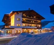
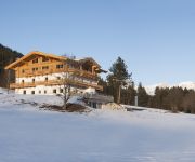
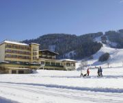
Hotels and Places to Stay
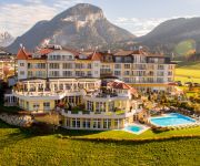
Panorama Royal
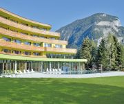
Das Sieben****S
Alpen Schlössl
Alexado
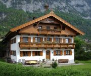
Bauernhof Maurerhof
Sonnschein
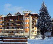
Hotel Simmerlwirt
Hochfilzer Genusslandhotel
Tirolerhof Gasthof Pension
Harmony Hotel Harfenwirt
Videos from this area
These are videos related to the place based on their proximity to this place.
Regenbogen ohne Regen - Blick von Bruckhäusl nach Hopfgarten
Dieser Regenbogen existierte während des Sonnenuntergangs am 15. September nur in den Wolken. Regen war an diesem Tag im Tal nämlich keiner gefallen, auch nicht beim Sonnenuntergang.
Föhnstimmung im Unterland
Es war kein echter Föhntag - dazu zeigte sich die Wolkendecke zu dicht, und die Temperaturen lagen zu niedrig. Doch der warme Wind blies doch spürbar - und die Wolkenformen ließen auch ...
UPC Tirol Liga: SV Kirchbichl - WSG Wattens II, 6. Runde
Die Reise nach Kirchbichl hat man sich in Wattens vermutlich anders vorgestellt. Die Wattener kassierten eine 3:0 Niederlage. Nach fünf sieglosen Spielen steht die Mannschaft von Trainer...
Unwetter in Wörgl - Frontankunft in Bad Häring und Schäden in Kirchbichl
Am 25. August gegen 18 Uhr zog eine Unwetterfront durch das Unterland. Vor allem die Gegend um Wörgl und Kirchbichl war davon betroffen, aber auch das Sölllandl, insbesondere die Orte Ellmau...
Videos provided by Youtube are under the copyright of their owners.
Attractions and noteworthy things
Distances are based on the centre of the city/town and sightseeing location. This list contains brief abstracts about monuments, holiday activities, national parcs, museums, organisations and more from the area as well as interesting facts about the region itself. Where available, you'll find the corresponding homepage. Otherwise the related wikipedia article.
Witches' Water
The Witches' Water is a theme park at the middle station of the cable car at Söll in Tyrol, Austria. The central part is a water park consisting of ponds and rivulets where children can play a variety of water games. It extends over an area of about 500 meters and is complemented by various alpine restaurants, playgrounds and a petting zoo.
Kufstein District
The Bezirk Kufstein is an administrative district in Tyrol, Austria. It borders Bavaria in the north, the Kitzbühel district in the southeast, and the Schwaz district in the southwest. The district has a geographical area of 969.81 km², and a population of 101,321 (2012) giving a population density of 104 people per km². The administrative center is Kufstein.
Kufstein Fortress
The Kufstein Fortress is the main landmark of Kufstein, a city of Tyrol in Austria. It is sometimes wrongly referred to as Geroldseck Fortress. It is located on a hill commanding Kufstein proper.
Thiersee Lake
The Thiersee Lake lies in the center of Vorderthiersee in the valley with the same name on a height of 616 m. It is surrounded by mountains forming a kettle. The lake can be reached by car or by local bus from Kufstein via the valley. The Lake can be used for bathing and possesses an excellent water quality of Grade A. Several possibilities like boat trips, swimming, Beach volley and others are given. The best conditions are in June because in Summer the water can warm up to 24°C.
Itter Castle
Itter Castle is a small castle standing on a high knoll in Itter, a village in North Tyrol (Austria), 20 km west of Kitzbühel. Itter Castle is located atop a hill at the entrance to the Brixental Valley. It is first mentioned in 1240. It belonged to Salzburg from 1312 until 1816, when it became part of Tyrol. The castle was purchased as a residence in 1884 by Sophie Menter, pianist, composer and student of Franz Liszt.
Sölllandl
Sölllandl (also Söllandl or Sölland) is a local term for a geographical region in Austria that covers the villages of Söll (Tirol), Scheffau am Wilden Kaiser, Ellmau and Going am Wilden Kaiser in the Tyrolean Unterland between Wörgl and St. Johann in Tirol. The term for this valley region, also includes the watersheds near Söll between the rivers Inn and Großache on the one hand and part of the Kitzbühler Ache on the other.
Kaisertal
The Kaisertal (formerly Sparchental) is a striking mountain valley between the mountain chains of the Zahmer and Wilder Kaiser in Austria's Kaisergebirge range in the Tyrol. In the ravine (Sparchenklamm) on the valley floor flows the stream of the Kaiserbach (Sparchenbach), which discharges north of Kufstein into the Inn (river). It is home to several, scenic isolated farms (e.g. the Pfandlhof and Veitenhof). A popular calendar image is St.
Wörgl Central Station
Wörgl Central Station (Wörgl Hauptbahnhof) is the main station of Wörgl, a city in the Kufstein district of the Austrian federal state of Tyrol, about 20 km from the state border with Bavaria.
Brünnstein
Brünnstein is a mountain of Bavaria, Germany.
Thierberg
Thierberg is a mountain located in the north and southwest of the town of Kiefersfelden and thus extends over the border between Austria and Germany and it extends up to Bavaria, Germany but the most part is in Tyrol. In the not-too-high mountain, the Inn Valley is located at approximately 500 meters above sea level. There are several lakes: Egelsee, Hechtsee and Längsee. Thierberg mountain is named after the village and cadastral community "Thierberg" .
Battle of Wörgl
In the Battle of Wörgl or Wörgel on 13 May 1809 a Bavarian force under French Marshal François Joseph Lefebvre attacked an Austrian Empire detachment commanded by Johann Gabriel Chasteler de Courcelles. The Bavarians severely defeated Chasteler's soldiers in series of actions in the Austrian towns of Wörgl, Söll, and Rattenberg. Wörgl is located 20 kilometres south of the modern-day German border on the upper Inn River.
Egelsee (Tyrol)
Egelsee is a lake of Tyrol, Austria.
Hechtsee
Hechtsee is a lake of Tyrol, Austria.
Hintersteiner See
Hintersteiner See is a lake of Tyrol, Austria.
Längsee (Tyrol)
Längsee is a lake of Tyrol, Austria.
Maistaller Lacke
Maistaller Lacke is a lake of Tyrol, Austria.
Pfrillsee
Pfrillsee is a lake of Tyrol, Austria.
Stimmersee
Stimmersee is a lake of Tyrol, Austria.
Brixental
The Brixental ("Brixen Valley") is a southeastern side valley of the Tyrolean Lower Inn Valley in Austria with a length of about 30 km. Near Wörgl (513 m AMSL) the Brixental and Inn valleys meet. The Brixental had belonged to Salzburg since 1312 and first joined Tyrol in 1816 when the new European order came into being. The valley lies in the Kitzbühel Alps and its main river of the valley is the Brixentaler Ache.
Windautal
The Windautal is a southern side valley of the Tyrolean Brixental in the Kitzbühel Alps in Austria with a length of about 16 km. The valley is lies almost entirely within the territory of the parish of Westendorf; only its northernmost part lies in Hopfgarten. To the south the valley borders on the state of Salzburg. To the north - near Hopfgarten (623 m) - the Windautal and Brixental valleys merge.
Tischofer Cave
The Tischofer Cave is a cave in the Kaisertal valley in the Kaisergebirge mountains in Austria. It was important locally as a gathering place and weapons cache for local rebels during the Napoleonic Wars. The roughly 40 m long cave, which is about 8.5 m high at the entrance, was used during the Stone Age by bears and other predators as shelter, as evinced by the excavated remains of bones.
Salzburg-Tyrol Railway
|- | |} The Salzburg-Tyrol Railway is a main line railway in Austria. It runs through the states of Salzburg and Tyrol from the city of Salzburg to Wörgl and belongs to the core network (Kernnetz) of the Austrian Federal Railways (ÖBB).
Kufstein railway station
Kufstein railway station serves the city of Kufstein, in the Kufstein district of the Austrian federal state of Tyrol. Opened in 1876, it is an Austrian-German border station, close to the border between Tyrol and Bavaria. The station forms part of the Lower Inn Valley railway, and is also a terminus of the Rosenheim–Kufstein railway. It is owned and operated by the Austrian Federal Railways (ÖBB).
Gießenbach (Kieferbach)
Gießgraben is a river of Bavaria, Germany.
University of Applied Sciences Kufstein
The University of Applied Sciences Kufstein, is an Austrian Fachhochschule in Kufstein in northwestern Tyrol.







![Webcam: Wildschönau: L 3 Wildschoenauer Straße [km 8,1], Blickrichtung: Oberau capture of the webcam Wildschönau: L 3 Wildschoenauer Straße [km 8,1], Blickrichtung: Oberau](https://images.webcams.travel/daylight/preview/1480269508.jpg)


