Delve into Woolloongabba
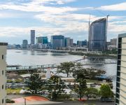
The district Woolloongabba of Brisbane in Brisbane (Queensland) with it's 3,916 habitants Woolloongabba is a district located in Australia about 586 mi north-east of Canberra, the country's capital town.
In need of a room? We compiled a list of available hotels close to the map centre further down the page.
Since you are here already, you might want to pay a visit to some of the following locations: Sunshine Coast, Carrolls Creek, , and . To further explore this place, just scroll down and browse the available info.
Local weather forecast
Todays Local Weather Conditions & Forecast: 24°C / 75 °F
| Morning Temperature | 16°C / 61 °F |
| Evening Temperature | 22°C / 71 °F |
| Night Temperature | 18°C / 65 °F |
| Chance of rainfall | 0% |
| Air Humidity | 51% |
| Air Pressure | 1024 hPa |
| Wind Speed | Gentle Breeze with 7 km/h (4 mph) from West |
| Cloud Conditions | Few clouds, covering 14% of sky |
| General Conditions | Few clouds |
Tuesday, 30th of April 2024
24°C (75 °F)
18°C (64 °F)
Light rain, gentle breeze, few clouds.
Wednesday, 1st of May 2024
23°C (73 °F)
18°C (64 °F)
Light rain, gentle breeze, broken clouds.
Thursday, 2nd of May 2024
22°C (72 °F)
17°C (63 °F)
Light rain, gentle breeze, overcast clouds.
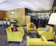
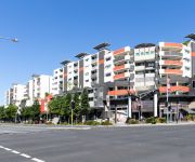
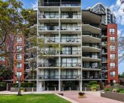
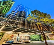
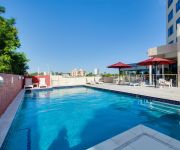
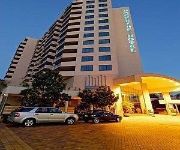
Hotels and Places to Stay
The Sebel Quay West Brisbane
The Point Brisbane
Gabba Central Apartments
The Docks on Goodwin
Capri by Fraser
Oaks 212 Margaret
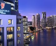
Stamford Plaza Brisbane
Central Dockside Apartment Hotel
Central Dockside
Swiss-Belhotel Brisbane
Videos from this area
These are videos related to the place based on their proximity to this place.
Brisbane City Australia | Pacific Motorway
Brisbane Pacific Motorway sometimes known as the Brisbane SE Fwy swings up across the river heading north with the City centre appearing on the right.
Dust Storm, Brisbane, Australia September 23, 2009
Very sorry about the terrible audio, I had a window open. This is taken driving across the riverside expressway. On the right the buildings of the city are usually clearly visable and on...
History of the Dutton Park War Memorial
Video of Nowell Taylor on Anzac Day 2014 giving a speech about the history of the Gair Park War Memorial in Dutton Park, Brisbane, Australia.
Thompsons~Strathpine Coach 17 - Denning Manufacturing Phoenix Silver
Resurrected from the now defunct elevatorman555 account! An immaculate coach operating on behalf of Queensland Rail during trackwork on the Cleveland Railway Line. The driver at the beginning...
5 Grattan Street - Woolloongabba (4102) Queensland by Treston Bamber
Property Video shoot of 5 Grattan Street - Woolloongabba (4102) Queensland by platinumhd http://www.platinumhd.tv for.
139/803 Stanley Street, Woolloongabba QLD By Sherrie Storor
Property Video shoot of 139/803 Stanley Street, Woolloongabba QLD by platinumhd http://www.platinumhd.tv for Place New Farm.
Videos provided by Youtube are under the copyright of their owners.
Attractions and noteworthy things
Distances are based on the centre of the city/town and sightseeing location. This list contains brief abstracts about monuments, holiday activities, national parcs, museums, organisations and more from the area as well as interesting facts about the region itself. Where available, you'll find the corresponding homepage. Otherwise the related wikipedia article.
Captain Cook Bridge, Brisbane
The Captain Cook Bridge is a motorway bridge over the Brisbane River in Brisbane, Australia. It was built exclusively for vehicular traffic and was opened in 1972. The bridge crosses at the South Brisbane Reach of the river, linking Gardens Point to Kangaroo Point . Captain Cook Bridge actually consists of two separate bridges, one for each direction of traffic. The bridge carries four lanes of traffic in either direction and links the M3 Pacific Motorway to the M3 Riverside Expressway.
Goodwill Bridge
The Goodwill Bridge is a pedestrian and cyclist bridge which spans the Brisbane River in Brisbane Australia, linking the South Bank Parklands / Queensland Museum on the southside, to the Gardens Point Campus of the Queensland University of Technology on the northside. The Goodwill Bridge was opened on 21 October 2001 and takes its name from most the popular entry in a public naming competition.
Park Road railway station
Park Road is a railway station in Brisbane, Queensland, Australia. It is part of the Queensland Rail City network. It is in a transition precinct between Zone 1 and Zone 2 of the TransLink integrated public transport system. The station forms the branching point for the Beenleigh/Gold Coast and Cleveland railway lines. Platform 4 of this station was intended for use by Gold Coast trains but the curvature of the platform has proved to be unsafe for commuter train usage.
Buranda railway station
Buranda is a railway station on the Cleveland Line, 3.4 km south-southeast from Brisbane (6.2 km from Central station by rail), the state capital of Queensland, Australia. It is part of the QR Citytrain network. It is in Zone 2 of the TransLink integrated public transport system. The station forms an interchange with Buranda busway station on the South East Busway and Eastern Busway, allowing easy access to the southern suburbs and into the Brisbane central business district.
Boggo Road Gaol
Boggo Road Gaol (alt. and older spelling "Bogga") was a notorious Australian prison located on Annerley Road in Dutton Park, an inner southern suburb of Brisbane, Queensland, Australia. The site is the only surviving intact gaol in Queensland that reflects penological principles of the 19th century. For many years it was Queensland's main prison.
Princess Alexandra Hospital
The Princess Alexandra Hospital (PAH) is on Ipswich Road in Woolloongabba, Australia. It is one of the major hospitals in Brisbane and is a teaching hospital of the University of Queensland. It is a tertiary level teaching hospital with all major medical and surgical specialities onsite except for obstetrics, gynaecology and paediatrics. A new building was opened in 2000 to replace the ageing red-brick PA Hospital complex built in the 1950s.
The Gabba
The Brisbane Cricket Ground, commonly known as The Gabba, is a major sports stadium in Brisbane, the capital of Queensland. It is named after the suburb of Woolloongabba, in which it is located. The land on which the ground sits was first set aside for use as a cricket ground in 1895 and the first cricket match was held on the site on 19 December 1896, between Parliament and The Press.
Kangaroo Point Cliffs
The Kangaroo Point Cliffs are located at Kangaroo Point just across the Brisbane River from the Brisbane CBD in Queensland, Australia. A popular recreation spot, they are conveniently close to the city and the South Bank Parklands. It can be reached by the Pacific Motorway, South-East Busway or a ferry to Thornton Street Wharf. The Cliffs are situated on the east bank of the river north of the Maritime Museum and opposite the Queensland University of Technology.
Dutton Park railway station
Dutton Park is a railway station on the Beenleigh Line of Brisbane, Australia. It is part of the Queensland Rail City network. It is in Zone 2 of the TransLink integrated public transport system. Dutton Park was the junction of the Wooloongabba Branch from 1884 until 1989.
Dutton Park, Queensland
Dutton Park is a suburb of Brisbane, Australia located about 4 km south of the Brisbane CBD. The suburb is predominantly residential, with some light industrial and commercial areas. The name Dutton comes from Charles Boydell Dutton, the Queensland Minister for Lands from 1883 to 1887, who created the recreation reserve in 1884.
Eastern Busway
The Eastern Busway is a bus-only corridor in Brisbane, Queensland. The busway runs from the University of Queensland St Lucia Campus via the Eleanor Schonell Bridge, connects with the South East Busway at Buranda busway station and then extends to Coorparoo following the Old Cleveland Road corridor.
Woolloongabba
Woolloongabba is an inner suburb of Brisbane, Australia located 4 km south of the Brisbane CBD. Experts are divided regarding the Aboriginal meaning of the name, preferring either 'whirling waters' (woolloon and capemm) or 'fight talk place' (woolloon and gabba). Woollongabba is particularly famous for being the site of the Brisbane Cricket Ground, known as "The Gabba".
Mater Hill busway station
Mater Hill Busway Station, at South Brisbane, an inner-south suburb in Brisbane, the state capital of Queensland, Australia. It is part of the South East Busway serviced by TransLink. Mater Hill Busway Station is close to the Mater Private Hospital – Brisbane and the South Bank Parklands. Mater Hill is located on the zone boundary between zones 1 & 2 of the TransLink integrated public transport system. Mater Hill Busway Station is the main route change busway station.
Woolloongabba busway station
The Woolloongabba busway station is part of the South East Busway in Brisbane, serviced by TransLink. It is on a spur from the main trunk route, with inbound services joining the busway proper at Mater Hill. It is adjacent to the Brisbane Cricket Ground, and in Zone 2 of the TransLink integrated public transport system.
Buranda busway station
The Buranda Busway Station, at Buranda, is part of the South East Busway serviced by TransLink bus routes. The busway station is beneath the Buranda Railway Station on the Cleveland Line. It is in Zone 2 of the TransLink integrated public transport system.
Mowbray Park ferry wharf
Mowbray Park is a ferry wharf in the suburb of East Brisbane used by the CityCat on the Brisbane River. Mowbray Park is named for Thomas Mowbray, a presbyterian minister who had been minister at Blackridge Parish Church, Scotland. In January 2011 the wharf sustained a moderate damage during the devastating floods; it was repaired and reopened on 14 February 2011.
River Plaza ferry wharf
River Plaza is a ferry wharf in the suburb of South Brisbane used by the CityFerry on the Brisbane River. In January 2011 the wharf sustained moderate damage during the devastating floods and the rebuilding works are expected to take months. A temporary River Plaza terminal is expected to open on 31 July 2011.
Queensland Maritime Museum
The Queensland Maritime Museum is located on the southern bank of the Brisbane River just south of the South Bank Parklands and Queensland Cultural Centre precinct of Brisbane, and close to the Goodwill Bridge. The museum was founded in 1971 and contains a two level exhibition building presenting historic sailing ship models together with merchant shipping from early cargo ships to modern container ships, tankers and cruise liners.
HMAS Diamantina (K377)
HMAS Diamantina (K377/F377/A266/GOR266), named for the Diamantina River in Queensland, is a River class frigate that served the Royal Australian Navy (RAN). Constructed in the mid-1940s, Diamantina was active from 1945 until 1946, was placed in reserve, then was recommissioned as a survey ship from 1959 until 1980. Following her second decommissioning, the frigate was preserved at the Queensland Maritime Museum as a museum ship.
Forceful (tugboat)
Forceful is an ocean-going tugboat built for the Queensland Tug Company. Forceful was built by Alexander Stephen and Sons Ltd in Govan, Scotland. She arrived at her homeport of Brisbane, Queensland on 7 March 1926. While she spent most of her career operating along the coast of Queensland, she was commissioned into the Royal Australian Navy during most of 1942 and 1943 as HMAS Forceful (W126). During her war service she was based at Darwin and operated mainly in northern Australian waters.
Buranda, Queensland
Buranda is a locality in the southern Brisbane suburbs of Greenslopes and Woolloongabba in Brisbane, the capital of Queensland, Australia. The location is an important transport hub for southern Brisbane. Logan Road and Ipswich Road pass through the area as does the South East Busway with a station called Buranda busway station. The Pacific Motorway passes through the area. There is also the Buranda railway station on the Cleveland railway line.
Princess Alexandra Hospital busway station
The Princes Alexandra Busway Station is serviced by TransLink bus routes travelling on the Eastern busway. It is located opposite O'Keefe Street. It is in Zone 2 of the TransLink integrated public transport system.
Boggo Road busway station
The Boggo Road Busway Station is serviced by TransLink bus routes travelling via the Eastern busway. It is located adjacent to the Park Road railway station. It is in Zone 2 of the TransLink integrated public transport system.
Queensland Children's Hospital
The Queensland Children's Hospital (QCH) is a new major children’s hospital under construction in South Brisbane, Queensland, Australia. The hospital will combine the Royal Children's Hospital, Herston and the Mater Children's Hospital together into one new facility located next to the existing Mater Children’s Hospital in South Brisbane. The construction of A$1.2 billion QCH is underway and it is due to be completed in 2014.
South Brisbane Town Hall
The Old South Brisbane Town Hall is the heritage-listed town hall of the Borough of South Brisbane, later the City of South Brisbane, Queensland, Australia. It is located on the south-west corner of the intersection of Vulture Street and Graham Street, South Brisbane, adjacent to Cumbooquepa, the residence of William Stephens, the Member of the Legislative Assembly of Queensland and mayor of Borough of South Brisbane.


