Discover Petrie Terrace
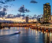
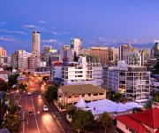
The district Petrie Terrace of Brisbane in Brisbane (Queensland) is a district in Australia about 587 mi north of Canberra, the country's capital city.
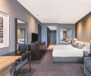
Looking for a place to stay? we compiled a list of available hotels close to the map centre further down the page.
When in this area, you might want to pay a visit to some of the following locations: Sunshine Coast, Carrolls Creek, , and . To further explore this place, just scroll down and browse the available info.
Local weather forecast
Todays Local Weather Conditions & Forecast: 24°C / 75 °F
| Morning Temperature | 16°C / 60 °F |
| Evening Temperature | 21°C / 71 °F |
| Night Temperature | 18°C / 64 °F |
| Chance of rainfall | 0% |
| Air Humidity | 51% |
| Air Pressure | 1024 hPa |
| Wind Speed | Gentle Breeze with 6 km/h (4 mph) from West |
| Cloud Conditions | Clear sky, covering 4% of sky |
| General Conditions | Sky is clear |
Tuesday, 30th of April 2024
23°C (74 °F)
18°C (64 °F)
Light rain, gentle breeze, broken clouds.
Wednesday, 1st of May 2024
23°C (73 °F)
18°C (64 °F)
Light rain, gentle breeze, scattered clouds.
Thursday, 2nd of May 2024
20°C (69 °F)
17°C (63 °F)
Light rain, gentle breeze, overcast clouds.
Hotels and Places to Stay
GAMBARO HOTEL
Evolution Apartment Hotel
Best Western Astor Metropole
METROPOLITAN MOTOR INN
Mercure Brisbane
SOUTH CENTRAL APARTMENTS
QUEST SPRING HILL SERVICED APTS
PARK REGIS NORTH QUAY
Grand Chancellor Brisbane
SUMMIT APARTMENTS
Videos from this area
These are videos related to the place based on their proximity to this place.
Brisbane City 'Riverside Precinct' Apartment - SOLD by the Ray White Pahl Team
Sold - 245/171 North Quay Brisbane City Marketed by Stephen Pahl 0404 266 085 Sold by Stephen Pahl Look no further than this 5 year old contemporary sleek apartment in the Statuesque ...
Paddington to Rosalie Village
Rosalie Village resides next to Paddington which lies in a valley in the foothills of Mount Coot-tha The area is extremely hilly with many peaks and gullies. Most of the retail is located along...
Shops 2 and 3 FOR LEASE 257 Given Terrace Paddington COMMERCIAL PROPERTY by RE/MAX Commercial CITY
Shops 2 &3/257 Given Terrace, Paddington: Geoff Esdale 0408 787 082 Given Tce Paddington is one of Brisbane's oldest and most popular fashion and food thoughafairs. Running from the very edge.
How to book your accommodation at Kelvin Grove Student Village
Learn how to book your accommodation at Kelvin Grove Student Village in just three easy steps!
2014 Village Ball Video
Didn't make it to the ball? Here's the video we screened featuring interviews from nominees, photos, and random videos. FOLLOW US Facebook: http://www.facebook.com/kelvingrovestudentvillage...
Unit for Rent in Spring Hill Spring Hill Unit 3BR/2BA by West End Property Management
Click http://www.metrocityrealty.com.au/ to visit Metrocity Realty for your "Brisbane Property Management" needs! You may also visit http://www.metrocityrealty.com.au/search/rentals for a list...
454 Upper Edward St, Spring Hill Inner City Brisbane living Real estate investment Flynn Apartments
454 Upper Edward St, Spring Hill is proudly marketed by Jocelyn Frost from RE/MAX Profile Bardon. Call her today on 0414 490 270, you'll be delighted you did. An excellent investment opportunity...
Unit 6, 25 Upper Clifton Terrace - Red Hill (4059) Queenslan...
Property Video shoot of Unit 6, 25 Upper Clifton Terrace - Red Hill (4059) Queensland by PlatinumHD http://www.platinumhd.tv for Harcourts Solutions Inner City.
Sold by Grant Penrose RE/MAX Profile Red Hill QLD Real estate 0418 747 035 Smakk Media Video
This property has been Sold 14/109 Musgrave Road Red Hill QLD 4059 property for sale and proudly marketed by Grant Penrose Mobile 0418 747 997 RE/MAX Profile. Directions: ...
Videos provided by Youtube are under the copyright of their owners.
Attractions and noteworthy things
Distances are based on the centre of the city/town and sightseeing location. This list contains brief abstracts about monuments, holiday activities, national parcs, museums, organisations and more from the area as well as interesting facts about the region itself. Where available, you'll find the corresponding homepage. Otherwise the related wikipedia article.
William Jolly Bridge
The William Jolly Bridge is a vehicular and pedestrian bridge over the Brisbane River in Brisbane, Queensland, Australia. It is a steel frame arch bridge with an unusual concrete veneer and was opened to traffic on 30 March 1932 by Sir John Goodwin, the Governor of Queensland. When opened, during the worst year of the Great Depression, the bridge was known simply as the Grey Street Bridge.
Merivale Bridge
The Merivale Bridge is a double track railway bridge crossing the Brisbane River. It crosses the Milton Reach of the river, slightly to the west of the William Jolly Bridge. Exclusively a railway crossing, it is located between the stations of South Brisbane and Roma Street, linking the northern and southern elements of the Citytrain system. The Merivale Bridge is the only inner-city rail crossing in Brisbane.
Roma Street Parkland
Roma Street Parkland covers 16 hectares in the centre of Brisbane, Queensland, Australia. The Roma Street Parkland is adjacent to Brisbane Transit Centre and the Roma Street Station. There is pedestrian access to the Roma Street Parkland from the Roma Street Station, as well as from Albert Street, and from the section of the Parkland which used to be called Albert Park, in Wickham Terrace.
Roma Street railway station
Roma Street is a major railway station in the Brisbane central business district, the state capital of Queensland, Australia. It was Brisbane's first railway station, opening in 1876. Roma Street is part of the Queensland Rail City network, in Zone 1 of the TransLink integrated public transport system, and is the Brisbane terminus for most Queensland long-distance trains. The station has a total of ten platforms. Platform 10 is for long-distance train travel within Queensland.
Queensland Police
The Queensland Police Service (QPS) is the law enforcement agency responsible for policing the Australian state of Queensland. In 1990, the Queensland Police Force was officially renamed the Queensland Police Service and the old motto of "Firmness with Courtesy" was changed to "With Honour We Serve". The headquarters of the Queensland Police Service is located at 200 Roma Street, Brisbane. The 1980s was a turbulent period in Queensland Police history.
Castlemaine Perkins
Castlemaine Perkins is a brewery located in Milton, Brisbane, Australia. It is a wholly owned entity of the Japanese-controlled Lion Nathan company.
Lang Park
Lang Park is the original name of the site located in the Brisbane suburb of Milton, Queensland, Australia, now occupied by the major sports facility known by its sponsorship name, Suncorp Stadium (formerly Suncorp-Metway Stadium). Lang Park is also known as Brisbane Stadium when in use during AFC competitions due to conflicting sponsorship reasons. The current facility comprises a three tiered rectangular sporting stadium with a capacity of 52,500 people.
Brisbane Girls Grammar School
Brisbane Girls' Grammar School, is an independent, secular, secondary day school for girls, located in Spring Hill, an inner suburb of Brisbane, Queensland, Australia. Founded in 1875, the school is one of eight grammar schools in Queensland which were established under the Grammar Schools Act of 1860. The school originally opened as a branch of the Brisbane Grammar School, with fifty students, under the direction of a Lady Principal, Janet O'Connor.
Wickham Park (Brisbane)
Wickham Park is on Wickham Terrace in Spring Hill, Brisbane, Queensland, Australia. Wickham Park is located next to the Roma Street Parkland in the section of the parkland which used to be called Albert Park. Wickham Park, which was named after John Clements Wickham, contains The Old Windmill, the oldest surviving building in Brisbane.
Roma Street busway station
The Roma Street Busway Station is an integration of bus and rail services at Roma Street Station beneath the coach deck of the Brisbane Transit Centre. It forms part of the Northern Busway. The station is in Zone 1 of the TransLink integrated public transport system. The Roma Street Busway Station's platforms are at the same level as the train platforms and use the pedestrian access that links the Transit Centre to the Roma Street Parkland.
Normanby busway station
The Normanby Busway Station is part of the Northern Busway in Brisbane, Australia. It is adjacent to Brisbane Grammar School and the Inner City Bypass. It is in Zone 1/2 of the TransLink integrated public transport system.
Whiskey Au Go Go fire
The Whiskey Au Go Go fire was a fire that occurred at 2.10 am on Thursday 8 March 1973, in the Whiskey Au Go Go nightclub in Fortitude Valley, Brisbane, Australia that killed 15 people. The building is at 356 St Pauls Terrace, Fortitude Valley (on the corner of Amelia Street and St Paul's Terrace) and still stands as of 2013.
Petrie Terrace, Queensland
Petrie Terrace is an inner-city precinct and major thoroughfare in Brisbane, Australia. It is less than 2 km west of the Brisbane General Post Office. The precinct is bordered to the west by Hale Street and to the east by Countess Street. Its northern boundary is Musgrave Road and its southern is Milton Road.
Caxton Street, Brisbane
Caxton Street is a street in Brisbane, Queensland, Australia located in the suburb of Paddington. Since the mid-19th century it has been one of Brisbane’s iconic precincts. The area prospered due to the local army barracks with Trams running along the street and establishments like the Caxton Street Hotel, Ithaca Baths (now demolished), and the Caxton Street Hall (now demolished).
Brisbane Grammar School
Brisbane Grammar School (BGS) is an independent, non-denominational, day and boarding school for boys, located in Spring Hill, an inner suburb of Brisbane, Queensland, Australia. It is the oldest secondary boys school in Brisbane. Established in 1868 under the Grammar Schools Act which was passed by the Queensland Government in 1860, the school has a non-selective enrolment policy and currently caters for approximately 1424 students from Years 6 to 12, including 135 boarders.
Kurilpa Bridge
The Kurilpa Bridge (originally known as the Tank Street Bridge) is a (A$)$63 million pedestrian and bicycle bridge over the Brisbane River in Brisbane, Queensland, Australia. The bridge connects Kurilpa Point in South Brisbane to Tank Street in the Brisbane central business district. In 2011, the bridge was judged World Transport Building of the Year at the World Architecture Festival.
Task Force Argos
Task Force Argos is a highly specialised branch of the Queensland Police Service responsible for the investigation of on-line child exploitation and abuse. Founded in 1997, the unit’s original charter was to investigate historical, institutional child abuse alleged during the Forde Inquiry. The unit's name was derived from Greek mythology in which Argus Panoptes or Argos, was a primordial “all seeing” giant with multiple eyes and who was guardian of lo.
North Quay, Brisbane
North Quay is a location in the Brisbane central business district and the name of street in the same area, running along the Brisbane River from an intersection near Makerston Street to the top of the Queen Street.
Commonwealth Law Courts
Harry Gibbs Commonwealth Law Courts on North Quay, Brisbane, Australia contains the Queensland registries of the High Court of Australia and the Federal Court of Australia; and the Brisbane registries of the Family Court of Australia, Federal Magistrates Court of Australia and the Administrative Appeals Tribunal. The building is thirteen storeys tall and construction was completed in August 1993.
Radar (radio)
Radar Radio (also referred to as Radar Music, colloquially called Radar) is an Australian Digital Radio station. It is run by Austereo and was launched on 11 December 2008.
Northern University Games
The Northern University Games (NUG) is an Australian inter-varsity multi-sport competition held annually in mid-year break (June/July in Australia) between universities and tertiary institutions from Queensland, Northern Territory and northern New South Wales. The games attract on average 600 competitors every year across seven different sports. It was first held in 2005.
Victoria Barracks, Brisbane
Victoria Barracks is an Australian Army base in the Brisbane suburb of Petrie Terrace in Queensland. The Victoria Barracks Museum is located on the site, and contains a large collection of replica and service medals covering the Army's involvement in the Boer War, World War I and World War II. Recently, a portion of the western part of Victoria Barracks has been redeveloped as a retail district called "The Barracks".
Radio Gaga (radio)
Radio Gaga was a pop up Digital Radio station broadcasting nationally in Australia while Lady Gaga toured the country in 2010. The station was part of the Austereo Today Network and only played Lady Gaga's music.
Go Between Bridge
The Go Between Bridge, formerly known as the Hale Street Link, is a toll bridge for vehicles, pedestrians and cyclists over the Brisbane River in inner-city Brisbane, Queensland, Australia. The bridge connects Merivale and Cordelia Streets in West End to Hale Street and the Inner City Bypass at Milton. It is Brisbane's first inner-city traffic bridge in 40 years and is expected to carry around 12,000 vehicles per day. The bridge opened to traffic in the early hours on 5 July 2010.
Queensland Stock Institute
The Queensland Stock Institute was a government scientific facility in Brisbane, Queensland, Australia, for the research and prevention of disease in agricultural animals relevant to Queensland. Established in 1893, it was the first research institution in Queensland dedicated to the investigation of disease. In 1900 it was renamed the Bacteriological Institute when activities were officially extended to include human pathology.


