Delve into Fortitude Valley
The district Fortitude Valley of in Brisbane (Queensland) with it's 4,469 habitants Fortitude Valley is a district located in Australia about 588 mi north-east of Canberra, the country's capital town.
In need of a room? We compiled a list of available hotels close to the map centre further down the page.
Since you are here already, you might want to pay a visit to some of the following locations: Brisbane, Sunshine Coast, Carrolls Creek, and . To further explore this place, just scroll down and browse the available info.
Local weather forecast
Todays Local Weather Conditions & Forecast: 24°C / 75 °F
| Morning Temperature | 16°C / 60 °F |
| Evening Temperature | 21°C / 71 °F |
| Night Temperature | 18°C / 64 °F |
| Chance of rainfall | 0% |
| Air Humidity | 51% |
| Air Pressure | 1024 hPa |
| Wind Speed | Gentle Breeze with 6 km/h (4 mph) from West |
| Cloud Conditions | Clear sky, covering 4% of sky |
| General Conditions | Sky is clear |
Tuesday, 30th of April 2024
23°C (74 °F)
18°C (64 °F)
Light rain, gentle breeze, broken clouds.
Wednesday, 1st of May 2024
23°C (73 °F)
18°C (64 °F)
Light rain, gentle breeze, scattered clouds.
Thursday, 2nd of May 2024
20°C (69 °F)
17°C (63 °F)
Light rain, gentle breeze, overcast clouds.
Hotels and Places to Stay
Brisbane Marriott Hotel
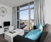
Meriton Suites Adelaide Street
M & A Apartments
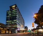
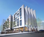
RYDGES FORTITUDE VALLEY
Mantra on the Quay
Republic Apartments
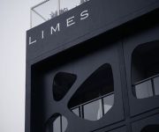
ZTO BE DELETED - LIMES HOTEL
One Thornbury Boutique B&B
Frisco Apartments
TRYP Fortitude Valley
Videos from this area
These are videos related to the place based on their proximity to this place.
coffee-art-one-drop-specialty-coffee-brisbane.wmv
Blaine and James of One Drop Specialty Coffee in Brisbane demonstrate their skills, philosophy and artistic flair.
Sold by Jonzun Lee 0418 885 708 RE/MAX Profile Bardon & Smakk Media video
Sold 40 Union Street Spring Hill Marketed by Jonzun Lee 0418 885 708 DIRECTIONS: http://www.whereis.com/qld/spring-hill/40-union-st YOUTUBE: http://www.youtube.com/user/JonzunLee1 LARGE.
15 East Village 25 James Street, New Farm QLD By Luke Croft
Property Video shoot of 15 East Village 25 James Street, New Farm QLD by PlatinumHD http://www.platinumhd.tv for Ray White South Brisbane.
78a Brookes Street, Bowen Hills Queensland By Aaron Woolard
Property Video shoot of 78a Brookes Street, Bowen Hills Queensland by platinumhd http://www.platinumhd.tv for Place New Farm.
306 The Terrace on Gregory, 587 Gregory Terrace - Bowen Hills (4006) Queensland by Sherrie Storor
Property Video shoot of 306 The Terrace On Gregory : 587 Gregory Terrace - Bowen Hills (4006) Queensland by platinumhd http://www.platinumhd.tv for.
Unit 37 451 Gregory Terrace Bowen Hills 4006 QLD by Joe Maca...
Property Video shoot of Unit 37 451 Gregory Terrace Bowen Hills 4006 QLD by platinumhd http://www.platinumhd.tv for Remax Integrity.
Unit 303, 100 Bowen Street - Spring Hill (4004) Queensland by An...
Property Video shoot of Unit 303, 100 Bowen Street - Spring Hill (4004) Queensland by platinumhd http://www.platinumhd.tv for.
5 Admiralty Towers 35 Howard Street, Brisbane QLD By Brandon Wortley
Property Video shoot of 5 Admiralty Towers 35 Howard Street, Brisbane QLD by PlatinumHD http://www.platinumhd.tv for Ray White South Brisbane.
Videos provided by Youtube are under the copyright of their owners.
Attractions and noteworthy things
Distances are based on the centre of the city/town and sightseeing location. This list contains brief abstracts about monuments, holiday activities, national parcs, museums, organisations and more from the area as well as interesting facts about the region itself. Where available, you'll find the corresponding homepage. Otherwise the related wikipedia article.
Story Bridge
The Story Bridge is a steel cantilever bridge spanning the Brisbane River that carries vehicular, bicycle and pedestrian traffic between the northern and the southern suburbs of Brisbane, Queensland, Australia. It is the longest cantilever bridge in Australia. The bridge is part of Bradfield Highway (15) and connects Fortitude Valley to Kangaroo Point. It is named for John Douglas Story.
Fortitude Valley railway station
Fortitude Valley (formerly Brunswick Street) is a railway station of the Queensland Rail City network of Brisbane, the state capital of Queensland, Australia. Located beneath the Valley Metro complex, with four platforms it is located in Zone 1 of the TransLink integrated public transport system. Pedestrian access to Fortitude Valley railway station is via two thoroughfares near the corner of Brunswick and Wickham Streets and a pedestrian overpass connecting to McWhirters.
Exhibition railway station, Brisbane
Exhibition Station is a special-purpose railway station in Brisbane, the state capital of Queensland, Australia. It forms part of the Exhibition Line of the Queensland Rail City network. It is in Zone 1 of the TransLink integrated public transport system. However an extra ticket surcharge must be paid to travel to this station. In 2009, TransLink CEO Peter Strachan blamed the surcharge on the RNA not willing to pick up the cost of running the station.
Fortitude Valley, Queensland
Fortitude Valley (also known simply as "The Valley") is a suburb of central Brisbane, the state capital of Queensland, Australia. The suburb lies immediately northeast of the Brisbane central business district, and is one of the hubs of Brisbane's nightlife, renowned for its Nightclubs, bars and adult entertainment. At the 2011 Australian Census Fortitude Valley recorded a population of 5,615.
Emerald Tower, Brisbane
Emerald Tower was a proposed skyscraper in Brisbane, Queensland, Australia. The building was to be developed on a 1529 square metre site at 555 Queen Street, Ann Street and Clarke Lane by Emerald Developments (Aust) Pty Ltd. The planned residential tower was to contain five-star luxury apartments and penthouses. Emerald Tower would be Brisbane's fifth tallest building if completed. Construction was planned to start at the beginning of 2007.
Brisbane Exhibition Ground
The Brisbane Exhibition Ground (also known as the RNA Showgrounds and the Ekka Grounds), is a showground established in Brisbane during 1875 especially for Ekka (formally titled the Royal Queensland Show). The Exhibition ground is owned and operated by the Royal National Agricultural and Industrial Association of Queensland. The Ekka is a show held at the Brisbane Exhibition Ground over two weeks in August each year.
Holy Name Cathedral, Brisbane
Holy Name Cathedral was a planned, then partially built, then discontinued project to build a Catholic cathedral in Fortitude Valley, Brisbane, Australia. It was to have been the seat of the Archbishopric of Queensland and was intended to have been the largest church building of any Christian denomination in the Southern Hemisphere. The formidable Archbishop James Duhig was the chief proponent of the project.
Bowen Park, Brisbane
Bowen Park is a heritage-listed precinct in Bowen Hills, Queensland, Australia.
St Joseph's College, Gregory Terrace
St Joseph's College, Gregory Terrace (commonly known as Terrace) is a Greater Public Schools private, Roman Catholic, day school for boys only, located in Spring Hill, an inner suburb of Brisbane, Queensland, Australia. Founded on 5 July 1875 by three Irish Christian Brothers, the College follows the Edmund Rice tradition, and currently caters for approximately 1370 students from Years 5 to 12.
Valley Metro (Fortitude Valley)
The Valley Metro is a shopping centre in Fortitude Valley in Queensland, Australia. It contains Fitness First, Terry White, 7/11, Foodworks, NAB, various specialty shops and a large food court. Valley Metro also contains Fortitude Valley railway station under the building, which is the third busiest railway station in Brisbane.
Clem Jones Tunnel
The M7 Clem Jones Tunnel (CLEM7), known during its development as the North-South Bypass Tunnel (NSBT), is a A$3.2 billion motorway grade toll road built under the Brisbane River, which crosses between the suburbs of Woolloongabba and Bowen Hills in Brisbane, Queensland. The CLEM7 Community Open Day, a public open day which included a tunnel run and walk, was held on 28 February 2010.
Holman Street ferry wharf
Holman Street is a ferry wharf in the suburb of Kangaroo Point used by the CityFerry on the Brisbane River. On January 12, 2011, most of the wharf was destroyed and washed away during flooding of the Brisbane River and the rebuilding works are expected to take months.
Metroad 3 (Brisbane)
The M3/A3 in Brisbane, Queensland, Australia, is a major urban road corridor. It connects Eight Mile Plains to Bald Hills via the following corridors: M3 Pacific Motorway between Eight Mile Plains and Brisbane CBD Coronation Drive and M3 Hale Street in the Brisbane CBD M3 Inner City Bypass and Horace Street between Brisbane CBD and Bowen Hills A3 Lutwyche Road between Bowen Hills and Kedron A3 Gympie Road between Kedron and Carseldine M3 Gympie Arterial Road between Carseldine and Bald Hills
Inner City Bypass, Brisbane
M3 Inner City Bypass (ICB) is a major motorway standard road in Brisbane, Queensland. The 4.5km bypass is north of the city. Bypassing the Brisbane central business district, it connects Brisbane’s Pacific Motorway and Go Between Bridge at Hale Street to Kingsford Smith Drive, the Clem Jones Tunnel and Lutwyche Road following the Exhibition railway line for the majority of its length. The route is marked as the M3 from the western part of the route, up until the Horace Street interchange.
All Hallows' School
All Hallows' School is a Catholic day school for girls, located close to the central business district of Brisbane, Queensland. Founded in 1861, the school follows in the tradition of the Irish Sisters of Mercy, and caters for over 1,400 girls from Years five to 12. The school was the first permanent home of the Sisters of Mercy in Queensland, and is the oldest surviving secondary school in Brisbane.
Anglican Diocese of Brisbane
The Anglican Diocese of Brisbane is based in Brisbane, Australia. The diocesan bishop's seat is St John's Cathedral, Brisbane. The current Archbishop of Brisbane is the Most Revd Phillip Aspinall, who is also the elected Primate of the Anglican Church of Australia. The diocese stretches from the south-eastern coastline of Queensland, south to the New South Wales border, and west to the Northern Territory border.
Ann Street, Brisbane
Ann Street runs parallel to Adelaide Street and is the northern-most street in the Brisbane CBD in Queensland, Australia. It is a major thoroughfare, running straight through the city and linking the suburb of Fortitude Valley with the Riverside Expressway.
St James College, Brisbane
St James College, Brisbane teaches over 400 students from grades 8 to 12, it is under the direction of the headmaster Mr Gerry Crooks. St James College, Brisbane or "Jimmies" as it is also known was established in 1868 with only 12 students and is the oldest Catholic boys' school in Queensland. In 1893, the Christian Brothers agreed to take over the school following major economic depression, the governments refusal to pay staff wages and inconsistent student enrolment.
McWhirters
McWhirters is a shopping centre and apartment building in Fortitude Valley an inner city suburb of Brisbane, Australia. The buildings occupy over an acre of land bound by Brunswick, Wickham, and Warner Streets.
St Joseph's College, Nudgee
St Joseph's Nudgee College (commonly referred to simply as Nudgee) is a private, Roman Catholic, day and boarding school for boys, located in Boondall, a northern suburb of Brisbane, Queensland, Australia. In 1891 it was decided by the Congregation of Christian Brothers that because of the large numbers of boarders at St. Joseph's College, Gregory Terrace and insufficient room to house them that a new school be opened to cater for the boarders at Nudgee. Both schools share St.
All Saints Anglican Church, Brisbane
All Saints Anglican Church, Wickham Terrace, Brisbane is the oldest Anglican Church in the City of Brisbane, first founded in 1862. The existing structure dates from 1869. For most of its history, it has been identified with the High Church or Anglo-Catholic tradition within Anglicanism.
Commercial Swimming Club
Commercial Swimming Club is a swimming club that is based at the Fortitude Valley Pool in centre of Brisbane, Queensland. It is one of the most successful clubs in Australia and has produced many Olympic swimmers and medalists.
Ann Street Church of Christ
Ann Street Church of Christ is a Christian church in the CBD of Brisbane, Australia that holds public worship services each Sunday morning. Its website details a range of activities for people of all ages including student outings, community barbecues, women's meetings, music and family ministries. The church is affiliated with the Churches of Christ in Australia and traces its roots to the Restoration Movement. The church was formed in 1883.
Howard Smith Wharves
Howard Smith Wharves is a wharf site on the Brisbane River in Brisbane, Queensland, Australia. The 3.5 ha site is culturally and historically significant and is one of the last undeveloped riverfront locations in Brisbane. Brisbane City Council had initially proposed an extensive commercial development of the site that includes hotel, sport and entertainment facilities in new or refurbished old buildings.
Mercy Heritage Centre Brisbane
The Mercy Heritage Centre Brisbane is a social history museum dedicated to the life and works of the Brisbane Sisters of Mercy. Opened in 2001, extensively refurbished, and completed in 2012 the museum is in All Hallows’ Convent, situated within the grounds of All Hallows' School. This historic building was the residence of the Brisbane Sisters from 1863 – 2007. The Mercy Heritage Centre run public tours on Tuesdays and Wednesdays at 9.30am, 11am, 1pm & 2.30pm.


