Discover Wellers Hill
Wellers Hill in Brisbane (Queensland) is a town in Australia about 583 mi (or 938 km) north-east of Canberra, the country's capital city.
Current time in Wellers Hill is now 12:14 AM (Sunday). The local timezone is named Australia / Brisbane with an UTC offset of 10 hours. We know of 8 airports near Wellers Hill, of which one is a larger airport. The closest airport in Australia is Brisbane Archerfield Airport in a distance of 4 mi (or 6 km), South-West. Besides the airports, there are other travel options available (check left side).
Also, if you like playing golf, there are a few options in driving distance. We discovered 2 points of interest in the vicinity of this place. Looking for a place to stay? we compiled a list of available hotels close to the map centre further down the page.
When in this area, you might want to pay a visit to some of the following locations: Brisbane, Sunshine Coast, Carrolls Creek, and . To further explore this place, just scroll down and browse the available info.
Local weather forecast
Todays Local Weather Conditions & Forecast: 24°C / 75 °F
| Morning Temperature | 15°C / 60 °F |
| Evening Temperature | 21°C / 69 °F |
| Night Temperature | 18°C / 64 °F |
| Chance of rainfall | 0% |
| Air Humidity | 53% |
| Air Pressure | 1024 hPa |
| Wind Speed | Gentle Breeze with 9 km/h (5 mph) from North-West |
| Cloud Conditions | Scattered clouds, covering 48% of sky |
| General Conditions | Light rain |
Sunday, 28th of April 2024
24°C (76 °F)
18°C (65 °F)
Broken clouds, gentle breeze.
Monday, 29th of April 2024
23°C (74 °F)
17°C (63 °F)
Light rain, light breeze, broken clouds.
Tuesday, 30th of April 2024
22°C (72 °F)
18°C (64 °F)
Light rain, gentle breeze, scattered clouds.
Hotels and Places to Stay
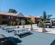
Comfort Inn & Suites Robertson Gardens
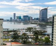
Swiss-Belhotel Brisbane
Hotel Chino
Sudima Suites
BEST WESTERN PLUS HOTEL DIANA
Gabba Central Apartments
Holland Park Motel
The Wellington Apartment Hotel
CENTRAL HILLCREST
Coopers Colonial Motel
Videos from this area
These are videos related to the place based on their proximity to this place.
4x100M M Secondary Schools Queensland Track Classic 2014 034
Queensland Sport/Athl. Centre - Site License 29/03/2014 - 9:54 PM 2014 Queensland Track Classic Brisbane, Qld, Australia...
100M B So Chun Hong 10.70 Queensland Track Classic 2014 021
Queensland Sport/Athl. Centre - Site License 29/03/2014 - 9:53 PM 2014 Queensland Track Classic Brisbane, Qld, Australia...
2008 Students World Cup, Round 2 Australia v Scotland
Relive the 2008 Round 2 clash of the Students Rugby League World Cup, played between Australian Universities and Scotland Students at Griffith University July 9 2008. To find out more about...
35 Pope Street, Tarragindi, Queensland
http://www.platinumre.com.au/property/details/908 An opportunity too good to pass up! This gorgeous two story rendered home with detached flat in trendy Tarragindi is sure to impress, and we...
SOLD: Country Quilt Doubletail Halfmoon Betta Pair
TO BUY - READ BELOW Gorgeous pair with great volume. Imported from select breeders in Thailand. Offered for sale $100AU/pr email to purchase. Details below. http://www.fishchick.com.au...
46 Sherley St, Moorooka RE/MAX Simon Au Properties
Address : 46 Sherley St. Moorooka Price : $489k+ Luxury Townhomes on Prestige Clifton Hill + City Views! REMAX SIMON AU presents this new luxury townhomes development on the prestige Clifton...
11 Woodlea Street, Moorooka Queensland By Will Bertelsen
Property Video shoot of 11 Woodlea Street, Moorooka Queensland by platinumhd http://www.platinumhd.tv for Ray White South Brisbane.
SEVERE hailstorm in BRISBANE - Australia
Monstrous images, a veritable bombardment from the air occurred on 26/11/2014 in Australia Brismane The images come from the Facebook page: https: //www.facebook.com/SevereWeathe .
Videos provided by Youtube are under the copyright of their owners.
Attractions and noteworthy things
Distances are based on the centre of the city/town and sightseeing location. This list contains brief abstracts about monuments, holiday activities, national parcs, museums, organisations and more from the area as well as interesting facts about the region itself. Where available, you'll find the corresponding homepage. Otherwise the related wikipedia article.
Tarragindi, Queensland
Tarragindi is a suburb on the southern side of Brisbane, Queensland, Australia. It is represented through the Holland Park and Moorooka Ward councillors on the Brisbane City Council.
Holland Park, Queensland
Holland Park is a suburb of Brisbane, the capital city of Queensland, Australia, that is situated approximately 8 km south of the Brisbane central business district. Holland Park is an older suburb made of largely post-World War II wooden homes. In fact over 89% of dwellings are houses. Logan Road, one of Brisbane's first major roads, bisects this slightly hilly suburb. Trams operated by the Brisbane City Council operated along Logan Road until 13 April 1969.
Toohey Mountain
Toohey Mountain is a medium sized mountain at the eastern side of the City of Brisbane's suburb of Moorooka. The rise was named after James Toohey, an Irish born Sydneysider who made his wealth in the California gold rush, before settling in the newly formed state of Queensland. To the north of the mountain is Tarragindi Hill and Wellers Hill. Grass Tree Ridge was the name given to the tall and long ridge that extends through parts of Tarragindi, Salisbury and Nathan, towards Sunnybank.
Holland Park West busway station
The Holland Park West Busway Station, at Holland Park West, is part of the South East Busway serviced by TransLink bus routes. It is in Zone 3 of the TransLink integrated public transport system. In addition to South East Busway services, Holland Park West is also serviced by routes travelling to UQ Lakes via the Eastern Busway and the cross-town Route 77 service, which travels via the Clem Jones Tunnel.
Griffith University busway station
The Griffith University Busway Station, at Mount Gravatt, is part of the South East Busway serviced by TransLink bus routes. It serves the Griffith University campuses at Mount Gravatt and Nathan. It is in Zone 3 of the TransLink integrated public transport system. Services to and from the Mains Road corridor join the busway at this station.
Nathan, Queensland
Nathan is a southern suburb of Brisbane, Australia. It was named in 1967 after Sir Matthew Nathan, Governor of Queensland from 1920 to 1926. Nathan is home to Toohey Forest Conservation Park, Griffith University's Nathan campus and the Queensland Sport and Athletics Centre which hosted the opening ceremony of the 1982 Commonwealth Games. The Queensland Academy of Sport currently uses the facilities located at the stadium. The Mount Gravatt Cemetery is part of Nathan.
Holland Park West, Queensland
Holland Park West is a suburb of Brisbane, Queensland, Australia. The suburb was gazetted in 1972. It is located in the inner suburbs south-east of the Brisbane central business district between the Pacific Motorway and Logan Road.
Queensland Institute of Business and Technology
The Queensland Institute of Business and Technology (QIBT) is a higher education institution delivering programs as a registered Higher Education Provider approved by the Australian Government’s Department of Education, Employment and Workplace Relations. QIBT is registered on the Commonwealth Register of Institutions and Courses for Overseas Students (CRICOS Provider Code 07137F) as required by the Education Services for Overseas Students (ESOS) Act 2000.


