Delve into Hemmant
The district Hemmant of Brisbane in Brisbane (Queensland) is a subburb in Australia about 590 mi north-east of Canberra, the country's capital town.
If you need a hotel, we compiled a list of available hotels close to the map centre further down the page.
While being here, you might want to pay a visit to some of the following locations: Sunshine Coast, Carrolls Creek, , and . To further explore this place, just scroll down and browse the available info.
Local weather forecast
Todays Local Weather Conditions & Forecast: 24°C / 75 °F
| Morning Temperature | 16°C / 61 °F |
| Evening Temperature | 22°C / 71 °F |
| Night Temperature | 18°C / 65 °F |
| Chance of rainfall | 0% |
| Air Humidity | 54% |
| Air Pressure | 1024 hPa |
| Wind Speed | Gentle Breeze with 7 km/h (4 mph) from West |
| Cloud Conditions | Few clouds, covering 13% of sky |
| General Conditions | Light rain |
Tuesday, 30th of April 2024
24°C (75 °F)
18°C (65 °F)
Light rain, gentle breeze, clear sky.
Wednesday, 1st of May 2024
23°C (73 °F)
19°C (66 °F)
Light rain, gentle breeze, broken clouds.
Thursday, 2nd of May 2024
22°C (72 °F)
18°C (64 °F)
Light rain, gentle breeze, overcast clouds.
Hotels and Places to Stay
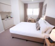
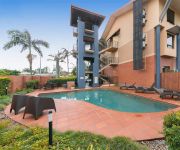
DOMAIN SERVICED APARTMENTS
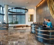
Pullman Brisbane Airport
MANLY MARINA COVE
Novotel Brisbane Airport
BEST WESTERN AIRPORT 85 MOTEL
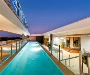
Domain Serviced Apartments
Quality Hotel Airport International
KINGSFORD SMITH MOTEL
Pegasus Motor Inn and Serviced Apartments
Link Portside Apart'Hotel
Videos from this area
These are videos related to the place based on their proximity to this place.
Louis Dobbelaar at Qld Schools State Championships, Wynnum Golf Club
Louis age 11 at the 2013 Queensland Schools State Championships. Louis won the Queensland Primary Schools Championship Title. Gross Winner.
16 Coralie Avenue, Wynnum West, Brisbane, Queensland, Australia
Situated in a very handy location close to Iona College, is this fabulous family style home at a realistic and affordable price. This home is proudly presented to the marketplace by your...
12 Melaleuca Pl, Wynnum West, Brisbane, Queensland, Australia
Pool Party Time for First Home Buyers! Proudly presented to the market is this low maintenance low set brick home, positioned a t the end of a cul-de-sac, ideal for first home buyers. 12...
112 McFadden Street, Wynnum, Brisbane, Queensland, Australia
A quality build by Coastal Properties, welcome home to 112 McFadden St. Positioned on the high side of the street, with the perfect North Easterly aspect, you are ideally positioned to capture...
32 Hillcrest Avenue, Wynnum, Brisbane, Queensland, Australia
Welcome to the Avenues! Located on prestigious Hillcrest Avenue, this home is truly all about "lifestyle". Combine the advantages of capital growth in a high demand location, with the easy...
20140921 AM Sonny Misar - Journey to Authenticity
The Journey to Authenticity preached by Sonny Misar at our Family Service. September 21, 2014 AM.
VW - Volkwagen Day out - Wynnum 2011.
VW day out at Wynnum in sunny Queensland Australia September 11 2011. Various models were on display on a picture perfect Sunday.
9a Bulgin Ave, Wynnum West
Very hard to find a "ready to move in" home within this price range, and proudly presented to the market. This property is absolutely perfect for the first home buyer or investor, and very...
20141026 AM Ps Nick Watson - Travel Tales
Pastor Nick Watson sharing on his recent travels. October 26, 2014 AM.
35 Rodney Street - Wynnum West (4178) Queensland by Benjamin Williams
Property Video shoot of 35 Rodney Street - Wynnum West (4178) Queensland by platinumhd http://www.platinumhd.tv for.
Videos provided by Youtube are under the copyright of their owners.
Attractions and noteworthy things
Distances are based on the centre of the city/town and sightseeing location. This list contains brief abstracts about monuments, holiday activities, national parcs, museums, organisations and more from the area as well as interesting facts about the region itself. Where available, you'll find the corresponding homepage. Otherwise the related wikipedia article.
Fort Lytton National Park
Fort Lytton is a national park in Queensland, Australia, 13 km northeast of Brisbane. It is located near the mouth of the Brisbane River on the southern bank. Fort Lytton is an important historical site. It is a pentagonal fortress hidden behind a moat and grassy embankments. It is the only fort in Australia with a moat.
Sir Leo Hielscher Bridges
The Sir Leo Hielscher Bridges are a pair of road bridges on the Gateway Motorway (M1), which skirts the eastern suburbs of Brisbane, Queensland, Australia. They are the most eastern crossing of the Brisbane River, the closest to Moreton Bay, crossing at the Quarries Reach, between Eagle Farm and Murarrie. The original bridge (formerly named the Gateway Bridge) was opened on 11 January 1986 and cost A$140 million to build. The duplicate bridge was opened in May 2010.
Murarrie railway station
Murrarie Station is a railway station on the Cleveland Line of Brisbane, Australia. It is part of the Queensland Rail City network. It is in Zone 3 of the TransLink integrated public transport system.
Hemmant railway station
Hemmant Station is a railway station on the Cleveland Line of Brisbane, Australia. It is part of the Queensland Rail City network. It is in Zone 3 of the TransLink integrated public transport system.
Wynnum North railway station
Wynnum North Station is a railway station on the Cleveland Line of Brisbane, Australia. It is part of the Queensland Rail City network. It is in a transition precinct between Zone 3 and Zone 4 of the TransLink integrated public transport system. It is by far one of the most popular stations in the area, with the early morning schedule regularly seeing the platform very congested.
Wynnum railway station
Wynnum Station is a railway station on the Cleveland Line of Brisbane, Australia. It is part of the Queensland Rail City network. It is in Zone 4 of the TransLink integrated public transport system.
Wynnum Central railway station
Wynnum Central railway station (formerly Wynnum South) is a railway station on the Cleveland Line of Brisbane, Australia. It is part of the Queensland Rail City network. It was opened in 1888 as Wynnum South and renamed Wynnum Central in 1931. It is in Zone 4 of the TransLink integrated public transport system.
Lindum railway station
Lindum Station is a railway station on the Cleveland Line of Brisbane, Australia. It is part of the Queensland Rail City network. Lindum is the last station before the parallel freight line to the Port of Brisbane diverges from the Cleveland line. It is in Zone 3 of the TransLink integrated public transport system.
Bulimba Creek
The Bulimba Creek catchment has it sources in the marshy parts of the suburbs of Runcorn and Kuraby in the south of Brisbane. It then flows in a northerly direction through the suburbs of Mansfield, Mackenzie, Carindale, Murarrie and Lytton, before meeting the Brisbane River along the Lytton Reach. The creek was originally known as Doboy Creek.
Tingalpa, Queensland
Tingalpa is located near Manly West and Belmont, Queensland in the Eastern suburbs of Brisbane, Australia. It is located 10 kilometres east of the Brisbane CBD. The suburb has some older style homes built in the post war period – weatherboard and chamferboard post war cottages in particular. Most of the new estates are made up of typically low set and high set brick and tile homes.
Pinkenba, Queensland
Pinkenba is the name of a suburb in eastern Brisbane on the northern side of the Brisbane River, 10 kilometres from the Brisbane central business district. The area is spatially isolated from other residential suburbs and is surrounded by the Brisbane Airport to the north and west, and industrial land and the bank of the Brisbane River to the south. Pinkenba recorded a population of 350 people at the 2011 Australian Census.
Murarrie, Queensland
Murarrie is a suburb of Brisbane, Australia. It is located in the eastern suburbs on the southern bank of the Brisbane River adjacent to the Gateway Bridge. Murarrie has both residential and industrial sections. Brisbane's two newspapers, The Courier-Mail and The Sunday Mail, are published at News Corporation's printing facility in Murarrie. Murarrie's postcode is 4172.
Iona College (Queensland)
Iona College, is a private, Roman Catholic, day school for boys, located in Wynnum, a suburb of Brisbane, Queensland, Australia. Founded in 1958, the college currently caters for approximately 1,500 students from years 5 to 12, on a 27–hectare campus 16 km east of the Brisbane central business district. Iona is operated by the Oblates of Mary Immaculate, a religious order that was founded in 1816 by Saint Eugene de Mazenod.
Metroad 1 (Brisbane)
Metroad 1 in Brisbane, Queensland, Australia, is the former designation of the major urban road corridor. It connects Bald Hills to the southern suburb of Beenleigh via the following corridors. Gateway Motorway between Bald Hills and Eight Mile Plains Pacific Motorway between Eight Mile Plains and Beenleigh Due to the recent resigning of Metroad 1 as the M1 of the new alphanumeric road system, this corridor is still undergoing new signage.
4RPH
Radio 4RPH 1296 kHz is a volunteer manned community radio station in Brisbane, Queensland, Australia. Radio 4RPH is a member of the Radio Print Handicapped Network. Its catch-phrases are, Your information station and Turning print into sound, and it is intended to serve all those who are, for any reason, handicapped from reading printed material. Newspapers, magazines, books, and other printed material are read to air.
4BH
4BH is a radio station in Brisbane, the state capital of Queensland, Australia. Its analogue broadcast frequency is 882 KHz AM and markets itself for the baby boomer market. 4BH also broadcasts in digital using the dab+ format on the Brisbane 2 DAB ensemble channel 9B 204.640 MHz. It is owned by Fairfax Media.
Wynnum West, Queensland
Wynnum West is an outer suburb of Brisbane, Australia located 13 km east of the CBD. Originally part of surrounding suburbs, Wynnum West was gazetted in 1975 as a separate suburb. People started to settle the from the 1860. Farming and viticulture was the main use of the land. During the 1880s and 1890s population was minimal, it wasn't until the post-war years that significant development happened.
Manly West, Queensland
Manly West is a suburb of Brisbane, Australia. It is 16 km east of the CBD. Manly West contains a primary school, a preschool, Moreton Bay College and Moreton Bay Boys College. Over 47% of households in this area consist of a couple with children and a further 35% are couples without children. Stand alone house account for 87% of all dwellings in this area, with townhouses accounting for a further 10%.
Hemmant, Queensland
Hemmant is a suburb of Brisbane, Australia. It is 11 km east of the CBD located on the Brisbane River.
Cannon Hill, Queensland
Cannon Hill is an inner suburb of Brisbane, Queensland, Australia located in the City of Brisbane. It is located 7 kilometres east of the Brisbane CBD. Cannon Hill was named after the Weedon family home 'Cannon Hill House'. Built in 1867, the house, which had extensive grounds and a maze, burnt down in 1927.
Moreton Bay College
Moreton Bay College is an independent Uniting Church, day school for girls, located in Manly West, an outer suburb of Brisbane, Queensland, Australia Established in 1901 as the Moreton Bay Girls' High School, by Alice J. Alison Greene and her sister Anne, the College currently caters for approximately 1,257 students from Preschool to Year 12.
Bulwer Island
Bulwer Island is a 120 hectares reclaimed tidal mangrove island at the mouth of the Brisbane River in the suburb of Pinkenba, Brisbane, Queensland, Australia. It is named for Sir Edward Bulwer-Lytton, the British Colonial Secretary who separated Queensland from New South Wales in 1859 and made Sir George Bowen its first Governor.
Kougari Oval
The BMD Kougari Oval is a sports venue in the Brisbane, Australia suburb of Manly West. Since 1967, it has been the home of the Wynnum-Manly Seagulls, a rugby league club playing in the Queensland Cup. The ground has a capacity of about 5,000 spectators, and the current naming-rights sponsor is The BMD Group, a Brisbane urban development company.
City of Brisbane
The City of Brisbane is the local government area that has jurisdiction over the inner portion of the metropolitan area of Brisbane, Queensland, Australia. Unlike LGAs in the other mainland state capitals, which are generally responsible only for the central business districts and inner neighbourhoods of those cities, the City of Brisbane administers a significant portion of the Brisbane metropolitan area. As such, it has a larger population than any other local government area in Australia.
Carmichael Park, Tingalpa
Carmichael Park is a multi-sport venue located at Tingalpa, Queensland. It is home to Brisbane Wolves.


